PROGRESSIVE WEB APPLICATION VERSION
MARCH 2022 PHOTO DIARYPHOTOGRAPHED BY WILLIAM MURPHY
SELECT IMAGES TO VIEW MORE PHOTOGRAPHS
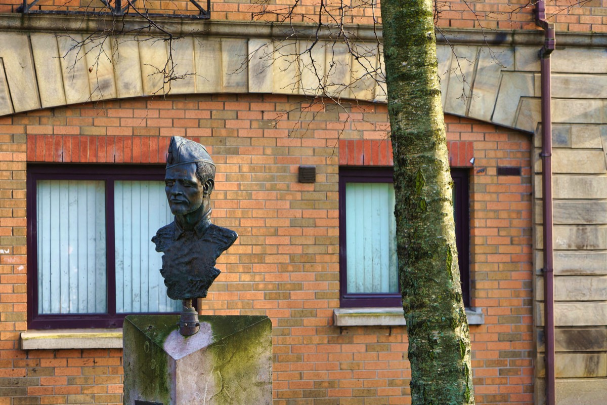
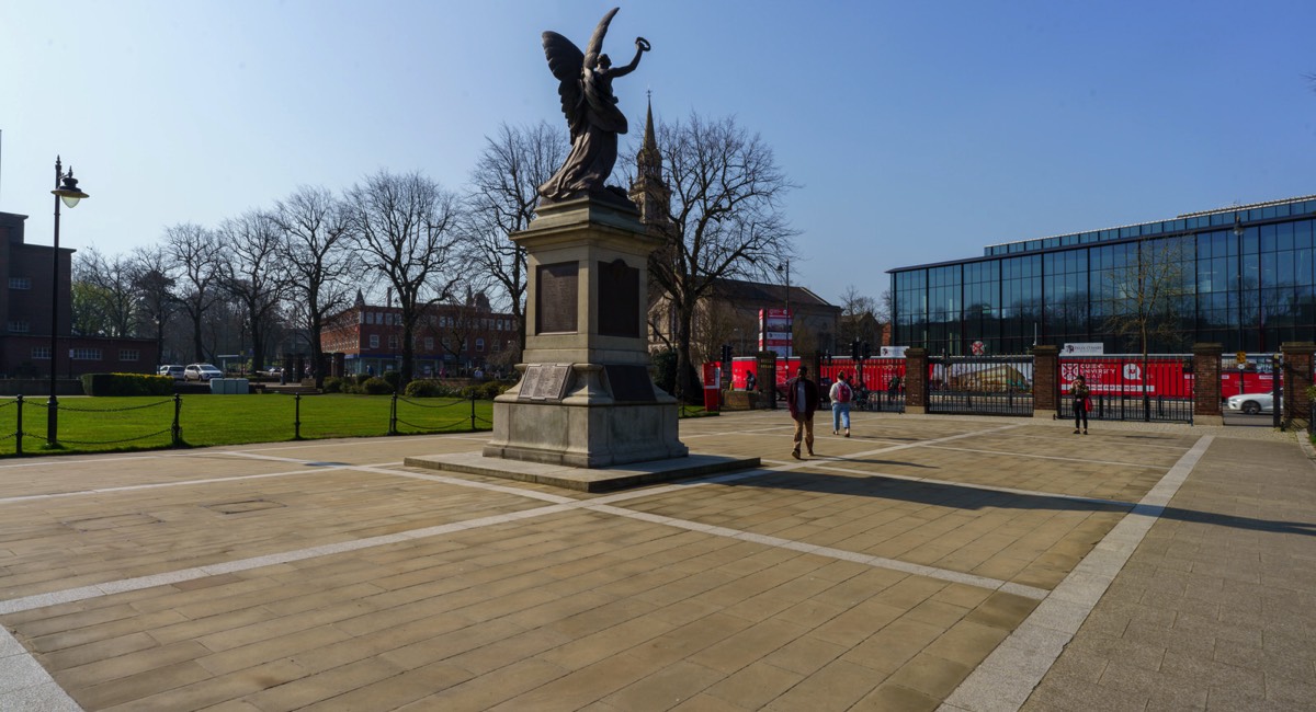
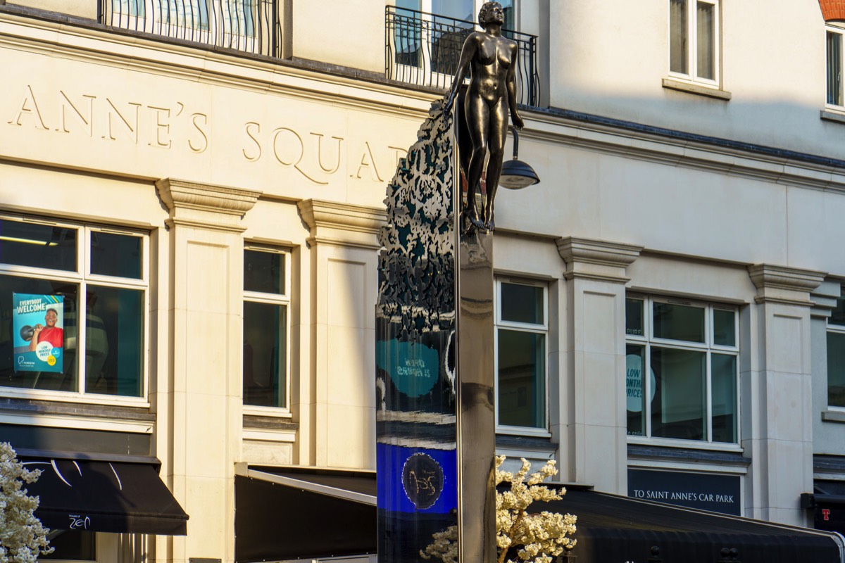
SPANISH CIVIL WAR MEMORIALSCULPTED BY ANTO BRENNAN
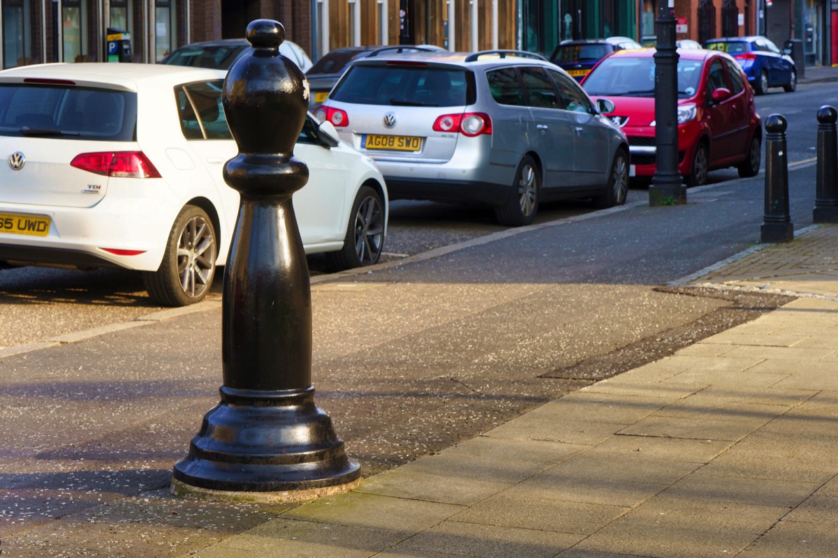
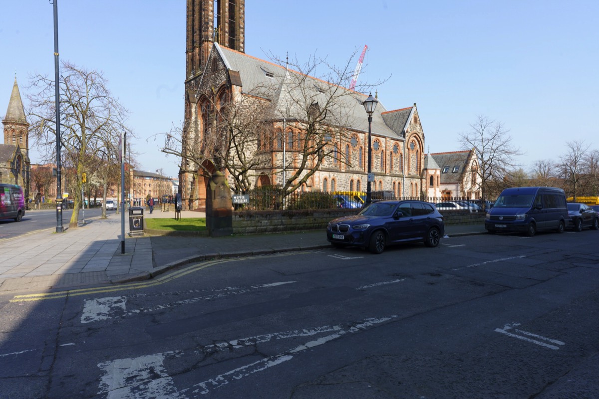
Back in I was contacted by a follower who mentioned that it should be Donegal not Donegall but in this instance they were wrong. When I was six years of age I lived in Donegal and we visited Belfast on a regular basis and one day I noticed that a street sign Donegall rather than Donegal and when I asked my father about he said that it was a very old spelling error and that no one could be bothered to change it. Later I discovered that my father did know exactly why but he felt that it was too complicated to explain in detail.
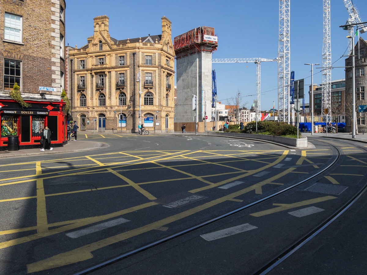
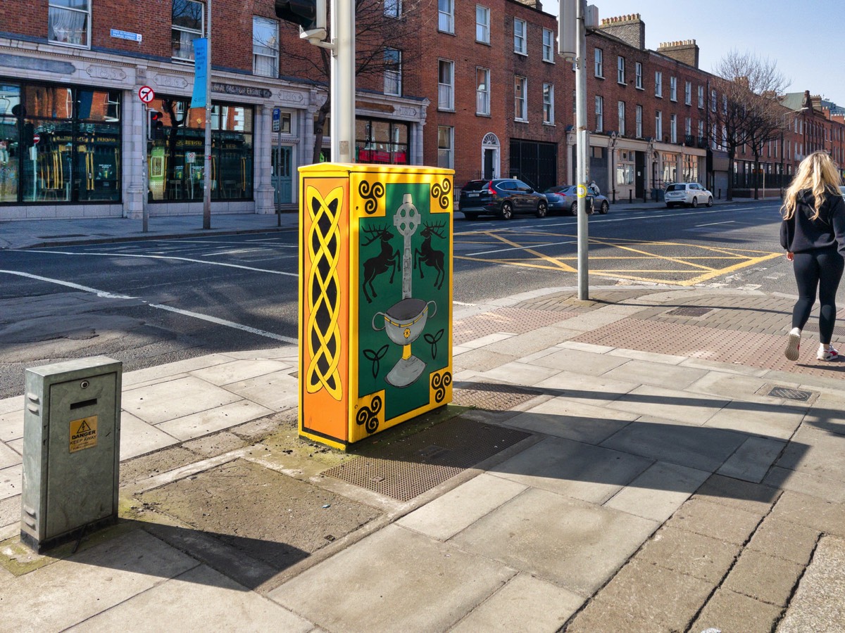
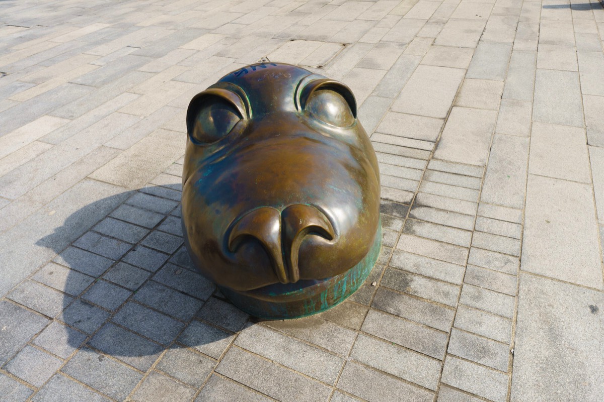
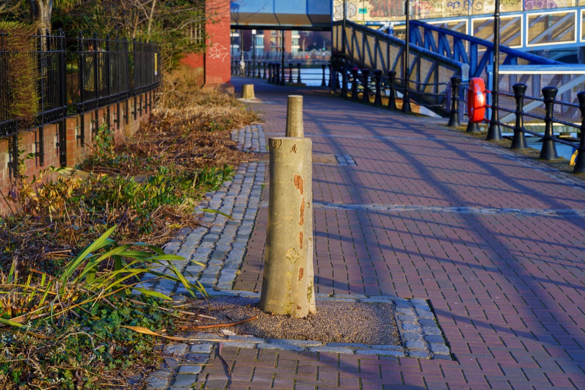
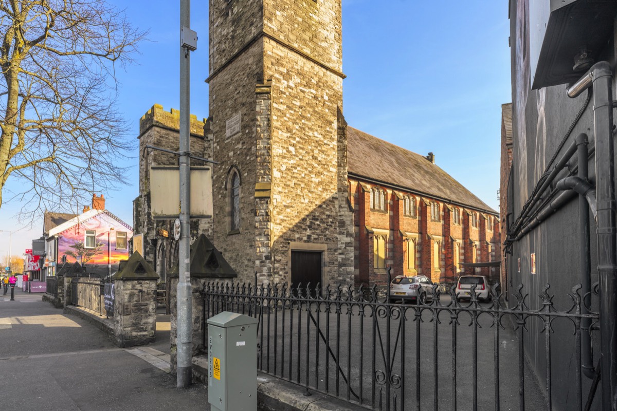
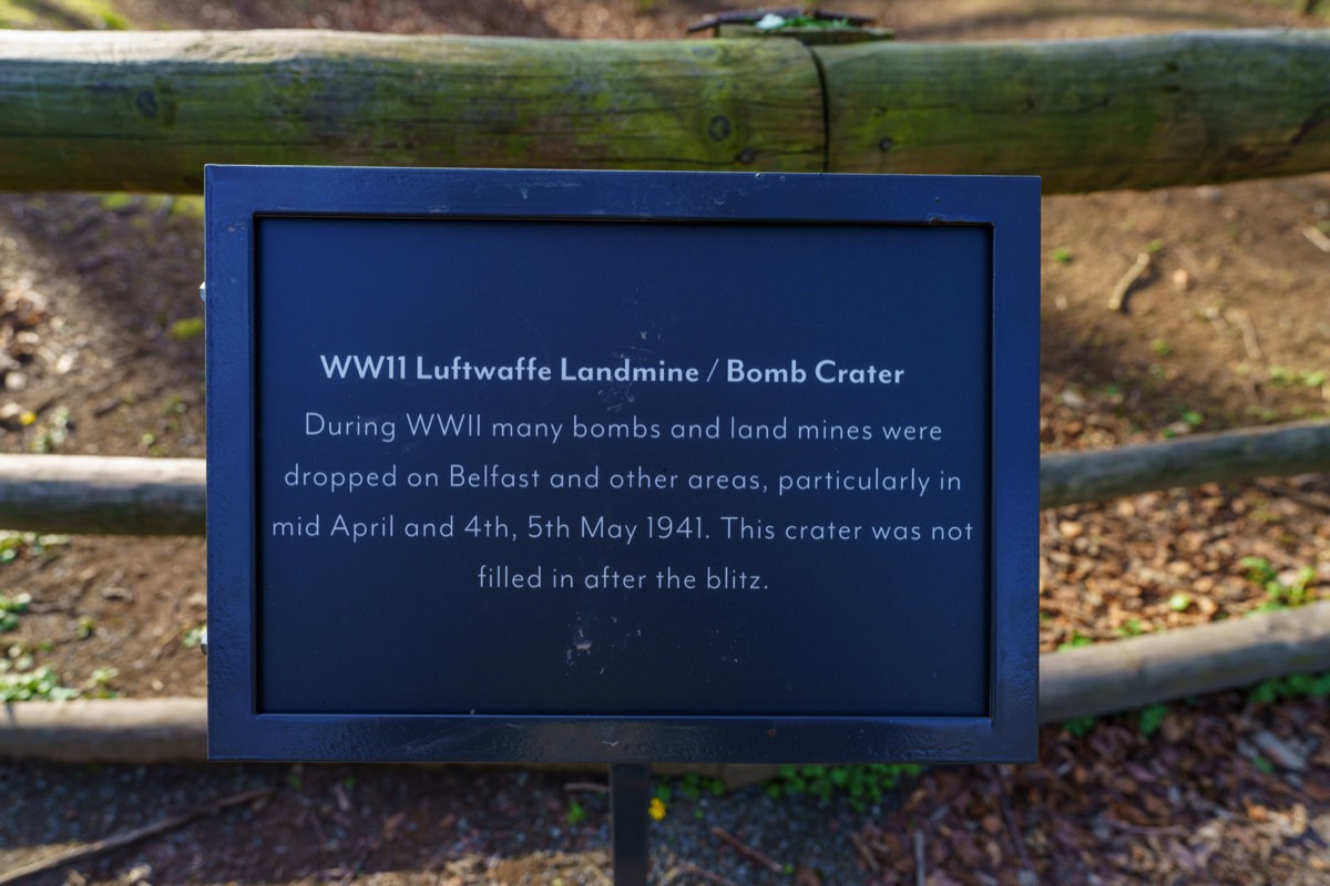
A PAWN VISITS BELFAST IS THIS A BOLLARD ON DONEGALL STREET
Back in I was contacted by a follower who mentioned that it should be Donegal not Donegall but in this instance they were wrong. When I was six years of age I lived in Donegal and we visited Belfast on a regular basis and one day I noticed that a street sign Donegall rather than Donegal and when I asked my father about he said that it was a very old spelling error and that no one could be bothered to change it. Later I discovered that my father did know exactly why but he felt that it was too complicated to explain in detail.
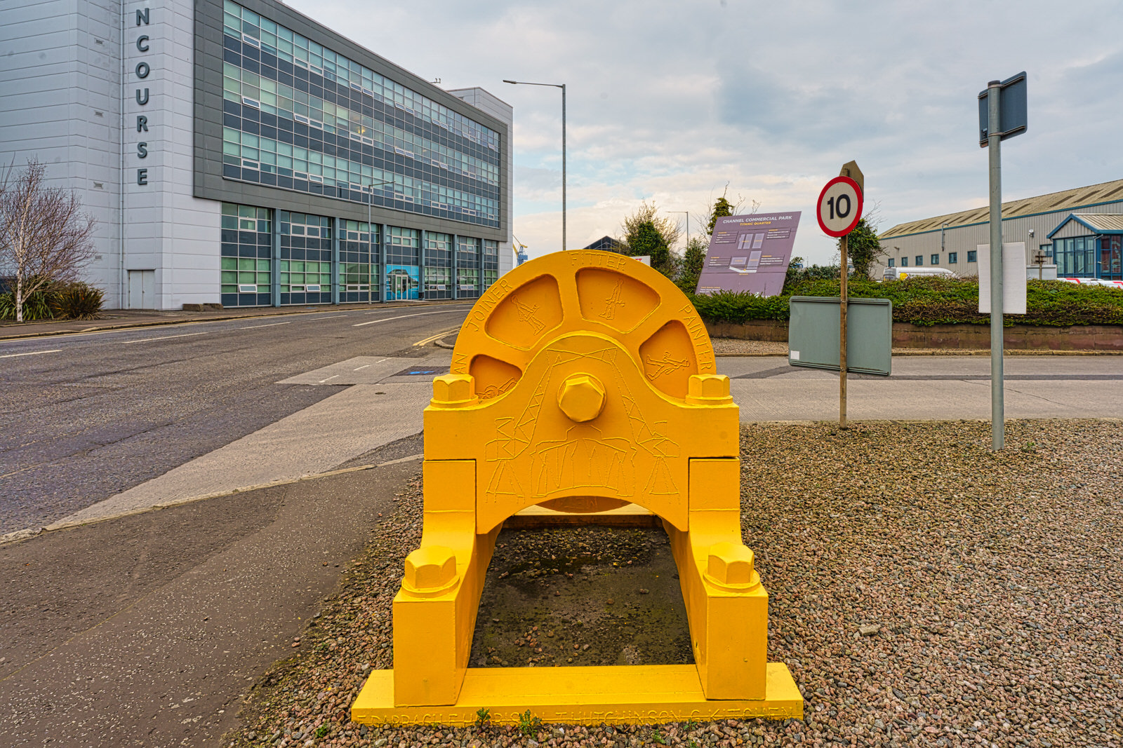
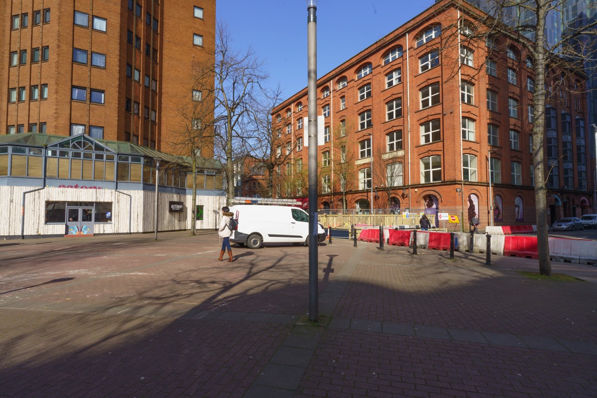
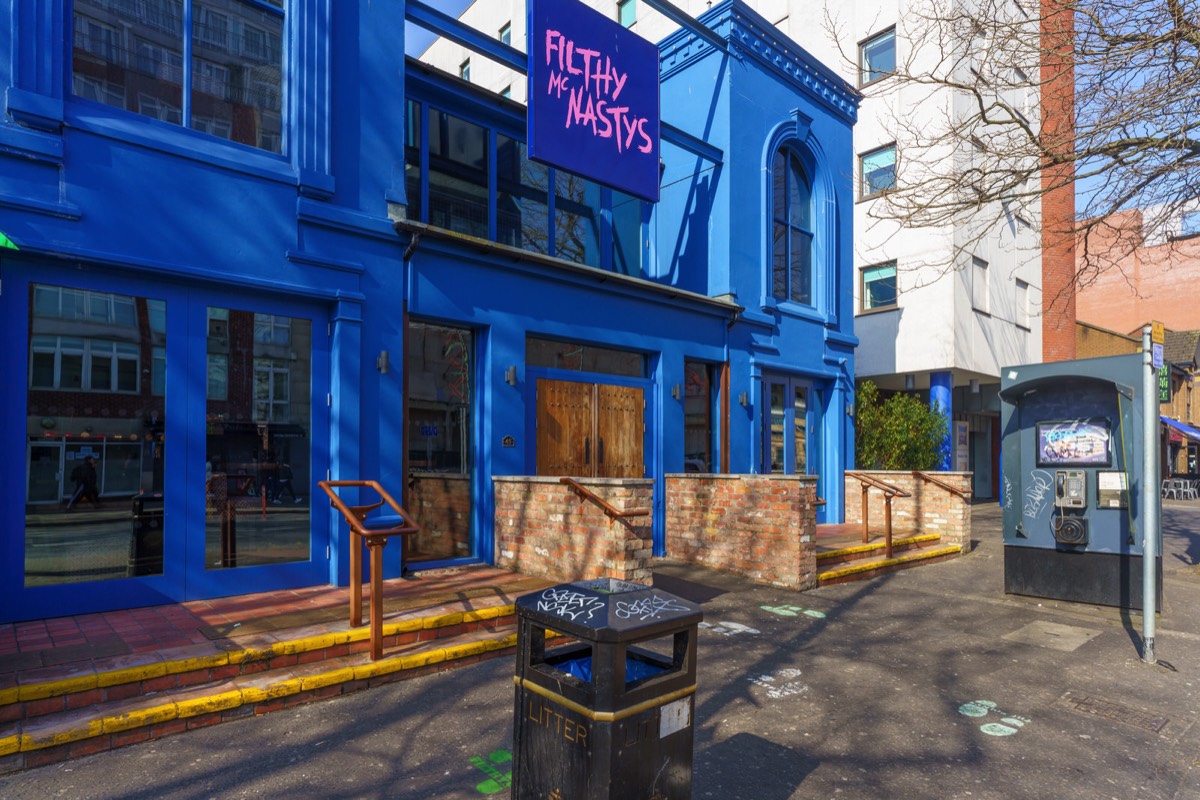
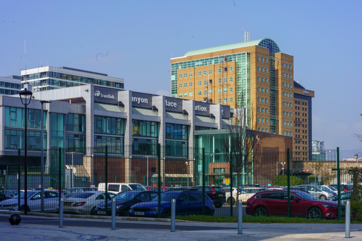
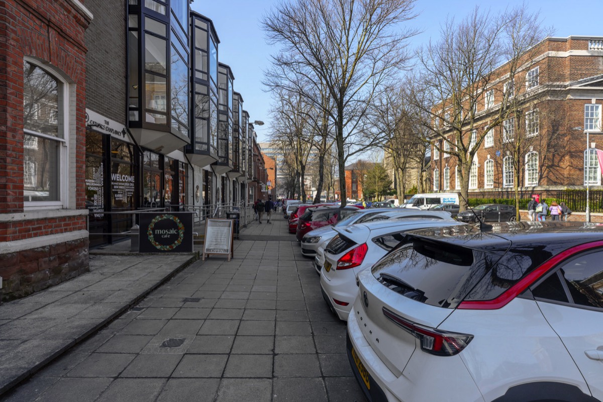
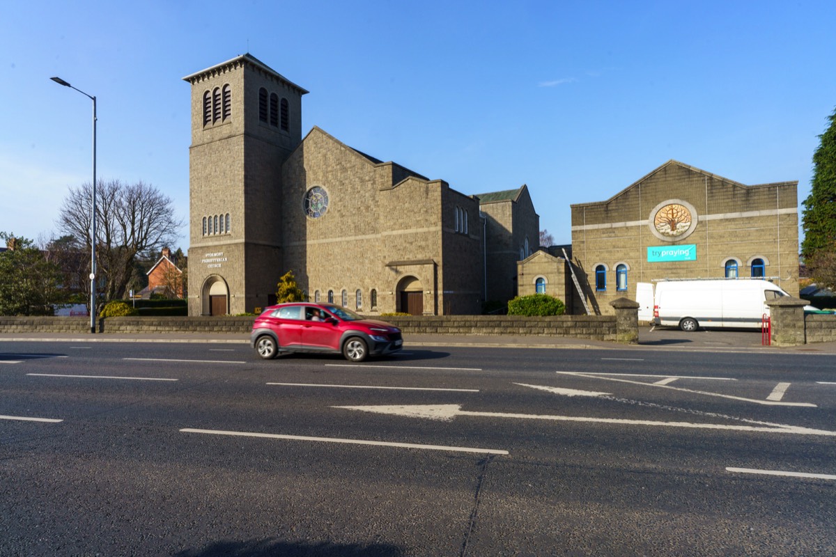
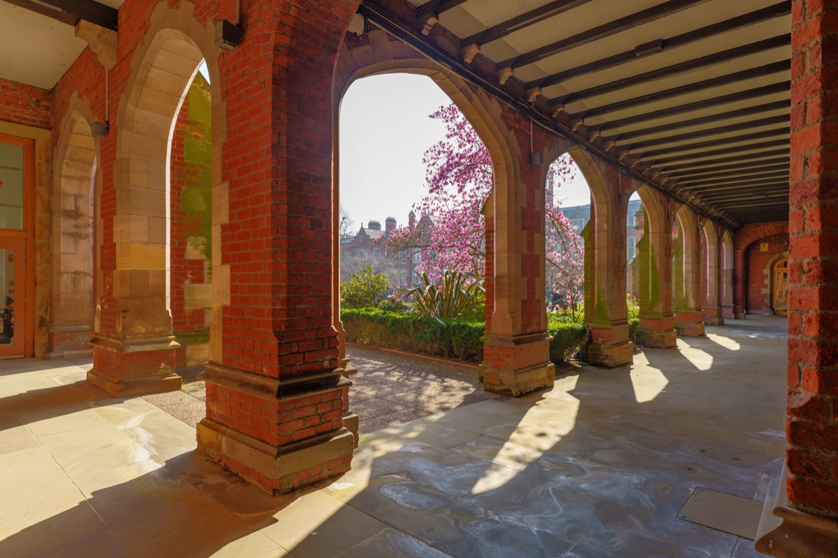
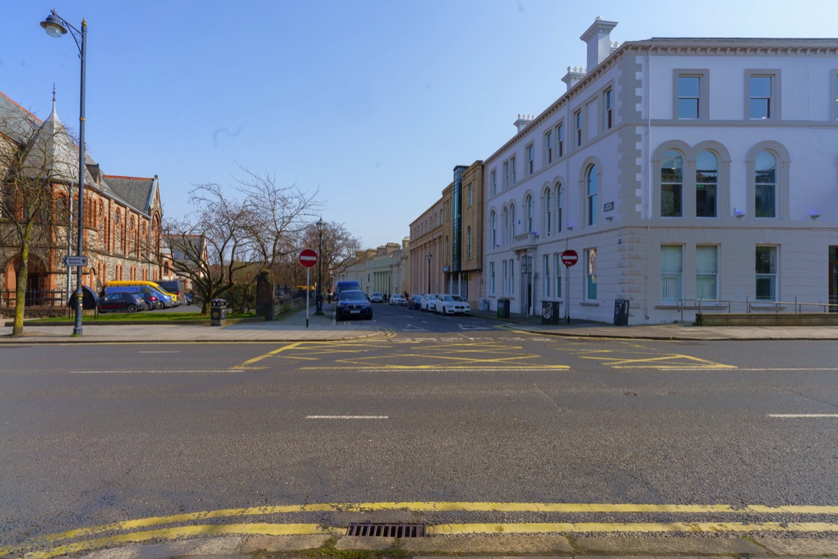
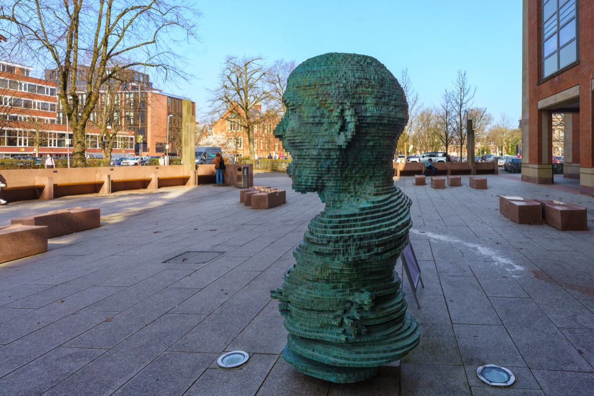
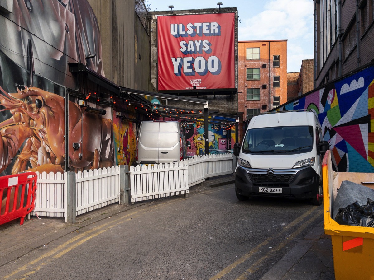
A TRIP ALONG DONEGALL STREET IN BELFASTURBAN DEPRESSION AND SOME URBAN EXPRESSION
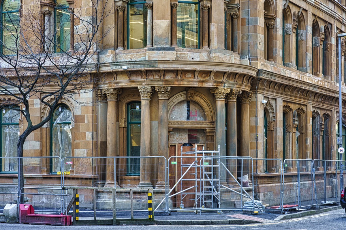
To make things worse, about six or seven months after I last visited the area there was a major fire which resulted in a report by an engineer indicating that repairs following a major fire in the Cathedral Quarter are likely to take years and that a cordon may need to remain around the listed Old Cathedral Building on Donegall Street, restricting access for several business owners, pedestrians and traffic.
THIS IS WHERE THE SCREEN CINEMA WAS STILL A WORK IN PROGRESS
EWART’S WAREHOUSE BELFAST NOW PART OF THE NEW EWART OFFICE COMPLEX
The same waiter also told me that the Ewart building was originally a box factory but further investigation leads me to believe that the business in question was located at 35 Bedford street which is now the Bridge House JD Wetherspoon [a superpub].
Because of its size and location it is/was not easy to photograph this four-storey sandstone building, which as lain empty for about twenty years. It was designed by James Hamilton, also the architect of the Waring Street Ulster Bank, now the Merchant Hotel.
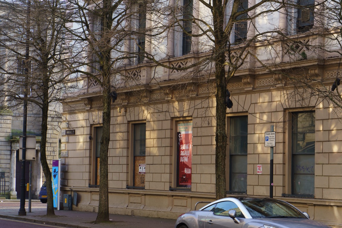
ADELAIDE STREET IN BELFAST PHOTOGRAPHED IN MARCH 2022
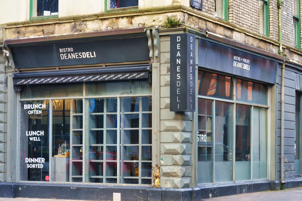
DEANS DELI ON BEDFORD STREET IN BELFAST IN MARCH 2022 THIS RESTAURANT HAD NOT YET REOPENED
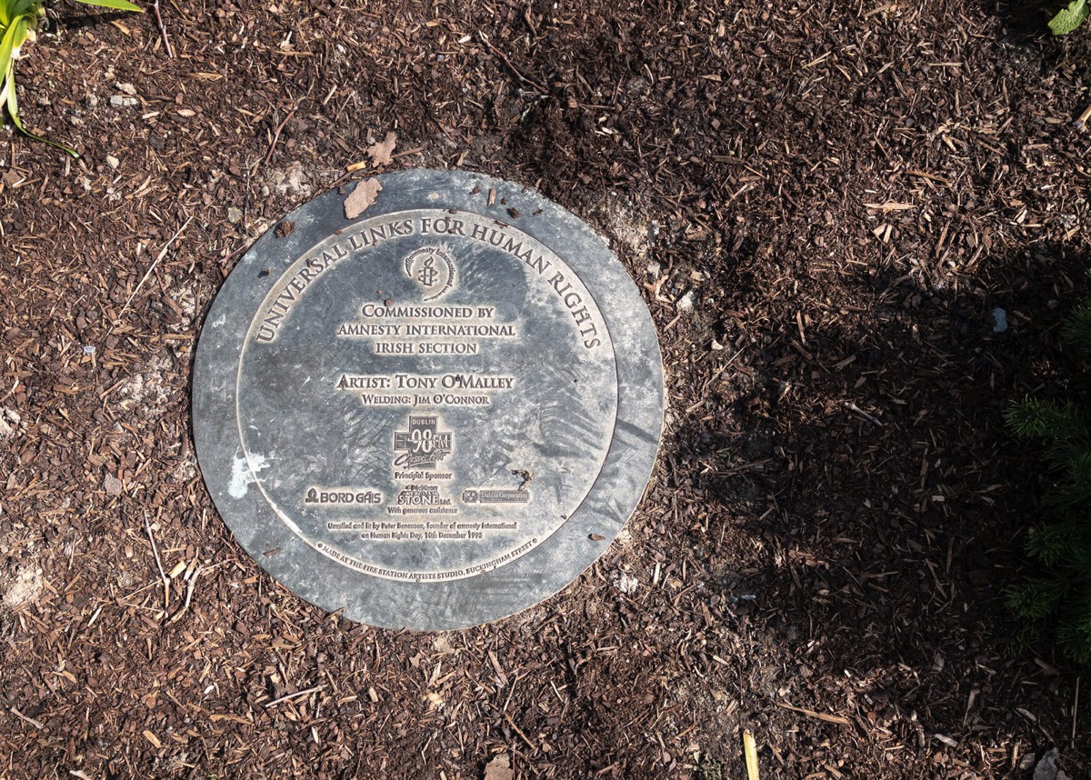
UNIVERSAL LINKS FOR HUMAN RIGHTS BY TONY O'MALLEY
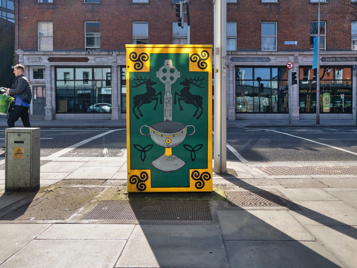
THE BOX OF KELLS BY DAVID MACKEY PEARSE STREET - SHAW STREET MARCH 2022
Artwork description:
"Using the Book of Kells with Ardagh Chalice and High Cross imagery of ancient Ireland, combined with the Harp Emblem of Ireland to bring together elements of Pearse Street and Trinity College."
DOCK STREET AND PRINCES DOCK STREET SAILORTOWN AREA OF BELFAST MARCH 2022
CHANGES AT BLACKSTAFF SQUARE IN BELFAST THE SCULPTURE AND THE CLOCK ARE GONE
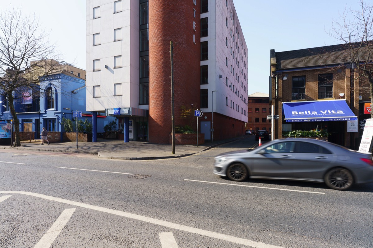
THE ETAP HOTEL MARCH 2022 WHY ARE THERE NO STREET FACING WINDOWS
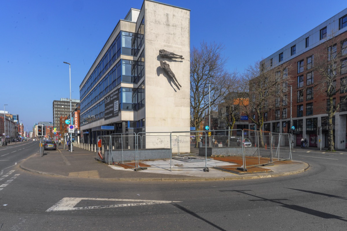
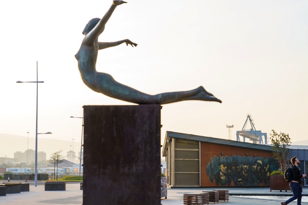
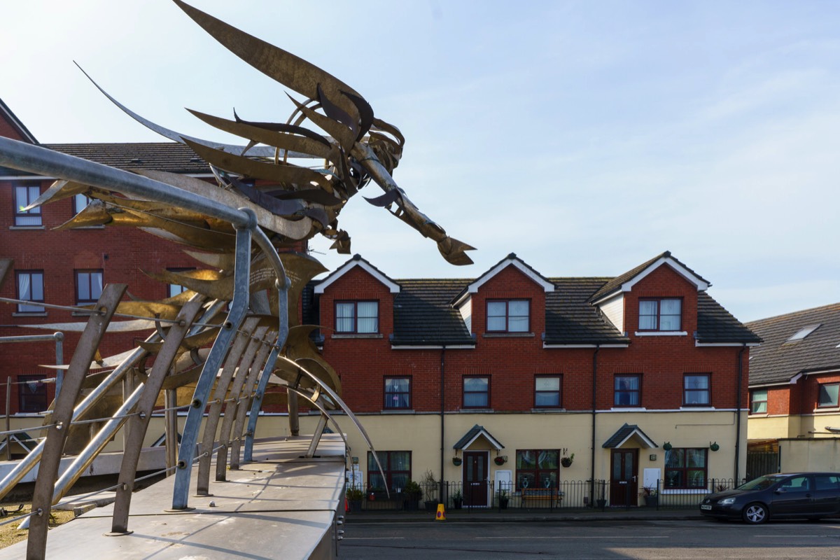
FLYING FIGURES SCULPTURE PHOTOGRAPHED MARCH 2022
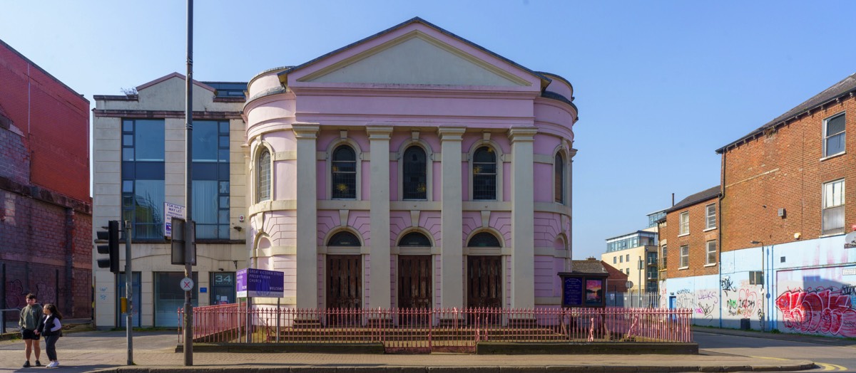
CRESCENT CHURCHPHOTOGRAPHED MARCH 2022
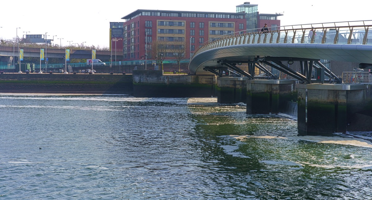
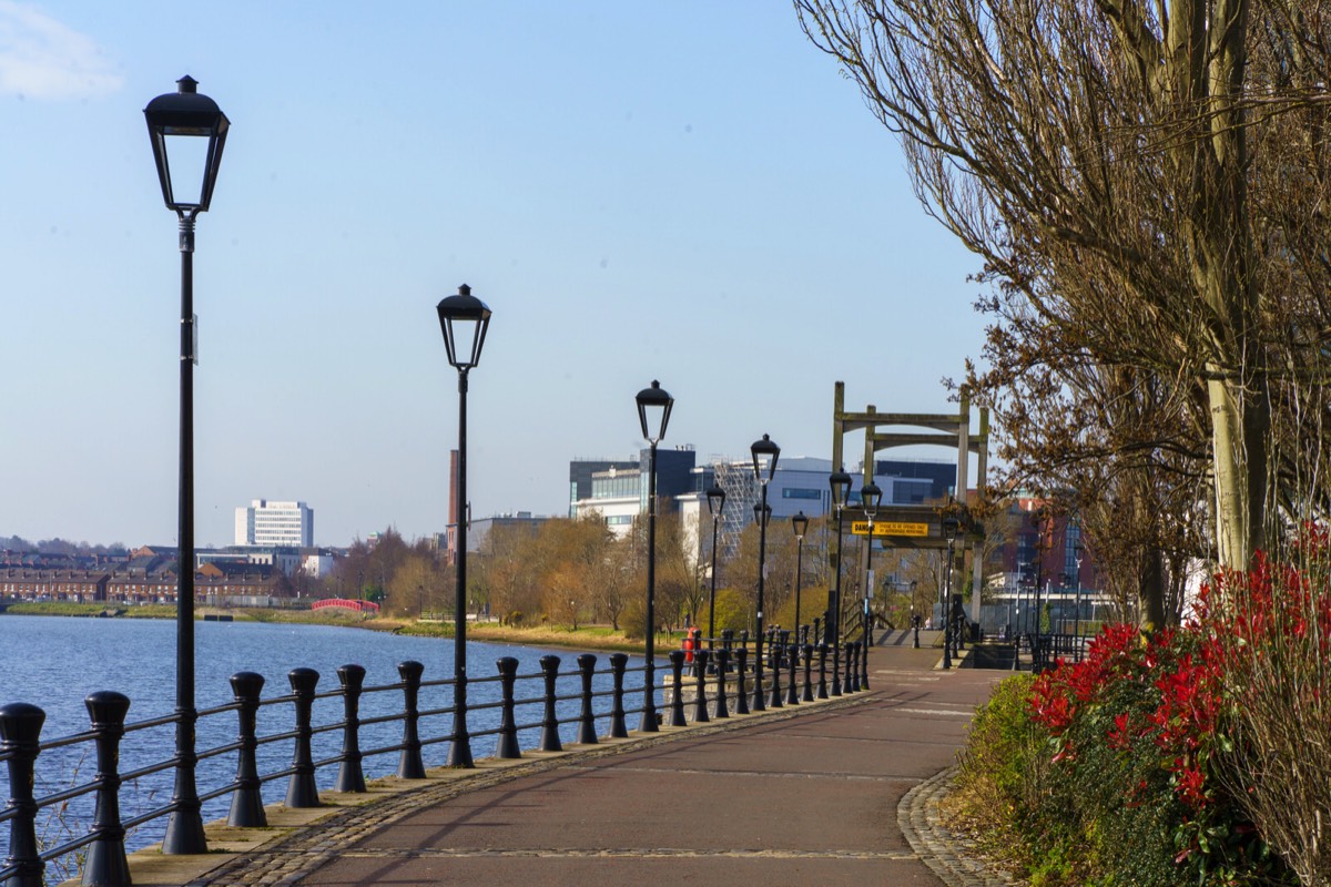
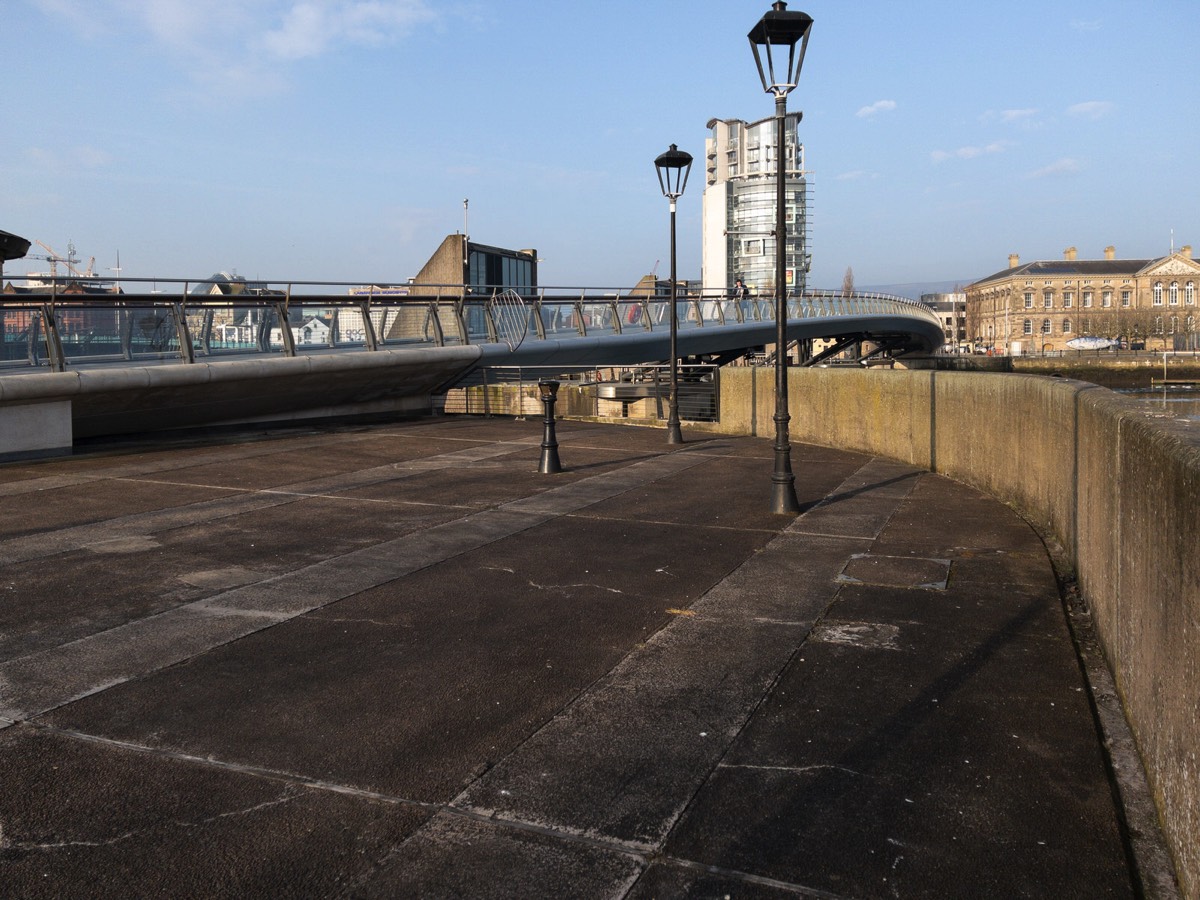
THE LAGAN WEIR AND NEARBYMARCH 2022
THE SEARCHER BY ROSS WILSON CS LEWIS SQUARE AT CONNSWATER IN BELFAST
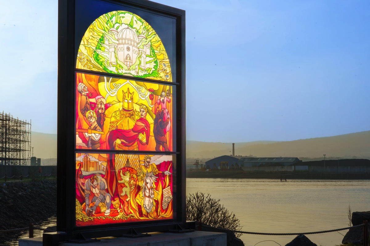
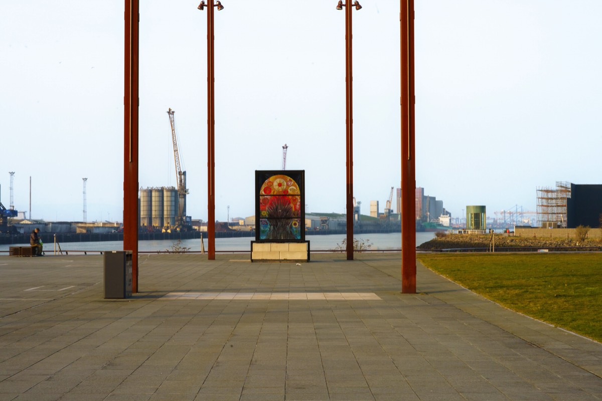
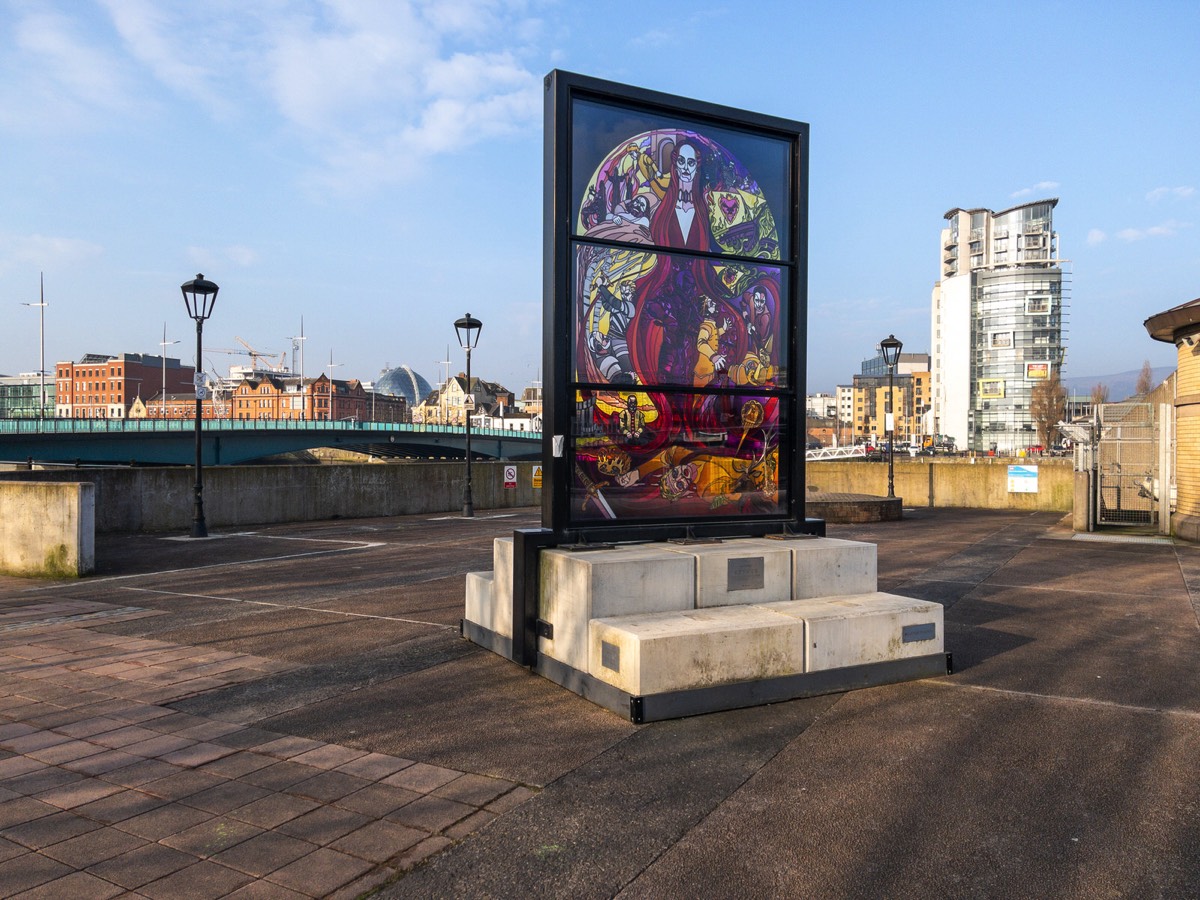
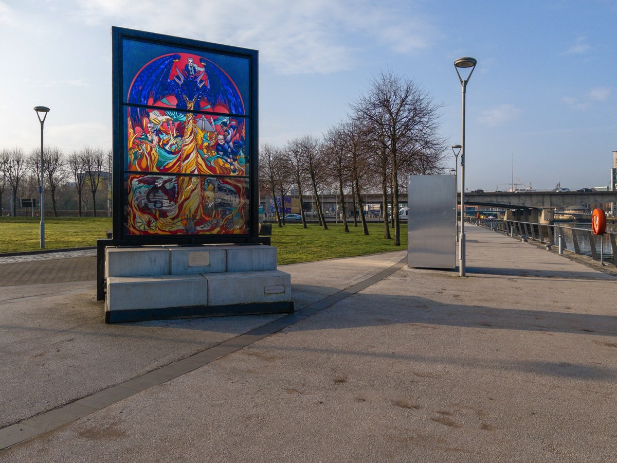
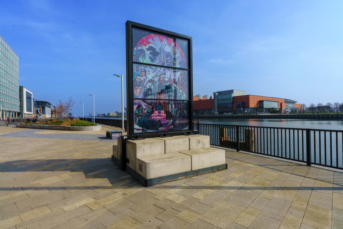
GLASS OF THRONES 2 THE RED WOMAN MELISANDRE LOCATED AT THE LAGAN WEIR
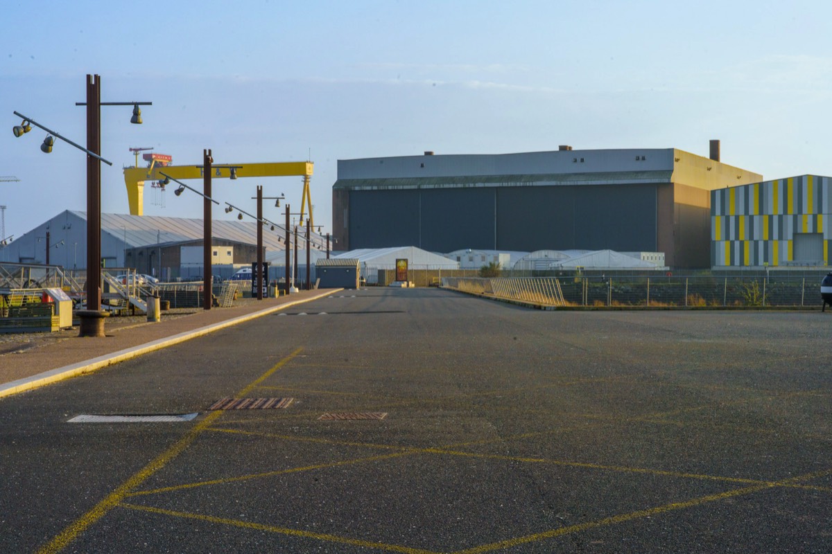
HMS CAROLINEPHOTOGRAPHED IN MARCH 2022

KIRKPATRICK MEMORIAL PRESBYTERIAN CHURCH UPPER NEWTOWNARDS ROAD BELFAST
THE LANYON BUILDINGTHE MAIN QUAD
SCULPTURE BY BOB SLOANON DISPLAY IN BELFAST

ROEBUCK ROADCLONSKEAGH AREA OF DUBLIN
Roebuck Road is in Clonskeagh a small southern suburb of Dublin, Ireland. The modern suburb lies partially within the city limits of Dublin but mostly within Dún Laoghaire–Rathdown. Roebuck Road defines the southernmost end of Clonskeagh; this area is sometimes known as Roebuck and occasionally considered to be part of Windy Arbour.

I TOOK A WALK ALONG GOATSTOWN ROAD BETWEEN ROEBUCK ROAD AND TANEY ROAD
For some reason I could not get my GPS to work during my walk along Goatstown Road so my photographs were not geo-tagged. As soon as I returned to Roebuck Road the problem was resolved.
Goatstown is a small Southside suburb of Dublin, Ireland. To the west is Dundrum, to the east is Blackrock, to the south is Sandyford, and to the north Ranelagh. It is mainly a residential area, with a primary school called Our Lady’s Grove, and two all girls secondary schools, Mount Anville and Jesus and Mary. There are amenities such as restaurants, a pub, a post office and various shops.
Goatstown got its name from the fact that formerly goats were bred there; in the 19th century it was popular to travel to Dundrum and nearby Goatstown as goat's milk was considered to be excellent for those suffering from tuberculosis.
A number of roads pass through Goatstown. At the crossroads the R112 passes from west (Taney Road) to east (Mount Anville Road), to the south is the R825 (Goatstown Road) and to the north is the R133 (Lower Kilmacud Road). A short distance from the crossroads is a T-junction where the R826 terminates at the R112 on the Taney Road.
The Luas green line runs through the southwest corner of Goatstown and the Dundrum Luas stop is nearby, with the vehicular entrance off Taney Road.
The bus routes of the 11, 11a and 75 run through Goatstown as well, linking Goatstown to the city centre, Dún Laoghaire and Tallaght. However, I would consider the bus services to be poor because of low frequency [in the case of the 11 every thirty minutes]
To the east of the Goatstown Road lies former allotment land, much of which was compulsorily purchased during the 1960s for the proposed Eastern Bypass / Saint Helen's link road. A portion of this land is currently being built on by Dún Laoghaire–Rathdown County Council, to provide social and affordable housing.
A Georgian house and remaining surrounding land, known as Trimbleston, was sold in the early 1990s to builders Sorohan Brothers. The house was subsequently damaged in two fires and the remaining ruins demolished and replaced by a housing and apartment development, also called Trimbleston. Phase two of Trimbleston has recently commenced with the demolition of five two-storey houses on Goatstown Road and construction of 202 dwelling units in their place and on land to the east owned by the Sorohans.

GOAT TO THE TOP OF THE MOUNTAINBY SINEAD TYNER
"Goat To The Top Of The Mountain" by Sinead Tyner.
For some reason I could not get my GPS to work during my walk along Goatstown Road so my photographs were not geo-tagged. As soon as I returned to Roebuck Road the problem resolved itself.

MEMORIAL PLAQUENORTH KING STREET MASSACRE

The killing of 15 civilians at North King Street was one of the worst acts committed by British forces in Ireland in the 20th century – on a par with the Croke Park shootings just a mile or so to the north of North King Street in 1920 in which 14 spectators at football match were gunned down.
NEWMARKET AREA OF DUBLIN18 MARCH 2022

RIALTOBY SANDRA BELL

ST KEVIN'S PARK AND CHURCH RUINSCAMDEN ROW
Ever since the demolition of Kevin Street College this old church has felt different, maybe because of additional sunlight.
There was a St. Kevin's Church in what is now St. Kevin's Park, Camden Row, Dublin, Ireland at least as far as the 13th century. After the Reformation, it became an Anglican Church. The original church was replaced around 1750 by a new one, closed in 1912 and now in ruins. Both churches were dedicated to Kevin of Glendalough. There is also a Catholic St. Kevin's Church a short distance away on Harrington Street.
During the 17th and 18th centuries many notable people resident in the suburbs south of the city were interred here. After the Reformation, although a Protestant cemetery, it had come by custom to be used by Catholics and the Quakers.
In 1825 John D'Arcy, owner of Anchor Breweries, the second largest porter company in Dublin at the time, was to be buried in St. Kevin's cemetery, having died suddenly after falling from his horse. When his funeral procession from Francis St. reached St. Kevin's cemetery the sexton, under the authority of the Protestant Archbishop of Dublin, Dr. Magee, met it at the gate and forbade Catholic prayers being recited at the grave-side; they had to be said on the roadway. The mourners retreated peacefully, but a huge outcry erupted as soon as the facts became known, which reached the ears of the Lord Lieutenant, The Marquess Wellesley (brother of the Duke of Wellington, and himself married to a Catholic). He expressed disapproval of Dr. Magee's order, and despite much opposition (cemeteries were a valuable source of income to their owners) tried to alleviate Catholic grievances. Daniel O'Connell used the scandal provoked by this to such effect that he was able to get through the legislation in establishing Golden Bridge (1829) and Prospect (1831) cemeteries, which led to the establishment of Glasnevin Cemetery.
At the start of the 19th century the cemetery, like many others in Dublin, became a target of the body-snatchers, although it was surrounded by high walls (changed to railings in the 1960s). In February 1830 a Frenchman named Nagles and his friend were attacked by a group of "sack-em-ups" lying in wait near the cemetery. The criminals' attention was diverted by the arrival of a cart-load of dead bodies, giving Nagles the opportunity to escape and notify the police at Arran Quay, who apprehended the culprits. On one occasion a body-snatcher was chased as far as Thomas Street, where he finally dropped his booty—the body of a young girl.
In June 1961 the body of a local five-year-old boy Tommy Powell from Cuffe Street was found in the graveyard. Blood-stained stones found nearby indicated that he had been murdered, but despite an intensive investigation, the murderer was never discovered.

WILTON TERRACEST PATRICK'S DAY 2022
This year I decided to avoid the St. Patrick's Day parade so I visited less busy parts of the city.
I lived and worked here for three or four years and also attended a nearby school for ten years and I have always liked the area but when I was young Wilton Place and Wilton Terrace was to be avoided, at night, as it was a very active red light area.
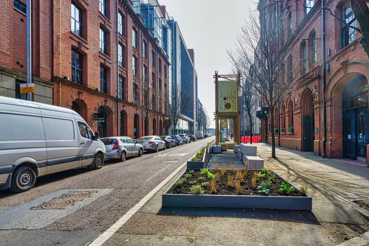
As you can see from my photographs there are a number of active construction sites in the area the main one being Wilton Park described as a landmark development which will see 5,000 additional people working and living in the neighbourhood when it is fully complete in 2024.
The Wilton Park site has been assembled over a 40-year period in order to transform this part of the city. As well as offices, the neighbourhood’s amenity-rich streetscapes will offer places to eat, drink and shop, and spaces to relax and dwell including a new public square and the restored one-acre park.
During construction, 95% of demolition waste was recycled and offices will use 60% less energy than the average what was typical until now. Two to Four Wilton Park will operate free of fossil fuels, running solely on renewable energy.

URBAN EXPRESSION ALONG LIBERTY LANEST PATRICK'S DAY 2022
This laneway was unusually busy today as people used it as a short cut or in order to avoid the crowds lining the streets because of the St. Patrick's Day parade.
In the past I described this as a laneway at the side of Kevin Street College but as the building has been demolished this is no longer a valid description as the. In fact, as I only discovered a few months ago, it was never an accurate description because South Church Lane is the the laneway that was at the side of the college.

ZION CHURCH AND SCHOOLZION ROAD - BUSHY PARK ROAD RATHGAR
The architect was Joseph Welland and Son.
A War Memorial Zion, inside the Zion Church, commemorates the members of the parish who were killed or missing in the Great War (World War I).
Joseph Welland (6 May 1798 – 6 March 1860) was born in Middleton, County Cork and became an Irish Architect for the Board of First Fruits and later the Ecclesiastical Commissioners. He was as a student to John Bowden and became his assistant and is noted to have designed many churches and schools around Ireland.
While working with John Bowden with the Board of First Fruits, he shared some of Bowden's works. These include St. Philip and St. James Church, Booterstown and St. Stephen's Church, Mount Street (The Pepper Canister), both of which Joseph Welland had to complete himself after Bowden's death in 1821.
Joseph Welland died on 6 March 1860 and was buried in St George's churchyard, Dublin.
His younger son William Joseph Welland (1832-1895) also designed churches, and worked for the Ecclesiastical Commissioners.
The High School is a 12–18 mixed, Church of Ireland, Independent secondary school in Rathgar, Dublin, Ireland. It was established in 1870 at Harcourt Street before moving to Rathgar in 1971 and amalgamated with The Diocesan School for Girls in 1974, becoming co-educational.
In 2009, it was ranked as the best-performing school in Ireland in terms of progression to third-level education and is part of the Erasmus Smith Trust.

THE DODDER WALK FROM ORWELL ROAD TO RATHFARNHAM ROAD
Today I surprised myself when I discovered that I was in Rathfarnham Village. I must admit that I had thought that the area surrounding the Yellow House Pub was Rathfarnham Village.
I was in Bushy Park and left it via the new pedestrian bridge bridge which lead to Dodder View Road. I looked up and noticed a church tower at the top of the hill across the road and as I did not know what church it was I decided to investigate. I walked up Church Lane only to arrive at the main street in Rathfarnham, a street that I have never visited before.
Rathfarnham Protestant Parish Church on the Main Street was built in 1795 to replace the church in the old graveyard. Beside the church is the old schoolhouse that dates from early in the nineteenth century. Immediately adjoining is Church Lane at the corner of which is a bank built on the site of a Royal Irish Constabulary barracks that was burned down by Anti-Treaty IRA forces in September 1922 during the Irish Civil War. In the lane is an old blocked up doorway of an early eighteenth-century type. Church Lane leads to Woodview cottages, which are built partly on the site of an old paper mill. The mill race previously mentioned passed under Butterfield Lane to the paper mill and continued on below Ashfield to turn the wheel of the Ely Cloth Factory. It was later turned into the Owen Doher River at Woodview Cottages. Until recently, when the new road was made to Templeogue, the old mill race could still be traced through the grounds of Ashfield where its dry bed was still spanned by several stone bridges.
The paper mill, of which some old walls and brick arches still survive, has been described as the oldest in Ireland but there does not appear to be any evidence to support this. The earliest reference to a paper mill here is 1719 when William Lake of Rathfarnham presented a petition for financial aid but we hear of one at Milltown as far back as 1694. In 1751 William and Thomas Slater whose works were destroyed by fire in 1775 made paper here. Archer's survey of 1801 mentions two paper mills here, Freemans and Teelings, and both Dalton in 1836 and Lewis in 1837 state that one paper mill was still working and from 1836 to 1839 the name Henry Hayes, Rathfarnham Mill appears in the directories. If this can be identified with the mill at Woodview cottages it must have become idle soon afterwards as it is designated "Old Mill" on the 1843 edition of the O.S. map. In 1854 when this mill had neither water wheel nor machinery an attempt was made to re-open it for the manufacture of paper but it came to nothing. The mill race has now been completely removed to make way for a housing development.
At the end of the main street, on the right, the road to Lower Rathfarnham passes the site of the earliest Constabulary barracks. This closed down in 1890 when the establishment was transferred to a house named Leighton Lodge near Loreto Abbey.

GIANO THE TUGBOAT SERVING THE PORT OF DUBLIN
This compact Tug has an innovative high displacement tunnel hull form, two large structural keels and a straight-line controllable pitch thruster configuration designed and built solely for ship handing. With the intuitive in-line handling controls, the Tug can produce 55 tonnes (respectively 70 tonnes for the 32m loa version) of bollard thrust and pull in all directions at full power with true 360 degree manoeuvrability, while maintaining a 0 degree list - plus a side-stepping speed of 7kn – from full ahead to full speed sideways in 10 seconds.
A tugboat or tug is a marine vessel that manoeuvres other vessels by pushing or pulling them, with direct contact or a tow line. These boats typically tug ships that cannot move well on their own, such as those in crowded harbours or narrow canals, or those that cannot move at all, such as barges, disabled ships, log rafts, or oil platforms. Some are ocean-going, some are icebreakers or salvage tugs. Early models had steam engines, and modern ones have diesel engines. Many have deluge guns, which help in firefighting, especially in harbours.


THE BOTTLE BOY PUBWAS ONCE VALLENCE & MCGRATH OR CONNORS
This caught me by surprise as there has not been a new pub on the North Wall Quay for a very long time and all that existed disappeared over an extended period of time. The last remaining was Vallence & McGrath which was established in 1908. If what I say is incorrect please correct me.

EAST ROAD FROM UPPER SHERIFF STREET TO CHURCH ROAD
I was a bit disappointed with these images as they were underexposed and any attempted corrections introduced lots of noise so I plan to revisit the East Wall area and photograph the area again later in the year.
East Wall dates from the end of the eighteenth century from the time of the construction of the North Wall. It was originally a working-class area, with many finding employment in Dublin Port, adjacent to the area.

OSSORY ROAD NORTH STRAND AREA OF DUBLIN
This is an old industrial area in the docklands and was once home to Cadburys and many other companies.
Cadburys chocolate was founded in Birmingham in the 1830’s. It was a century later when the company opened its first Irish factory in 1933 on the Ossory Road. Three of the company’s products were made here, including their famous Dairy Milk bars. In 1939 they opened a second Dublin factory, on the East Wall Road.
The premises on the East Wall Road had been built eight years earlier (in 1931) for the Gallaher tobacco group, and named Virginia House. Once acquired by Fry Cadbury it was renamed Alexandra House. In 1964 the current Cadburys factory in Coolock opened, which saw the demise of the East Wall operation. The building was taken over by Wiggins Teape and renamed Gateway House . In 2001 Gateway house was demolished by Collen Bros.
Osraige (Old Irish) or Osraighe (Classical Irish), Osraí (Modern Irish), anglicised as Ossory, was a medieval Irish kingdom comprising what is now County Kilkenny and western County Laois, corresponding to the Diocese of Ossory. The home of the Osraige people, it existed from around the first century until the Norman invasion of Ireland in the 12th century. It was ruled by the Dál Birn dynasty, whose medieval descendants assumed the surname Mac Giolla Phádraig.

LUKE KELLY STATUE AT GUILD STREETVANDALISED MANY TIMES
The Statue of Luke Kelly is a large marble sculpted head of Irish folk singer Luke Kelly. The statue is located at the north end of Linear Park, near the junction of Sheriff Street Upper and Guild Street, Dublin 1.
In July 2020 a A man has appeared in court charged in connection with the vandalism of a statue of Luke Kelly in Dublin. It was alleged that the defendant had sprayed the statue of the former Dubliners’ singer in Guild Street with blue paint on Sunday evening at 4.45pm.

MEATH PLACEOFF MEATH STREET
It was a very wet windy day when I visited the area.
Meath Place is a short street off Meath Street. There are some modern apartments at the Meath Street end and then the street is mostly made up of small cottages and one or two industrial buildings. Meath Street is a great street for shopping, one of the last market streets left in Dublin, it has the Liberty Market, A great selection of Butchers Shops, Green Grocers and cafes.

MEATH PLACE
LOVE LANEACTUALLY CRAMPTON COURT
Crampton Court, shown in my photograph, connects Dame Street to East Essex Street in Temple Bar and it runs parallel to Crane Lane [more or less].

JAMES JOYCE BRIDGEULYSSES WAS PUBLISHED 100 YEARS AGO
Ulysses is a modernist novel by Irish writer James Joyce. It was first serialised in parts in the American journal The Little Review from March 1918 to December 1920 and then published in its entirety in Paris by Sylvia Beach on 2 February 1922, Joyce's 40th birthday. It is considered one of the most important works of modernist literature and has been called "a demonstration and summation of the entire movement." According to Declan Kiberd, "Before Joyce, no writer of fiction had so foregrounded the process of thinking".
Ulysses chronicles the appointments and encounters of the itinerant Leopold Bloom in Dublin in the course of an ordinary day, 16 June 1904. Ulysses is the Latinised name of Odysseus, the hero of Homer's epic poem the Odyssey, and the novel establishes a series of parallels between the poem and the novel, with structural correspondences between the characters and experiences of Bloom and Odysseus, Molly Bloom and Penelope, and Stephen Dedalus and Telemachus, in addition to events and themes of the early 20th-century context of modernism, Dublin, and Ireland's relationship to Britain. The novel is highly allusive and also imitates the styles of different periods of English literature.
Since its publication, the book has attracted controversy and scrutiny, ranging from an obscenity trial in the United States in 1921 to protracted textual "Joyce Wars". The novel's stream of consciousness technique, careful structuring, and experimental prose—replete with puns, parodies, and allusions—as well as its rich characterisation and broad humour have led it to be regarded as one of the greatest literary works in history; Joyce fans worldwide now celebrate 16 June as Bloomsday.

FOUNTAINWOLFE TONE QUAY
I have frequently complained that the majority of fountains and water features in Dublin are inactive or dry. However, today, I was surprised to see that this installation on Wolf Tone Quay actually had water but maybe it was because of recent heavy rains. If you examine the photographs you may notice that the water jets are inactive.
Wolfe Tone Quay is one of several quays along the Liffey, part of maritime developments within the city stretching back to the thirteenth century. Formerly known as Albert Quay, but known as Wolfe Tone Quay since the early twentieth century, this structure dates from the early nineteenth century and is the most westerly of the northern quays. The quay wall is of well-built ashlar granite and presents a strong visual statement. The quays are of significance in the context of the economic and maritime development of Dublin city as one of Ireland’s principal ports. They are representative of early nineteenth-century engineering technology.


WOLFE TONE QUAY
EAST ESSEX STREETTEMPLE BAR AREA OF DUBLIN
Essex Street dates from 1674 and is named after Arthur Capel the Earl of Essex and Lord Lieutenant of Ireland at the time.

CROW STREETTEMPLE BAR AREA OF DUBLIN
Crow Street was named after William Crowe who held land in the area in the early seventeenth century and built a house called the 'Crowes Nest'. The street it was laid out in 1731 on land which is shown as undeveloped on Charles Brooking's map of Dublin dating to 1728.

CROPPIES ACRE 1798 MEMORIAL PARK10 MARCH 2022
In recent years Dublin City Council’s Parks and Landscape Services have carried out an extensive works programme to upgrade the park and make it public park more accessible for the citizens of Dublin and visitors to the city.

THIS MEMORIAL MARKS THE CROPPY'S ACRECROPPIES ACRE 1798 MEMORIAL PARK
The name ‘Croppy’ was used in Ireland in the 1790s and was a reference to rebels who closely cropped their hair to mimic the French Revolutionaries of the period who cut their hair in contrast to the aristocracy who wore powdered wigs.
Three hundred captives were put to death in the Smithfield area of Dublin and their bodies were suspended from the bridges along the River Liffey. They were then buried in the area now known as Croppy’s Acre in front of Collins Barracks, now a branch of the National Museum of Ireland.
There are two separate parks which may be related but in general tourist guides appear to be unaware of this fact to the extent that some claim that Anna Livia is located in the park beside the the Museum Luas Tram Stop.
The major park, the one normally associated with the museum tram stop, is officially the Croppies Acre 1798 Memorial Park while the smaller park featuring Anna Livia and a small pond is the Croppies Memorial Park. The distinction is/was important because the larger park has been closed to the public for extended periods.
For many years due to anti-social behaviour, mainly drugs related, the major memorial park was off-limits to the public. There was also problems with homeless people occupying parts of the park.
The good news is that the Croppies Acre 1798 Memorial Park, Wolfe Tone Quay, Dublin 7 is once again open to the public and, much to my surprise it is open 24 hours seven days a week.

SCULPTURE AT ENTRANCE TO ST KILIAN'S GERMAN SCHOOL ON ROEBUCK ROAD
The photograph is a bit confusing because a row of black and orange bollards can be seen through part of the sculpture ... I am assuming that the sculpture is a representation of the saint.
St Kilian's German School (Deutsche Schule Dublin - DSD) is an independent German international school in Dublin, Ireland.
Kilian, also spelled Killian (or alternatively Irish: Cillian; Latin: Kilianus), was an Irish missionary bishop and the Apostle of Franconia (Franconia is nowadays the northern part of Bavaria), where he began his labours towards the end of the 7th century. His feast day is 8 July.
St Kilian's is legally a single organisation, with a primary school, offering kindergarten (junior infants) and vorschule (senior infants) and main primary school (1st to 6th classes), and a secondary school. It is open to students from ages 4 to 18.
German is taught from the start, but is not required for entry. In primary school, where relevant, input from the school programme of the German state of Baden-Württemberg is used. Depending on development of German language skills, pupils may have the option to pursue a German curriculum stream from 4th class. The school provides German language education beyond the level required by the Irish German curriculum, enabling pupils to take the German Sprachdiplom exams and qualify with the linguistic level required to enter German universities.
Some classes in the Junior Cycle (1st to 3rd years) are shared with the Lycée Français d'Irlande.
St Kilian's was founded in the early 1950s, developing from the work of a Dublin charity, the Save the German Children Society, founded in 1945.
Since 2002, St Kilian's has shared sites with Lycée Française d'Irlande, the combined campus known as the "Eurocampus".
The secondary school has a typical rate of progression to third-level of 90-100%. In 2020 this reduced to 63%, following significant reduction in teacher-assigned grades, with even native German language speakers being graded H3 instead of school-assessed H1. The school and 9 pupils pursued High Court actions over this.
OPERATION SHAMROCK
Operation Shamrock was a scheme bringing refugee children from mainland Europe to Ireland in the aftermath of the Second World War. It was organised by the Irish Red Cross, and involved about 500 children, mostly from Germany, who stayed for three years before returning home.
Irish assistance to Germany reinforced in Britain the perception, fostered by wartime neutrality, that Ireland was pro-Nazi. Conversely, West Germany in the 1950s had gratitude for Ireland's postwar relief aid, and ties grew between the countries. In January 1956 a memorial fountain sculpted by Joseph Wackerle and commissioned by the German Gratitude Fund was unveiled in St Stephen's Green, Dublin, by the West German ambassador.
In 1961, the German war cemetery was opened near St Kevin's Hostel, Glencree, for graves of German aviators killed in Ireland during the war. In 1974, the hostel became the Glencree Centre for Peace and Reconciliation, which played a role in the Northern Ireland peace process in the 1990s.
German-language courses provided for refugees in Dublin led to the foundation of St Kilian's German School.
In March 1997, a reunion of over 300 foster-children and families was held at the German embassy in Dublin, attended by Presidents Mary Robinson of Ireland and Roman Herzog of Germany.
As part of The Gathering Ireland 2013, 21 refugee children from Germany, France and Austria returned to Glencree.

FORME IN MUTAZIONDEUCD COLLEGE CAMPUS
There are at least 35 examples of public art throughout the campus and having obtained a detailed map I hope to photograph all of them over the next few months.
Zennaro (b.1926, Venice) is a leading Italian exponent of the Concrete Art movement. Concrete Art is a form of abstraction that dismisses any analogies to nature or the natural world. This work was donated by the late Italian Ambassador to Ireland Dr. Francesco Carlo Gentile.

FIRST VISIT TO UCD CAMPUS101 PHOTOGRAPHS BY WILLIAM MURPHY
MY FIRST TIME TO PHOTOGRAPH THE UCD CAMPUS - 5 MARCH 2022
As I had photographed ever university campus in Ireland other than UCD and as I was in the area I decided that I should visit and photograph the Belfield campus.
Belfield is a small enclave, not quite a suburb, in Dún Laoghaire–Rathdown, Ireland. It is synonymous with the main campus of University College Dublin.
Belfield is close to Donnybrook, Ballsbridge, Clonskeagh, Goatstown and Stillorgan and takes its name from Belfield House and Demesne, one of eight properties bought to form the main campus of University College Dublin. It is adjacent to the R138 road.
Belfield was one of the original sites suggested as a possible location for Dublin Airport before Collinstown was chosen. Nowadays, Belfield is synonymous with University College Dublin, being the location of that institution's main 132-hectare campus. University College Dublin (UCD) dates back to its foundation at 86 St. Stephen's Green in 1851 as the Catholic University of Ireland founded by John Henry Newman who was its first rector.
In 1934, UCD bought Belfield House and from 1949 to 1958 purchased a group of adjoining properties to form a potential campus estate.
In 1960, the Government recommended that the College move from the city centre to Belfield. The first buildings to be completed on the new campus were those of the Faculty of Science in 1964. The other faculties moved to Belfield on a phased basis as their new buildings were completed, although as of 2007, parts of a few remain in Dublin city centre. Additionally, the Michael Smurfit Graduate School of Business is based on the remainder of the Carysfort (former School of Education) campus in Blackrock.

NOAH'S EGG AT UCD CAMPUSBY RACHEL JOYNT
Rachel Joynt was commissioned by leading horse-trainer Dermot Weld to make this sculpture for the new Veterinary Medicine building. The quote beside the piece 'Omne vivum ex ovo' means all things come from the egg. Sperm like shapes cover the surface of the egg and include depictions of bulls, rats and hamsters as well as man. The sculpture is decorated with small holes, which create a planetarium-like effect when viewed from the pointed end.
Rachel Joynt (born 1966 in County Kerry) is an Irish sculptor who has created some prominent Irish public art. She graduated from the National College of Art and Design in Dublin in 1989 with a degree in sculpture.
Her father, Dick Joynt,[2] was also a sculptor. Rachel Joynt is preoccupied by ideas of place, history and nature, and her work often examines the past as a substrate of the present. Her commissions include People's Island (1988) in which brass footprints and bird feet criss-cross a well-traversed pedestrian island near Dublin's O'Connell Bridge. She collaborated with Remco de Fouw to make Perpetual Motion (1995), a large sphere with road markings which stands on the Naas dual carriageway. This has been described by Public Art Ireland as 'probably Ireland's best known sculpture' and was featured, as a visual shorthand for leaving Dublin, in The Apology, a Guinness advert. Joynt also made the 900 underlit glass cobblestones which were installed in early 2005 along the edge of Dublin's River Liffey; many of these cobblestones contain bronze or silver fish.
PRESS RELEASE:
'NOAH'S EGG', a giant cast-bronze egg sculpture, was unveiled on Tuesday 8 June 2004 by leading trainer, Dermot Weld at the UCD Veterinary School in Belfield. The sculpture was a gift from Dermot Weld to the UCD Faculty of Veterinary Medicine.
Noah's Egg represents the beginnings and potential of life, and symbolises both the field of veterinary medicine and the scholarly pursuits and ambitions of the Veterinary students and staff.
Noah's Egg, which was created by Rachel Joynt, is an interactive sculpture. It is decorated with small holes, which create a planetarium-like effect when viewed from the pointed end. The Egg's ochre, shell-like surface is richly textured with sperm-like shapes of various creatures including man, bull, rabbit, guinea pig, rat, mouse and hamster. At night, Noah's Egg will be illuminated by a warm red glow like an incubator light. Noah's Egg sits outside the UCD Veterinary Faculty's new state-of-the-art premises at Belfield.
At the unveiling ceremony Dr Hugh Brady, President of UCD said, "It is our ambition that the UCD Veterinary School be recognised as an international leader in veterinary education, research and clinical service. We are delighted that a graduate of the faculty, Dermot Weld, has generously donated this magnificent sculpture to UCD as a symbol of this ambition."
UCD's Faculty of Veterinary Medicine moved to its new purpose-built facility at Belfield in 2002. The new building provides students with an ideal environment to undertake their studies in Veterinary Medicine, with laboratories suited to the pursuit of innovative research and a superbly planned veterinary hospital to observe and practice veterinary medicine first hand. The Veterinary School is adjacent to the Faculties of Agriculture and Science and the Conway Institute for Biomolecular and Biomedical Research, which ensures that the School is well positioned to participate in the exciting developments in the life sciences at UCD.

RECLINING AND CONNECTED FORMS BY HENRY MOORE
For some strange reason this appears to be ignored by visitors and tourists who photograph everything except this.
Years ago Henry Moore provided , on loan, a sculpture which became known as 'The King And Queen' and it was located on the Library forecourt but as he was not happy about the location he decided that it should be returned. He had not been happy with the location because he felt that there was a conflict with the forecourt lanterns and because there was not enough sunlight on the north facing forecourt.
The university worked persistently to find a replacement for the King and Queen and eventually proposed the work by Pomodoro which is now permanently installed on the forecourt and which appears to have been made for it. A perfect outcome.
Eventually Trinity obtained another work by Henry Moore, for which a location in Library Square was agreed and where it has remained.
Henry Spencer Moore OM CH FBA (30 July 1898 – 31 August 1986) was an English artist. He is best known for his semi-abstract monumental bronze sculptures which are located around the world as public works of art. As well as sculpture, Moore produced many drawings, including a series depicting Londoners sheltering from the Blitz during the Second World War, along with other graphic works on paper.
His forms are usually abstractions of the human figure, typically depicting mother-and-child or reclining figures. Moore's works are usually suggestive of the female body, apart from a phase in the 1950s when he sculpted family groups. His forms are generally pierced or contain hollow spaces. Many interpreters liken the undulating form of his reclining figures to the landscape and hills of his Yorkshire birthplace.
Moore became well known through his carved marble and larger-scale abstract cast bronze sculptures, and was instrumental in introducing a particular form of modernism to the United Kingdom. His ability in later life to fulfil large-scale commissions made him exceptionally wealthy. Despite this, he lived frugally; most of the money he earned went towards endowing the Henry Moore Foundation, which continues to support education and promotion of the arts.


SHERIFF STREET LIFTING BRIDGEI HOPE THAT SOMEONE DECIDES TO RESTORE THIS

THE POINT TRAM STOP THE POINT VILLAGE AND NEARBY
To be honest the immediate area is a bit bleak and unappealing, but this is only my opinion.
The Point Luas stop,the easternmost terminus of the docklands extension of the Luas Red Line light rail system, is located in the middle of the Point Village complex. This Luas link to Tallaght connects the Point Village to other transport options, including the DART, suburban rail, Busáras, mainline rail, and the future Dublin Metro. The Dublin Port Tunnel southern portal is located nearby.
The Point Village is a commercial and residential development in the North Wall area of Dublin, Ireland. The elements of the €800 million development completed to date include offices and residential and hotel accommodation, a small shopping centre, a cinema, a museum and a five-level underground car park. The development ran into a number of problems and was taken over by NAMA in April 2013.
The main building of the development - now branded as Point Square - containing the retail, hotel and cinema elements as well as office space - was completed prior to the post-2008 Irish economic downturn, however the retail element did not open except as an entry to the cinema.
Dunnes Stores had agreed to be the anchor of the retail element, but has delayed opening the store for more than a decade, appealing repeated legal demands to do so. Some of the internal units are to be combined and converted to health or leisure units due to continued low demand for retail.
The office space has been taken by Oath, moving some operations from their main location at East Point Business Park, and Voxpro.
The hotel element of the development operates as The Gibson Hotel, opened in June 2010 and including nine suites, with access to terrace gardens. It also includes a spa, gymnasium, two outdoor hot-tubs and large conference facilities.
The 73m Exo Building is, as of 2022, under construction on the site of the cancelled Watchtower Building at the Eastern end of Point Village.

ST. JOSEPH'S CHURCH AND NEARBYEAST WALL AREA OF DUBLIN
St. Joseph's Church is a Catholic church situated on Church Road in the East Wall area of Dublin, Ireland.
Originally this area was part of St Laurence O'Toole Parish, North Wall, in the diocese of Dublin. From 1919 there was a church known as the 'Tin Church' on Church Road, at a site opposite Seaview Avenue. In 1941 this became the parish church of the newly constituted parish of East Wall. This building is now a gym.
In 1954 it was decided to build a new, bigger church, the present St Joseph's Church, at the junction of Church Road and St Mary's Road. The Foundation Stone was blessed on 8 November 1954, and on 29 July 1956 the then Archbishop John Charles McQuaid blessed and officially opened the new Church of St Joseph in East Wall.
St Joseph's church has seen significant changes since it was built. Many of these changes are reflected in work that has been carried out on the church building over the years. The Sanctuary was reordered. This enables the priest to celebrate Mass facing the people. The reordered Sanctuary is a much bigger space and facilitates the active involvement of lay people.
In the late 1980's, the mortuary chapel was converted to a Blessed Sacrament Oratory that could accommodate small groups for the celebration of Mass. At the present time, the Blessed Sacrament is reserved in this area.
In the 1990s, the marble baptismal font was moved from its original location off the front porch area to a position in front of the Sanctuary where Baptisms are now carried out in front of the Sanctuary.
The building was modified in order to be inclusive of the needs of all people, whatever their disabilities. New ramps have been constructed outside the front of the church, elimination of the step at the main door. Special toilet facilities are available inside the main entrance. Changes for people with hearing and visual impairments have also taken place: improvement of the sound system and the introduction of a loop system, and improvement of lighting within the church.
The establishment of a new Radio Link enables housebound parishioners to participate by radio in the liturgical life of the parish.

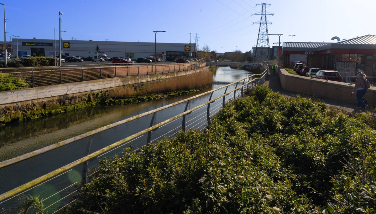
ROYAL CANAL PREMIUM CYCLE ROUTE SHERIFF STREET TO NEWCOMEN BRIDGE
The weather caught me by surprise today as it was a beautiful sunny day so I took the opportunity to visit the East Wall area of the Docklands.
Dublin City Council’s Royal Canal cycle route is a new 7km pathway and linear park(s) running from the North Quays to Ashtown. To the best of my knowledge the first 500m section was completed about twelve years ago.
The second section from Sheriff Street to Newcomen Bridge was completed in July 2020. This section consists of a segregated three-metre wide cycle track and two-metre wide footpath on a viaduct bridge alongside a new linear park.
The third section will run from the North Strand to Cross Guns Bridge in Phibsborough. The final section, from Phibsborough to Longford Bridge in Ashtown, has been divided into four phases the first of which was due to be completed by the end of 2020.
The Royal Canal Way is a 144-kilometre (89-mile) long-distance trail that follows the towpath of the canal from Ashtown, Dublin to Cloondara, County Longford. It is typically completed in three days. It is designated as a National Waymarked Trail by the National Trails Office of the Irish Sports Council and is managed by Waterways Ireland. In 2015, Dublin City Council began extending the walking and cycling route along the Royal Canal from Ashtown to Sheriff Street Upper. The Royal Canal Way connects with the Westmeath Way west of Mullingar, and will eventually form the eastern end of the Dublin-Galway Greenway, the final part of EuroVelo Route 2, a cycling path from Moscow across Europe to Galway.
The Royal Canal Greenway is the greenway encompassing the Royal Canal Way between Maynooth and Cloondara, with a branch to Longford. It was launched in March 2021.

SEAN O'CASEY COMMUNITY CENTREINTERESTING BUILDING
Located on St Mary's Road, East Wall, Dublin.
I first noticed this building back in 2009 but at the time I got lost trying to locate it but I now know the area must better.
The building provides social resources and civic representation for the community of the East Wall, including a theatre, day-care, creche, educational and recreational facilities.
Built on reclaimed land, its street network swivelled against the dominant grid iron urban development, East Wall is a place apart, contained within city-scale infrastructural boundaries.
Circumscribed by the curved lines of nineteenth-century railway tracks and the straight line of the eighteenth-century sea wall, it is offset from the Georgian grid parallel with the River Liffey. The site for the project is on the cleared ground of a former school building, appropriated in recent years for community welfare and sports facilities. The site exists as a significant void within the low-rise density of the neighbourhood of two storey terraced housing.

FATIMA LUAS STOPJAMES WALK RIALTO
Back in the 1970s and 1980s when I worked nearby Fatima Mansions was an area that I avoided at all costs and old habits die hard so I am still inclined to avoid the area. However, I am not sure how it happened but I arrived at the Fatima Tram Stop.
Fatima Mansions is an extensive public housing complex located in Rialto, Dublin. In the early 21st century, it underwent a substantial urban renewal programme with the assistance of public and private funding. All existing apartment blocks were demolished to make way for 600 accommodation units, consisting of social, affordable and private housing along with community, business and leisure facilities at a cost of €200 million. The blocks have since been renamed Herberton Apartments, but the area is still referred to locally as Fatima, which is the name of the adjacent Luas Red Line tram stop.
Work on the original complex started before World War II under the direction of Dublin Corporation (now Dublin City Council) but construction was held up due to material shortages. The first phase of construction was finally completed after the war and the first tenants began to move in in 1947: the development consisted of fifteen blocks, each of four floors in height. They replaced tenement housing for the area's working-class residents, and provided a great improvement in living conditions. In the mid 1980s the area became notorious for its high levels of heroin use and drug dealing, which eventually led to the original complex's demolition due to the drug problem's severity.

A progressive web application (PWA), commonly known as a progressive web app, is a type of application software delivered through the web, built using common web technologies including HTML, CSS, JavaScript, and WebAssembly. It is intended to work on any platform that uses a standards-compliant browser, including both desktop and mobile devices.
As of 2021, PWA features are supported to varying degrees by Google Chrome, Apple Safari, Firefox for Android, and Microsoft Edge but not by Firefox for desktop.
Since a progressive web app is a type of webpage or website known as a web application, they do not require separate bundling or distribution. Developers can just publish the web application online, ensure that it meets baseline "installability requirements", and users will be able to add the application to their home screen. Publishing the app to digital distribution systems like Apple App Store or Google Play is optional.
In 2015, designer Frances Berriman and Google Chrome engineer Alex Russell coined the term "progressive web apps" to describe apps taking advantage of new features supported by modern browsers, including service workers and web app manifests, that let users upgrade web apps to progressive web applications in their native operating system (OS). Google then put significant efforts into promoting PWA development for Android. Firefox introduced support for service workers in 2016, and Microsoft Edge and Apple Safari followed in 2018, making service workers available on all major systems.
By 2019, PWAs were supported by desktop versions of most browsers, including Microsoft Edge (on Windows) and Google Chrome[ (on Windows, macOS, Chrome OS and Linux).
In December 2020, Firefox for desktop abandoned implementation of PWAs (specifically, removed the prototype "site-specific browser" configuration that had been available as an experimental feature). A Firefox architect noted: "The signal I hope we are sending is that PWA support is not coming to desktop Firefox anytime soon." Mozilla still plans to support PWAs on Android.
Since a progressive web app is a type of webpage or website known as a web application, they do not require separate bundling or distribution. In particular, there is no requirement for developers or users to install the web apps via digital distribution systems like Apple App Store, Google Play, Microsoft Store or Samsung Galaxy Store. To varying degrees, the major app stores support publication of PWAs.[1] Google Play, Microsoft Store,[19] and Samsung Galaxy Store support PWAs, but Apple App Store does not. Microsoft Store publishes some qualifying PWAs automatically (even without app authors' request) after discovering them via Bing indexing.
Progressive web apps are all designed to work on any browser that is compliant with the appropriate web standards. As with other cross-platform solutions, the goal is to help developers build cross-platform apps more easily than they would with native apps. Progressive web apps employ the progressive enhancement web development strategy.
Some progressive web apps use an architectural approach called the App Shell Model.[ In this model, service workers store the Basic User Interface or "shell" of the responsive web design web application in the browser's offline cache. This model allows for PWAs to maintain native-like use with or without web connectivity. This can improve loading time, by providing an initial static frame, a layout or architecture into which content can be loaded progressively as well as dynamically.
The technical baseline criteria for a site to be considered a progressive web app and therefore "installable" by browsers were described by Russell in a follow-up post[23] and updated since:
Originate from a secure origin. Served over TLS and green padlock displays (no active mixed content). Progressive web apps must be served via HTTPS to ensure user privacy, security, and content authenticity.
Register a service worker with a fetch handler. Progressive web apps must use service workers to create programmable content caches. Unlike regular HTTP web cache, which caches content after the first use and then relies on various heuristics to guess when content is no longer needed, programmable caches can explicitly prefetch content in advance before it's used for the first time and explicitly discard it when it is no longer needed. This requirement helps pages to be accessible offline or on low quality networks.
Reference a web app manifest. The manifest must contain at least the five key properties: name or short_name, start_url, and display (with a value of standalone, fullscreen or minimal-ui), and icons (with 192px and a 512px versions). Information contained in manifest makes PWAs easily shareable via a URL, discoverable by a search engines, and alleviates complex installation procedures (but PWAs still can be listed in a third-party app store).[27] Furthermore, PWAs support native app-style interactions and navigation, including being added to home screen, displaying splashscreens, etc.
Commercial DisclosurePLEASE NOTE THAT LINKS BELOW MAY REDIRECT YOU TO THE AMAZON LOCATION MOST LIKELY TO SHIP TO YOUR ADDRESS
You will find links to buy products from Amazon, Google and other partners. If you click on these links, you’ll find that the URL includes a small extra piece of text which identifies that the click came from my websites. This text is an affiliate code, and it means that I get a small percentage of the money you spend if you choose to buy that product, or, in some cases, other products from the site soon after. These affiliate links help pay the costs of producing my websites and ensure that the content is free to you.