THE GRANGEGORMAN AREA OF DUBLIN
Grangegorman is a suburb of Dublin, Ireland, situated on the Northside of the city, in the administrative area of Dublin City Council. It is also a civil parish in the historical barony of Dublin. It is best known as the location of St. Brendan's Hospital which was historically the main psychiatric hospital serving the greater Dublin region.
Along with Stoneybatter and Glassmanogue, Grangegorman was recorded in 1610 as one of only three remote villages in this region and at that stage, lying north of Ostman town and north of the River Liffey they were not joined to the city of Dublin. The area is currently the subject of a major redevelopment plan under the aegis of the Grangegorman Development Agency.
Grangegorman is located in the Dublin 7 postal district. North of the River Liffey and about 1 km from Dublin city centre, its boundaries run along Brunswick Street North, Prussia Street and Manor Street, the North Circular Road and Phibsborough Road and Constitution Hill. Grangegorman is surrounded to the south east by Smithfield to the west by Stoneybatter, north by Cabra, to the north and east by Phibsborough / Broadstone.
The geographical definition of the north Dublin electoral division known as Arran Quay B, encompasses Grangegorman. The 2006 Census gives the population of Arran Quay B as 3692. This represents a 19.5 per cent increase from the population of the area in 2002.
The 'Neighbourhood of Grangegorman' is defined by Irish statute, the Grangegorman Development Agency Act (2005). Schedule 2, section 4 of this act defines the 'Neighbourhood of Grangegorman' as consisting of the electoral wards of Arran Quay A, Arran Quay B, Arran Quay C, Arran Quay D, Arran Quay E, Inns Quay B, Inns Quay C and Cabra East C. Essentially, this act, for the purposes of the statutory body of the Grangegorman Development Agency, extends the spatial definition of Grangegorman as far south as the River Liffey, and encompasses parts of east Cabra, Phibsborough, Broadstone and Stoneybatter.
According to this definition the population of the 'Neighbourhood of Grangegorman' was equal to 24,534 in 2006.
SORRY FOR THE DELAY
-
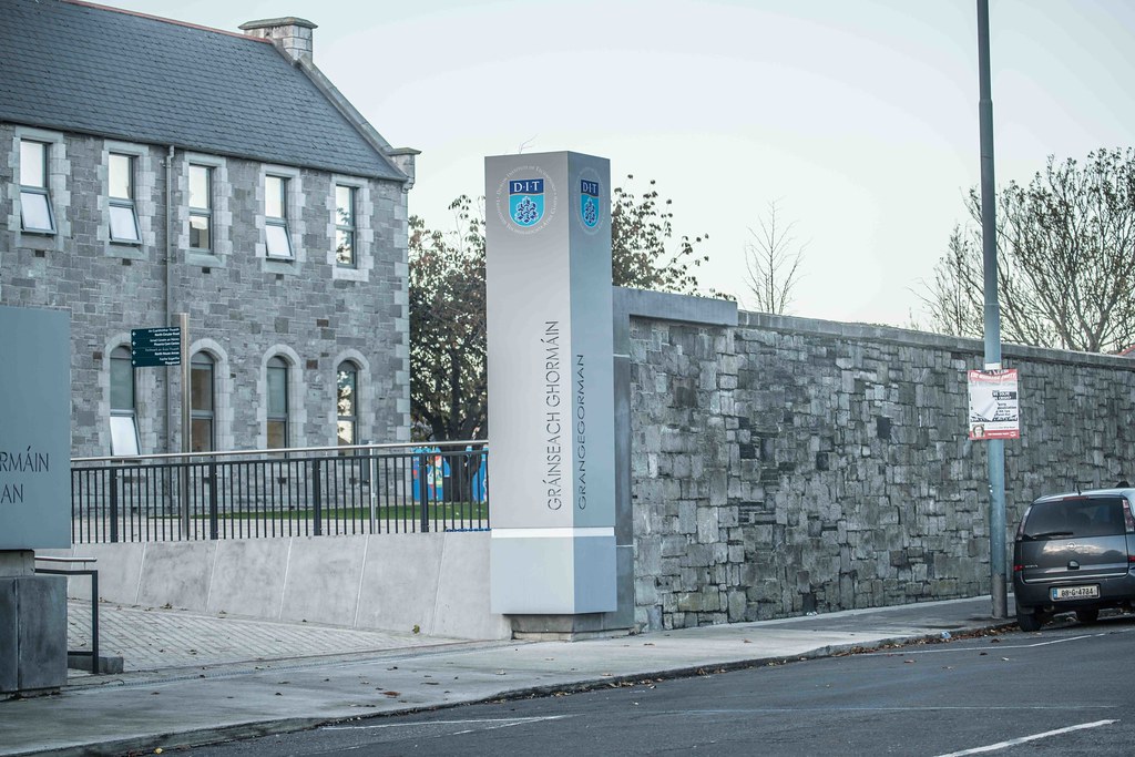
DIT CAMPUS
-
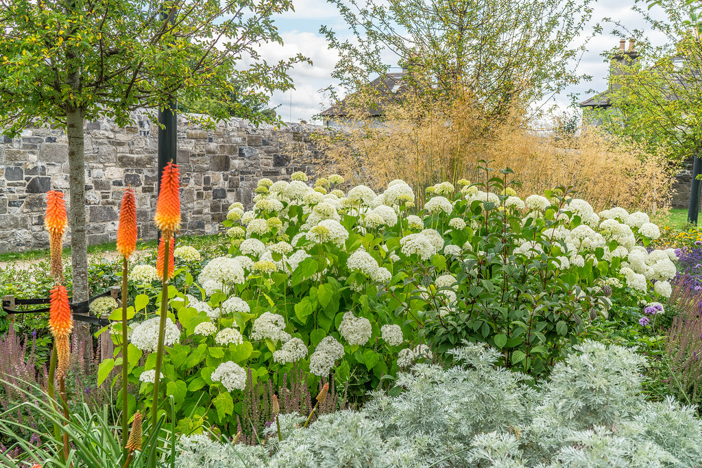
FLOWER GARDEN -JULY 2016
-
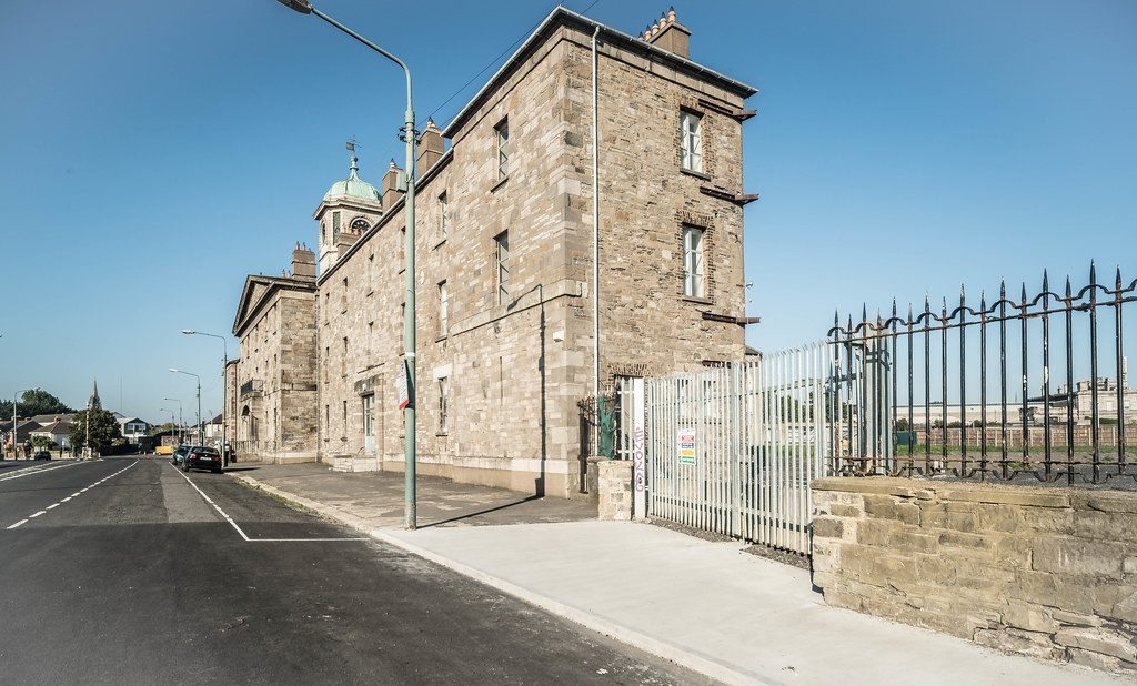
RICHMOND PENITENTIARY
HISTORIC TIMELINE:
1773 – House of Industry, Brunswick St. N (demolished)
1806 – Bedford Asylum (demolished)
1810 – Richmond Asylum (Francis Johnston House) F Johnston (S range only remains)
1814 – Richmond Penitentiary (Clocktower) F Johnston (partial)
1836 – Church of Ireland G Wilkinson
1849 – St Lawrence’s Church W G Murray
1850 – Fever Hospital W G Murray
1854 – District Asylum (North House) W G Murray
1925 – Grangegorman District Mental Hospital
1960 – St. Brendan’s Psychiatric Hospital
2013 – St. Brendan’s Hospital closes. All Patients and staff move to the Phoenix Care Centre
You will find links to buy products from Amazon, Google and other partners. If you click on these links, you’ll find that the URL includes a small extra piece of text which identifies that the click came from my websites. This text is an affiliate code, and it means that I get a small percentage of the money you spend if you choose to buy that product, or, in some cases, other products from the site soon after. These affiliate links help pay the costs of producing my websites and ensure that the content is free to you.
COPYRIGHT INFORMATION BELOW APPLIES ONLY TO PHOTOGRAPHS

This work by William Murphy aka Infomatique is licensed under a Creative Commons Attribution-NonCommercial-ShareAlike 4.0 International License.
Permissions beyond the scope of this license may be available at https://excellentstreetimages.com/in-the-year-twentytwenty/copyright/.