This life sized statue of Patrick Kavanagh sitting on one side of a park bench is by John Coll and it was unveiled in June 1991. It is situated on the north bank of the Grand Canal across from  Mespil Road. Previously, I incorrectly described it as being on Mespil Road when it is, in fact, at Wilton Terrace. I have noticed that a number of other accounts describe it as being on Mespil Road ... I hope that I am not responsible for such errors. Note: When I was young Wilton Terrace was a very active red-light area at night.


Patrick Kavanagh (21 October 1904 – 30 November 1967) was an Irish poet and novelist. His best-known works include the novel Tarry Flynn, and the poems "On Raglan Road" and "The Great Hunger". He is known for his accounts of Irish life through reference to the everyday and commonplace. He also played as a goalkeeper for his local Gaelic football club.


John Coll is one of Ireland's most prominent figurative sculptors. He has sculpted many works of national importance including monuments to the poet Patrick Kavanagh and the writer Brendan Behan on the Dublin canals. Other large-scale projects include a monument to Countess Markievicz in Rathcormac, Co Sligo and locally a life-size portrait of the racehorse "Bobby-Jo" in Mountbellew, Co Galway.

LIFE SIZED STATUE OF PATRICK KAVANAGH 001
LIFE SIZED STATUE OF PATRICK KAVANAGH 002
LIFE SIZED STATUE OF PATRICK KAVANAGH 003
LIFE SIZED STATUE OF PATRICK KAVANAGH 004
LIFE SIZED STATUE OF PATRICK KAVANAGH 005
LIFE SIZED STATUE OF PATRICK KAVANAGH 006
LIFE SIZED STATUE OF PATRICK KAVANAGH 007

Previously the statues were inside the window of a nearby building. Moved outside c. 2017


I have noticed a number of blogs indicating that the artist responsible for this set of sculptures was/is John Coll but they may be confused as he was responsible for the statue of Patrick Kavanagh on the Grand Canal at Baggot Street [nearby]and  Brendan Behan on the Royal Canal in Drumcrondra. 


These two sculptures, by Neil C Breen [according to the List Of Public Art In Dublin],  have been outside Warrington House at Mount Street Crescent since 1994 [Moved outside c. 2017] however I do not know how long Starbucks have been here but making a guess I would say that they have operated from Warrington House since 2018 or 2019. Note: Unfortunately I cannot locate any information about Neil C Breen.


I am willing to bet that most Dubliners are unaware of this pair of statues at Mount Street Crescent. The statues do not appear to be listed in any tour guides. I have tried, but failed, to have them listed [pinned] on Google Maps but I intent to try again.


It should be noted that there are two sculpture nearby: "Birdie" by Rowan Gillespie and "Memories Of Mount Street" by Derek Fitzsimons. Of course I have photographed both,


John Brendan Keane (21 July 1928 – 30 May 2002) was an Irish playwright, novelist and essayist from Listowel, County Kerry. John is the taller of the two.


Brian Patrick Friel (9 January 1929 – 2 October 2015) was an Irish dramatist, short story writer and founder of the Field Day Theatre Company. He had been considered one of the greatest living English-language dramatists. He has been likened to an "Irish Chekhov" and described as "the universally accented voice of Ireland".  His plays have been compared favourably to those of contemporaries such as Samuel Beckett, Arthur Miller, Harold Pinter and Tennessee Williams.


Recognised for early works such as Philadelphia, Here I Come! and Faith Healer, Friel had 24 plays published in a career of more than a half-century. He was elected to the honorary position of Saoi of Aosdána. His plays were commonly produced on Broadway in New York City throughout this time, as well as in Ireland and the UK. In 1980 Friel co-founded Field Day Theatre Company and his play Translations was the company's first production. With Field Day, Friel collaborated with Seamus Heaney, 1995 recipient of the Nobel Prize in Literature. Heaney and Friel first became friends after Friel sent the young poet a letter following publication of his book Death of a Naturalist.


Friel was a member of the American Academy of Arts and Letters, the British Royal Society of Literature and the Irish Academy of Letters. He was appointed to Seanad Éireann in 1987 and served until 1989. In later years, Dancing at Lughnasa reinvigorated Friel's oeuvre, bringing him Tony Awards (including Best Play), the Laurence Olivier Award for Best New Play and the New York Drama Critics Circle Award for Best Play. It was also adapted into a film, starring Meryl Streep, directed by Pat O'Connor, script by Frank McGuinness.


BRIAN FRIEL AND JOHN B KEANE 001
BRIAN FRIEL AND JOHN B KEANE 002
BRIAN FRIEL AND JOHN B KEANE 003
BRIAN FRIEL AND JOHN B KEANE 004
BRIAN FRIEL AND JOHN B KEANE 005

In June 2019 it was announced that this hundred year old pub (Situated on Mountpleasant Square in Ranelagh) would cease trading immediately.  However, it has recently reopened as a Gastro Bar offering Spicy Chicken Wings or Irish Cod and Chips.


At the centre of Ranelagh is "Ranelagh Triangle", semi-officially "the Angle", which is the junction of Ranelagh Village and Charleston Road at Field's Terrace. Nearby restaurant "Tribeca" references these geographical features (i.e., Tri-angle Be-low Ca-nal). To the North of the Triangle is the "Hill Area" of Ranelagh, which was the scene of Lee Dunne's novel, "Goodbye to the Hill". Ranelagh contains many fine Victorian streets such as those surrounding Mount Pleasant Square.

THE HILL PUB IS BACK IN ACTION 001
THE HILL PUB IS BACK IN ACTION 002
THE HILL PUB IS BACK IN ACTION 003

The Kodak Building is one of two listed Art Deco buildings in Dublin. It was designed by Architects Donnelly, Moore and Keatinge in 1930.


A complete refurbishment was undertaken in 1998 to convert the building into modern office space by Paul Keogh Architects . The project received an RIAI Award and won a prestigious Glen Dimplex Design Award in 2002. It was short listed for the RIAI Silver Medal for Conservation and has featured in international publications on the design principles of remodelling existing buildings for contemporary use.


Kodak began selling its original camera, created by George Eastman, in 1888 in the US for $25. It was a leather-covered box camera that came pre-loaded with 100-exposure roll film. When used up, the entire camera could be sent to the Kodak factory, after which it would be returned loaded with fresh film along with the negatives and mounted prints, for a cost of $10. It was advertised with the slogan "You Press the Button, We Do the Rest". Replacement film was sold for $2 for customers who had access to photographic processing. The ease of use and relatively low cost made photography widely accessible to the general public rather than only professional photographers, beginning the modern era of consumer photography.


The Eastman Kodak Company (referred to simply as Kodak  is an American public company that produces various products related to its historic basis in analogue photography. The company is headquartered in Rochester, New York, and is incorporated in New Jersey. Kodak provides packaging, functional printing, graphic communications, and professional services for businesses around the world. Its main business segments are Print Systems, Enterprise Inkjet Systems, Micro 3D Printing and Packaging, Software and Solutions, and Consumer and Film. It is best known for photographic film products.


KODAK HOUSE IN RATHMINES 001
KODAK HOUSE IN RATHMINES 002
KODAK HOUSE IN RATHMINES 003
KODAK HOUSE IN RATHMINES 004

Bathing was very popular from the eighteenth century onwards. For example, Blackrock is mentioned in a number of books of the time as being an attractive bathing area for many Dublin inhabitants.


Two separate bathing areas in old Dun Laoghaire have been noted in maps dating from the 1790s. Sources mention baths in Kingstown being built by the Royal Hotel in 1828. They were probably removed to make way for the construction of the railway in 1836.


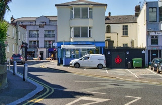
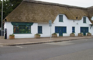
In 1843, John Croswaithe built baths on the corner of Scotsman's Bay. Originally known as the Royal Victorian Baths, they were only used by those who had the means to afford them. This is the site of today's Dun Laoghaire baths.


Crosthwaite lived in Victoria Cottage, which is now long demolished. It stood where the road now runs, in front of the present-day Dun Laoghaire Baths. Croswaithe Park in Dun Laoghaire immortalises his name.


Kingstown Urban District Council bought the baths in the late 1890s and renovated them between 1905 and 1911 at a cost of £12,000. This is when they became known as Kingstown Baths, and later Dun Laoghaire Baths. The current derelict Edwardian entrance dates from this time. Crosthwaite also built baths at Seapoint, which were privately owned.


Dun Laoghaire beach was also a popular bathing area. The beach was pebbly, but set up with terraces and sun loungers. Many old photographs and postcards show this to be a very popular area for bathing and recreation.


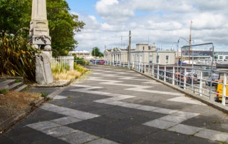
Works at the Dun Laoghaire Baths continue and when complete will provide for the continuing public use of the area. Works include the retention and securing of the existing Baths Pavilion and the removal of dilapidated structures to the rear of the Pavilion to create a new route between Newtownsmith and the East Pier. This walkway will be at a level that will create a safe and secure walk offering panoramic views over Scotsman’s Bay. The form of this walk will reflect the original rocky shoreline and the historic alignment of the old gun battery that was originally located on this site. The walkway will incorporate sitting and viewing points and the land adjoining this walk will be re-graded to create sloping grassed areas. The scheme also proposes the refurbishment of the small gazebo situated along this route.


The existing Baths Pavilion together with a smaller outbuilding will be retained, weathered and secured while the remaining dilapidated outbuildings to the rear and side of the Pavilion will be removed.  It is proposed to fit out the Pavilion to accommodate studio space for artists and to provide gallery and café facilities. The studios will be managed by the Arts Department. The original Baths entrance along Windsor Terrace will be restored to provide access. An outdoor ‘café terrace’ linked to the new café will provide an attractive sitting area for viewing eating and relaxing. It is also proposed to create new public toilets facilities at street level which will also be accessible for wheelchair users. Footpaths along Windsor Terrace will be upgraded, and new street trees planted.


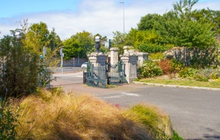
These uses and improvements will create new life and provide enhanced public facilities which will complement and link the area to the adjoining Peoples Park, the completed Metals Project Phases 1 and 2 and the recently completed DLR Lexicon Environs project.


Project Update


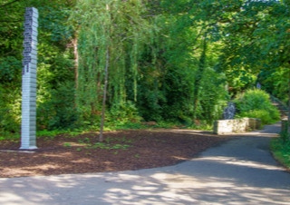
The project is divided into several work zones. These zones include work to the new jetty, works to the new sea walls, works to the Pavilion and works to tie into the existing walkway at Newtownsmith. Currently works to the new jetty are nearing completion. This has created a new viewing point with stunning vistas across Scotsman’s Bay to Sandycove Harbour. The new long bench on the jetty has been also been completed which is inspired by the sitting bench where swimmers relax overlooking Sandycove Harbour. The new Casement Memorial Sculpture by the sculptor Mark Richards is complete and is dramatically sited on a plinth at the end of the jetty.


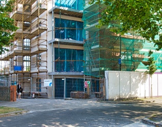
The construction of massive new sea walls supporting the new walkway at the back of the pavilion are also nearing completion. The old Pavilion building has been stabilised enclosed and is now fully weathered. This has allowed the artists’ studios at the lower level and café at the upper level to be progressed with the installation of electrical and mechanical services.  While significant progress has been made in all these areas overall progress in constructing the works has been slower than anticipated. A combination of factors has contributed to this including a requirement to stabilise the retaining walls that supports the Queens Road and Dart cutting, difficulty in constructing the jetty and underpinning and stabilisation required for the Pavilion Building. As a consequence of this the Contractor advises a completion date of Summer 2022. This completion date is however subject to the ongoing impact of the site closure caused by the Covid pandemic.


DUN LAOGHAIRE BATHS A WORK IN PROGRESS 001
DUN LAOGHAIRE BATHS A WORK IN PROGRESS 002
DUN LAOGHAIRE BATHS A WORK IN PROGRESS 003
DUN LAOGHAIRE BATHS A WORK IN PROGRESS 004
DUN LAOGHAIRE BATHS A WORK IN PROGRESS 005
DUN LAOGHAIRE BATHS A WORK IN PROGRESS 006
DUN LAOGHAIRE BATHS A WORK IN PROGRESS 007
DUN LAOGHAIRE BATHS A WORK IN PROGRESS 008
DUN LAOGHAIRE BATHS A WORK IN PROGRESS 009
DUN LAOGHAIRE BATHS A WORK IN PROGRESS 010

Blackrock, some hundreds of years ago, was variously called Newtown-at-the Black Rock, Newtown on the Strand by the Black Rock, Newtown Castle Byrne, or simply Newtown, so that "Blackrock" is simply an abbreviation of one of its ancient titles. For example, the town was called Newtown in a 1488 Act of Parliament. The name still survives in Newtown Avenue, and Newtown House. It was thus distinguished from Newtown-in-the-Deer-Park, as the village of Newtown Park was then called, from the circumstance that it was built in the Deer Park belonging to Stillorgan House, or Castle (a quo Newtownpark Avenue).


Blackrock is named after the local geological rock formation to be found in the area of Blackrock Park. Most of it is now buried under the park, but it is said that it is possible to see it just north of the pond. The rock itself is a limestone calp that when wet appears black, thus giving the name Black Rock. For the construction of the railway in 1834, the rock was extensively used for the wall cappings between Williamstown and Blackrock and can also be seen in the walls of the train station at Blackrock. St. Marys Chapel of Ease on St. Mary's Place, nicknamed the Black Church, is constructed using the same Black Rock (limestone calp), although the rock used in its construction is locally sourced to the church.


IS BLACKROCK A VILLAGE OR A TOWN 001
IS BLACKROCK A VILLAGE OR A TOWN 002
IS BLACKROCK A VILLAGE OR A TOWN 003
IS BLACKROCK A VILLAGE OR A TOWN 004
IS BLACKROCK A VILLAGE OR A TOWN 005
IS BLACKROCK A VILLAGE OR A TOWN 006
IS BLACKROCK A VILLAGE OR A TOWN 007
IS BLACKROCK A VILLAGE OR A TOWN 008
IS BLACKROCK A VILLAGE OR A TOWN 009
IS BLACKROCK A VILLAGE OR A TOWN 010
IS BLACKROCK A VILLAGE OR A TOWN 011
IS BLACKROCK A VILLAGE OR A TOWN 012

Blackrock railway station serves Blackrock in Dún Laoghaire–Rathdown, Ireland. It opened publicly on 17 December 1834 and is one of the three original stations on the Dublin and Kingstown Railway (D&KR), the oldest public passenger railway in Ireland. From the inception of the Dublin Area Rapid Transit (DART) service in 1984, all DART services stop at Blackrock.


Directly outside the station are bus stops served by several Dublin Bus routes, Go-Ahead Ireland routes and some private operators.


I was contacted by an online follower asking why I sometimes used "Train Station" as well as "Railway Station". Over the years I have seen signs in Ireland that referred to Train Station, Station or Railway Station.


According to various sources: In British English, traditional terminology favours railway station or simply station, even though train station, which is often perceived as an Americanism, is now about as common as railway station in writing; railroad station is not used, railroad being obsolete. In British usage, the word station is commonly understood to mean a railway station unless otherwise qualified.


In the United States, the most common term in contemporary usage is train station; railroad station and railway station are less common, though they were more common in the past. In the U.S., the term depot is sometimes used as an alternative name for station, along with the compound forms train depot, railway depot and railroad depot - it is used for both passenger and freight facilities. The term depot is not used in reference to vehicle maintenance facilities in American English whereas it is in the UK and Ireland, and even neighbouring Canada, for example.

TRAIN STATION IN BLACKROCK VILLAGE 001
TRAIN STATION IN BLACKROCK VILLAGE 002
TRAIN STATION IN BLACKROCK VILLAGE 003
TRAIN STATION IN BLACKROCK VILLAGE 004
TRAIN STATION IN BLACKROCK VILLAGE 005
TRAIN STATION IN BLACKROCK VILLAGE 006
TRAIN STATION IN BLACKROCK VILLAGE 007
TRAIN STATION IN BLACKROCK VILLAGE 008
TRAIN STATION IN BLACKROCK VILLAGE 009
TRAIN STATION IN BLACKROCK VILLAGE 010
TRAIN STATION IN BLACKROCK VILLAGE 011
TRAIN STATION IN BLACKROCK VILLAGE 012
TRAIN STATION IN BLACKROCK VILLAGE 013
TRAIN STATION IN BLACKROCK VILLAGE 014
TRAIN STATION IN BLACKROCK VILLAGE 015

The town was officially renamed Kingstown in 1821 in honour of a visit by the British King George IV, but reverted to its ancient Irish name by resolution of the town council in 1921. This monument was erected to mark the occasion of the visit.

The inscription is as follows: 


To Commemorate the visit of the King to this part of his

dominions and to record that on the 3rd of September 1821

His Majesty in person graciously named this Asylum Harbour

the Royal of Harbour of George IV and on the same day

embarked from hence.


King George arrived in Ireland on his 59th birthday in August 1821 and it was expected that he would arrive in Dun Laoghaire. I think that it was spelled 'DunLeary' at the time. But for some reason [related to too much alcohol] he first landed in Ireland at the West pier in Howth where his footprints were recorded for posterity. 


After spending a few weeks having a great time in Ireland the king decided to exit via Dun Laoghaire which was later renamed Kingstown in his honour. The name did not change back until 1922 when Ireland was independent. 


The George IV monument was erected about 1823 to commemorate the 1821 visit. However, the monument was controversial from the start. It was lampooned by Thackeray the poet. Also,  it was a target for many protesters and attacks including a bombing in  1970, after which one of the 4 balls forming the base was badly damaged and had to be replaced [if my memory serves me well the ball was initially replaced by a block of wood which remained for an expended period].


GEORGE IV MEMORIAL ERECTED IN 1823 001
GEORGE IV MEMORIAL ERECTED IN 1823 002
GEORGE IV MEMORIAL ERECTED IN 1823 003
GEORGE IV MEMORIAL ERECTED IN 1823 004
GEORGE IV MEMORIAL ERECTED IN 1823 005

I have noticed that very few passers-by pay any attention to this large sculpture located beside the LexIcon Library and Cultural Centre in Dun Laoghaire.


The "Triple Cross" of Christ the King, symbolising the three distinct aspects of Christ's life – Desolation, Consolation and Triumph – has been standing 18 feet high as a major landmark for the town, since it was formally unveiled in 1978.


The sculpture is 18 feet high and weighs approximately 3.5 tons. The three scenes depicted on the tall bronze pillar symbolise three distinct aspects of Christ’s life - desolation, consolation and triumph. A shrouded weary Jesus, crucified on the cross, the heavy canopy symbolising the day of gloom and despair; the resurrected Christ with arms outstretched; and Christ pulling clear of his bondage and emerging to greet his followers. These scenes follow clockwise around the mast of the pillar, the arms of the cross dividing them as we move down the piece. The sculpture narrows to angular sheets of bronze until we reach the large bronze plaques, which form the lower section. 


The Christ the King Statue is by Andrew O’Connor, a well-known Irish American sculptor whose work is on display throughout the world. Among his best-known works are the statue of Abraham Lincoln in Springfield, Illinois; Peace by Justice in The Hague; Tristan and Iseult in the Brooklyn Museum and the Lafayette Monument in Baltimore. Based in Paris for many years, O’Connor was strongly influenced by Auguste Rodin, whom he knew. The sculpture now known as Christ the King and located in Dún Laoghaire was originally known as the Triple Cross. O’Connor entered the Triple Cross in a competition held by the French for a Monument to the Dead of the Great War. O’Connor was awarded the Legion d’Honneur for the Triple Cross. It was first exhibited, in plaster, at the Paris Salon of 1926. 


According to a 1932 booklet the original idea for the erection of a sculpture in Dún Laoghaire came from a 1925 Encyclical Letter which instituted the Feast of Christ the King – to be held on the last Sunday of October.


In 1931 a group of laymen in Dún Laoghaire got together with a view to erecting a statue to honour the new feast day. Dún Laoghaire was regarded as the gateway to Ireland and thus a fitting place to raise such a significant monument. A committee was established to select and acquire a site for the sculpture. The selection criteria for the site was that there should be an uninterrupted view of the monument for ships entering and leaving the harbour as well as those traversing the bay and that there should be easy approach to those who wished to visit the site on land. 


An appeal booklet appeared the following year announcing Andrew O’Connor as the committee’s choice of sculptor. The piece was eventually cast in bronze but World War II intervened and it was hidden in France to avoid its three tonnes being melted down. It was eventually delivered to Dún Laoghaire in 1949. However, due to local clerical opposition to the statue it was not erected and for many years was stored in a back garden on Rochestown Avenue. Eventually Christ the King was unveiled in the Haigh Terrace location on December 16, 1978 forty-seven years after the public meeting in the town hall. This location was not the originally intended location and came in for criticism at the time of the sculpture’s erection. 


A LARGE TRIPLE CROSS IN DUN LAOGHAIRE 001
A LARGE TRIPLE CROSS IN DUN LAOGHAIRE 002
A LARGE TRIPLE CROSS IN DUN LAOGHAIRE 003
A LARGE TRIPLE CROSS IN DUN LAOGHAIRE 004
A LARGE TRIPLE CROSS IN DUN LAOGHAIRE 005
A LARGE TRIPLE CROSS IN DUN LAOGHAIRE 006
A LARGE TRIPLE CROSS IN DUN LAOGHAIRE 007
A LARGE TRIPLE CROSS IN DUN LAOGHAIRE 008
A LARGE TRIPLE CROSS IN DUN LAOGHAIRE 009

Blackrock Park is a pleasant green area overlooking Dublin Bay, in Blackrock County Dublin, and boasts a well equipped children's playground, cycle path and trees.


There is also a picturesque pond containing a small island, and swans can regularly been seen there. The Peace Fountain in the pond was constructed in 1986 to mark International Year for Peace.


Blackrock had a beach that was a popular bathing place until the construction of the railway close to the shoreline. The space between the shore and the railway created an area that flooded with sea water at high tide. This created a malodorous salty marsh similar to that at Booterstown marsh. This marsh was a cause of local discomfort for years until it was decided by the Blackrock Town Commissioners (established in 1860) to fill the area in and create a park. The park, which stretches from Blackrock to Booterstown (encompassing Williamstown), was created in the early 1870s. The granite gates at the main entrance once belonged to a house called Vauxhall. The gardens at the entrance were part of the gardens of the old house.


The Williamstown Martello Tower in Blackrock Park was built between 1804–1806. When the tower was built, it would have been surrounded by sea water at high tide as it was built in the inter-tidal beach area. The tower became isolated from the sea when the construction of the railway took place, but sea water still flowed into the area at high tide. It wasn't until the filling in of the area to form the Blackrock Park that the tower was to be on dry land. That part of the tower which is visible today is actually the first floor as the ground floor is buried underground.


BLACKROCK PUBLIC PARK 3 AUGUST 2022 001
BLACKROCK PUBLIC PARK 3 AUGUST 2022 002
BLACKROCK PUBLIC PARK 3 AUGUST 2022 003
BLACKROCK PUBLIC PARK 3 AUGUST 2022 004
BLACKROCK PUBLIC PARK 3 AUGUST 2022 005
BLACKROCK PUBLIC PARK 3 AUGUST 2022 006
BLACKROCK PUBLIC PARK 3 AUGUST 2022 007
BLACKROCK PUBLIC PARK 3 AUGUST 2022 008
BLACKROCK PUBLIC PARK 3 AUGUST 2022 009
BLACKROCK PUBLIC PARK 3 AUGUST 2022 010
BLACKROCK PUBLIC PARK 3 AUGUST 2022 011
BLACKROCK PUBLIC PARK 3 AUGUST 2022 012
BLACKROCK PUBLIC PARK 3 AUGUST 2022 013
BLACKROCK PUBLIC PARK 3 AUGUST 2022 014
BLACKROCK PUBLIC PARK 3 AUGUST 2022 015
BLACKROCK PUBLIC PARK 3 AUGUST 2022 016
BLACKROCK PUBLIC PARK 3 AUGUST 2022 017
BLACKROCK PUBLIC PARK 3 AUGUST 2022 018
BLACKROCK PUBLIC PARK 3 AUGUST 2022 019
BLACKROCK PUBLIC PARK 3 AUGUST 2022 020
BLACKROCK PUBLIC PARK 3 AUGUST 2022 021
BLACKROCK PUBLIC PARK 3 AUGUST 2022 022
BLACKROCK PUBLIC PARK 3 AUGUST 2022 023
BLACKROCK PUBLIC PARK 3 AUGUST 2022 024
BLACKROCK PUBLIC PARK 3 AUGUST 2022 025
BLACKROCK PUBLIC PARK 3 AUGUST 2022 026
BLACKROCK PUBLIC PARK 3 AUGUST 2022 027
BLACKROCK PUBLIC PARK 3 AUGUST 2022 028
BLACKROCK PUBLIC PARK 3 AUGUST 2022 029
BLACKROCK PUBLIC PARK 3 AUGUST 2022 030
BLACKROCK PUBLIC PARK 3 AUGUST 2022 031
BLACKROCK PUBLIC PARK 3 AUGUST 2022 032
BLACKROCK PUBLIC PARK 3 AUGUST 2022 033
BLACKROCK PUBLIC PARK 3 AUGUST 2022 034
BLACKROCK PUBLIC PARK 3 AUGUST 2022 035
BLACKROCK PUBLIC PARK 3 AUGUST 2022 036
BLACKROCK PUBLIC PARK 3 AUGUST 2022 037
BLACKROCK PUBLIC PARK 3 AUGUST 2022 038

The park is located in Rathfarnham, Rathgar and Milltown. It is named after the River Dodder, which flows through it.


The Dodder Valley Linear Park is a unique and priceless asset for the people of South Dublin and beyond. In addition to its natural conservation value, the park offers a rich heritage, outstanding scenery and a sanctuary for peaceful recreation.


A SECTION OF THE DODDER LINEAR PARK 001
A SECTION OF THE DODDER LINEAR PARK 002
A SECTION OF THE DODDER LINEAR PARK 003
A SECTION OF THE DODDER LINEAR PARK 004
A SECTION OF THE DODDER LINEAR PARK 005
A SECTION OF THE DODDER LINEAR PARK 006
A SECTION OF THE DODDER LINEAR PARK 007
A SECTION OF THE DODDER LINEAR PARK 008
A SECTION OF THE DODDER LINEAR PARK 009
A SECTION OF THE DODDER LINEAR PARK 010
A SECTION OF THE DODDER LINEAR PARK 011
A SECTION OF THE DODDER LINEAR PARK 012
A SECTION OF THE DODDER LINEAR PARK 013
A SECTION OF THE DODDER LINEAR PARK 014
A SECTION OF THE DODDER LINEAR PARK 015
A SECTION OF THE DODDER LINEAR PARK 016
A SECTION OF THE DODDER LINEAR PARK 017
A SECTION OF THE DODDER LINEAR PARK 018
A SECTION OF THE DODDER LINEAR PARK 019
A SECTION OF THE DODDER LINEAR PARK 020
A SECTION OF THE DODDER LINEAR PARK 021
A SECTION OF THE DODDER LINEAR PARK 022
A SECTION OF THE DODDER LINEAR PARK 023
A SECTION OF THE DODDER LINEAR PARK 024
A SECTION OF THE DODDER LINEAR PARK 025
A SECTION OF THE DODDER LINEAR PARK 026

In the past I have referred to the location as Stillorgan Hill rather than The Hill Stillorgan and this attracted some negative comments.


I first photographed this pub back in April 2012 which is more than ten years ago and the area has seen a lot of change since then and a number of large buildings, across the road from the pub, have been demolished making the immediate area somewhat unattractive.


The Stillorgan Orchard is one of the South Dublin’s oldest established pubs and is very popular because of its excellent food and location. Although it is the largest thatched roof pub in Ireland you will be surprised on entering to experience a modern European style cafe look. Spacious seating, lots of natural light and atmosphere. They have great parking facilities, two heated patios and they can cater for private parties and functions.


STILLORGAN ORCHARD 001
STILLORGAN ORCHARD 002
STILLORGAN ORCHARD 003
STILLORGAN ORCHARD 004
STILLORGAN ORCHARD 005
STILLORGAN ORCHARD 006
STILLORGAN ORCHARD 007
STILLORGAN ORCHARD 008
STILLORGAN ORCHARD 009
STILLORGAN ORCHARD 010
STILLORGAN ORCHARD 011
STILLORGAN ORCHARD 012
STILLORGAN ORCHARD 013
STILLORGAN ORCHARD 014
STILLORGAN ORCHARD 015

Kilmacud (Irish: Cill Mhic Oda, meaning 'The Church of the Son Of Oda') is a suburban area of Dublin in Dún Laoghaire–Rathdown, Ireland, at least partly contiguous with Stillorgan.


Kilmacud is north of Sandyford, east of Dundrum and south of Goatstown. The west end of the Lower Kilmacud Road starts in Goatstown, heading in a southerly direction. It then goes southeast through what appears to be a narrow shortcut and on out to the end of Drummartin Road and turns east. From there it continues eastwards through to the Stillorgan dual carriageway or N11. In total, it is about 2.6 kilometres or 1.6 miles long. The Upper Kilmacud Road starts in Dundrum and goes uphill initially it continues eastward, levels off, and continues until a sharp corner brings it northward and downhill. It joins the Lower Kilmacud Road close to St. Laurence's Boys School. It is about 2.9 kilometres or 1.8 miles long.


The areas of Kilmacud and Stillorgan are overlapping. For example, Kilmacud Crokes GAA club is located in Stillorgan and Stillorgan's Roman Catholic parish is called Kilmacud. Kilmacud can be described as the area between and immediately around the Upper and Lower Kilmacud Roads. A now-gone placename sign for Stillorgan stood up until the 1970s near Beaufield Park, which is on the section of the Lower Kilmacud Road running between the shops near St. Laurence's Church, and the Stillorgan Shopping Centre. This would have been on the western edge of Stillorgan, and many of the existing housing estates mentioned earlier would not have been in place prior to the 1950s, so it would have marked the beginnings of a built-up area. The area now referred to as Kilmacud would have been on the western side of the sign, with the Chapel of SS Laurence and Cuthbert close by. This was long before the current church was dedicated just to St. Laurence O'Toole, which opened in 1964.


LOWER KILMACUD ROAD - STILLORGAN VILLAGE 001
LOWER KILMACUD ROAD - STILLORGAN VILLAGE 002
LOWER KILMACUD ROAD - STILLORGAN VILLAGE 003
LOWER KILMACUD ROAD - STILLORGAN VILLAGE 004
LOWER KILMACUD ROAD - STILLORGAN VILLAGE 005
LOWER KILMACUD ROAD - STILLORGAN VILLAGE 006
LOWER KILMACUD ROAD - STILLORGAN VILLAGE 007
LOWER KILMACUD ROAD - STILLORGAN VILLAGE 008
LOWER KILMACUD ROAD - STILLORGAN VILLAGE 009
LOWER KILMACUD ROAD - STILLORGAN VILLAGE 010
LOWER KILMACUD ROAD - STILLORGAN VILLAGE 011
LOWER KILMACUD ROAD - STILLORGAN VILLAGE 012
LOWER KILMACUD ROAD - STILLORGAN VILLAGE 013
LOWER KILMACUD ROAD - STILLORGAN VILLAGE 014
LOWER KILMACUD ROAD - STILLORGAN VILLAGE 015
LOWER KILMACUD ROAD - STILLORGAN VILLAGE 016
LOWER KILMACUD ROAD - STILLORGAN VILLAGE 017
LOWER KILMACUD ROAD - STILLORGAN VILLAGE 018
LOWER KILMACUD ROAD - STILLORGAN VILLAGE 019
LOWER KILMACUD ROAD - STILLORGAN VILLAGE 020
LOWER KILMACUD ROAD - STILLORGAN VILLAGE 021
LOWER KILMACUD ROAD - STILLORGAN VILLAGE 022
LOWER KILMACUD ROAD - STILLORGAN VILLAGE 023
LOWER KILMACUD ROAD - STILLORGAN VILLAGE 024
LOWER KILMACUD ROAD - STILLORGAN VILLAGE 025
LOWER KILMACUD ROAD - STILLORGAN VILLAGE 026
LOWER KILMACUD ROAD - STILLORGAN VILLAGE 027

I lived in Stillorgan in 1964 when the Parish of St. Laurence O’Toole, Kilmacud, was formed. The Parish was made up of Kilmacud and Stillorgan. The first Parish Priest was Canon Harley. Until then our local church was Mount Merrion.


Kilmacud takes its name from the Irish Cill Mochuda, the church of Mochud. Mochud was from Munster, and is associated with the monastery of Lismore, Co.Waterford. He is said to have died around 703. 


St. Brigid is the saint associated with Stillorgan. She founded the monastery in Kildare in the 5th or 6th century, which became one of the “Big Three” – with Iona and Armagh. Emissaries from Kildare came to Stillorgan, and built their church on the site of the present Church of Ireland church, probably in the early 9th century.


After WWII Dublin began to expand. Kilmacud and Stillorgan mushroomed and the needs of the Parish took on new dimensions.The De La Salle Brothers started St Benildus College in 1966 to provide secondary education for boys. Five years later, 1971, the Sisters of the Handmaids of the Sacred Heart of Jesus opened St Raphaela’s to provide a similar education for girls. Fr Walsh C.C. saw the need to provide physical recreation for young people in the Parish and was instrumental in founding the Kilmacud GAA Club in 1959.


A few years earlier, in 1948, the chapels of ease at Kilmacud and Mount Merrion were amalgamated into a single parish. Sixteen years later, in 1964, Kilmacud then became a Parish in its own right.


The chapel in Kilmacud was now much too small for the growing population, and all recognized that a new church was needed. The Sisters of Our Lady of Charity donated a site, and the Church of St Laurence O’Toole was opened on December 14, 1969 by the Archbishop of the time Most Rev John Charles McQuaid. After the death of Canon Harley on January 13, 1981 Monsignor Val Rogers was appointed Parish Priest in June of the same year, a position he held with great distinction until he retired on his 75th birthday in 1995.


ST LAURENCE O'TOOLE CHURCH 001
ST LAURENCE O'TOOLE CHURCH 002
ST LAURENCE O'TOOLE CHURCH 003
ST LAURENCE O'TOOLE CHURCH 004
ST LAURENCE O'TOOLE CHURCH 005
ST LAURENCE O'TOOLE CHURCH 006
ST LAURENCE O'TOOLE CHURCH 007
ST LAURENCE O'TOOLE CHURCH 008
ST LAURENCE O'TOOLE CHURCH 009
ST LAURENCE O'TOOLE CHURCH 010
ST LAURENCE O'TOOLE CHURCH 011
ST LAURENCE O'TOOLE CHURCH 012

I lived beside Stillorgan Shopping for the first thirty years of its existence and as it was the first shopping centre [mall] in Ireland and many of my friends were more than envious and kept finding excuses to visit me at home. Even though the centre is old and small compared to most modern shopping centres it is very popular as it is an outdoor centre.


Stillorgan Village is now an outdoor Centre, with wide malls and covered walkways.  The Centre’s strong retail offering includes well-known brands such as Tesco, Dunnes, Kilkenny and Donnybrook Fair.  However, Stillorgan Village is also home to many boutique brands and Irish owned businesses.


In the 1930s, 60 houses were built at Beaufield Park. The Merville Estate was subsequently built in the 1950s on land belonging to the Jolly family dairy farm. St Laurence's Park was completed in October 1954.


The first bowling alley in Ireland, the Stillorgan Bowl opened in December 1963 and was demolished in May 2021.


The first shopping centre to be built in Ireland opened in Stillorgan in 1966. It was opened by Dickey Rock. It had three supermarkets, Powers, Liptons and Quinnsworth. The road in front of the shopping centre was completely lined with cottages built during the early 19th century and, to enable the construction of the centre, they were knocked down and the rubble was used to fill in and level the lands that are now Páirc De Burca, the playing field of Kilmacud Crokes. 

STILLORGAN VILLAGE SHOPPING MALL 001
STILLORGAN VILLAGE SHOPPING MALL 002
STILLORGAN VILLAGE SHOPPING MALL 003
STILLORGAN VILLAGE SHOPPING MALL 004
STILLORGAN VILLAGE SHOPPING MALL 005
STILLORGAN VILLAGE SHOPPING MALL 006
STILLORGAN VILLAGE SHOPPING MALL 007
STILLORGAN VILLAGE SHOPPING MALL 008
STILLORGAN VILLAGE SHOPPING MALL 009
STILLORGAN VILLAGE SHOPPING MALL 010
STILLORGAN VILLAGE SHOPPING MALL 011
STILLORGAN VILLAGE SHOPPING MALL 012
STILLORGAN VILLAGE SHOPPING MALL 013
STILLORGAN VILLAGE SHOPPING MALL 014
STILLORGAN VILLAGE SHOPPING MALL 015
STILLORGAN VILLAGE SHOPPING MALL 016
STILLORGAN VILLAGE SHOPPING MALL 017
STILLORGAN VILLAGE SHOPPING MALL 018
STILLORGAN VILLAGE SHOPPING MALL 019

As the plaque describing this sculpture has been painted over I had difficulty finding any information relating to this structure which could well have been a 5G communications mast or a bee friendly structure.


After some online searching I now know that the seven metre tall structure is a "slender aluminium sculpture" with a "simple stacked cellular grid".


I later came Dublin City Council's description:  "Corban Walker has created an elegant, large-scale work based on many configurations of a cellular grid." 


"The interplay between projecting and recessed sections of the sculpture will create a lively, joyful vision of simplicity that belies the complexity of its making. Standing at over 7 metres high, the minimalist work will enhance the reflective and meditative environment of the duck pond and assert itself as a distinctive new feature of the park."


Bushy is the fourth of six new sculptures commissioned as part of Dublin City Council’s Sculpture Dublin initiative.


BUSHY IS A NEW TALL SCULPTURE IN BUSHY PARK 001
BUSHY IS A NEW TALL SCULPTURE IN BUSHY PARK 002
BUSHY IS A NEW TALL SCULPTURE IN BUSHY PARK 003
BUSHY IS A NEW TALL SCULPTURE IN BUSHY PARK 004
BUSHY IS A NEW TALL SCULPTURE IN BUSHY PARK 005
BUSHY IS A NEW TALL SCULPTURE IN BUSHY PARK 006
BUSHY IS A NEW TALL SCULPTURE IN BUSHY PARK 007
BUSHY IS A NEW TALL SCULPTURE IN BUSHY PARK 008
BUSHY IS A NEW TALL SCULPTURE IN BUSHY PARK 009

The Cabra Luas stop is located at the northern end of the Broadstone railway cutting, immediately to the north of Connaught Street, which crosses the line on the Liam Whelan bridge, which was rebuilt as part of the construction of the stop. The main entrance is a long ramp leading from the eastern side of the bridge to the middle of the southbound platform (there are also stairs which lead from the middle of the ramp to the end of the platform). A second entrance consists of a pathway leading from the northern end of the stop to the nearby Mount Bernard Park.


The cutting is somewhat wider than the stop itself, meaning that there is some leftover space behind the northbound platform. Saplings have been planted in this area in an attempt to reduce the Luas's carbon footprint. Saplings have also been planted on the southbound platform.


CONNAUGHT STREET IN THE PHIBSBOROUGH AREA OF DUBLIN 001
CONNAUGHT STREET IN THE PHIBSBOROUGH AREA OF DUBLIN 002
CONNAUGHT STREET IN THE PHIBSBOROUGH AREA OF DUBLIN 003
CONNAUGHT STREET IN THE PHIBSBOROUGH AREA OF DUBLIN 004
CONNAUGHT STREET IN THE PHIBSBOROUGH AREA OF DUBLIN 005
CONNAUGHT STREET IN THE PHIBSBOROUGH AREA OF DUBLIN 006
CONNAUGHT STREET IN THE PHIBSBOROUGH AREA OF DUBLIN 007
CONNAUGHT STREET IN THE PHIBSBOROUGH AREA OF DUBLIN 008
CONNAUGHT STREET IN THE PHIBSBOROUGH AREA OF DUBLIN 009
CONNAUGHT STREET IN THE PHIBSBOROUGH AREA OF DUBLIN 010
CONNAUGHT STREET IN THE PHIBSBOROUGH AREA OF DUBLIN 011

Shandon Crescent is a lovely tree lined street of well-maintained houses which links Shandon Park and Connaught Street. Dating from the 1930's, the houses are ideal for young families.


I have seen Connaught Parade described as being next to Dalymount Park other than this there is very little information available.


The spelling used on  street signs in the area caught my attention as I was taught in school that the spelling was Connacht so I checked Wikipedia and while they agree with me I am still a bit uncertain.


Here is an extract from an online discussion "Connaught is to Connacht what Peking is to Beijing. In phases during the twentieth century a group of clumsily anglicised Gaelic names (Leix for Laois, Dunleary for Dun Laoghaire) were phased out (in reality, binned) and replaced by their original Gaelic antecedents. Connaught is one of these. It remained in usage until the mid-20th century before being respelt in the original Gaelic, which is now the correct form in both Irish and English. Part of the change was linked to the introduction of a new latin alphabet into Irish." 


According to Wikipedia: Connacht, formerly spelled Connaught, is one of the provinces of Ireland, in the west of Ireland. Since the early 17th century, there have been four Provinces of Ireland: Connacht, Leinster, Munster, and Ulster. The Irish word for this territorial division, cúige, meaning "fifth part", indicates that there were once five; however, in the medieval period there were more. The number of provinces and their delimitation fluctuated until 1610, when they were permanently set by the English administration of James I. The provinces of Ireland no longer serve administrative or political purposes but function as historical and cultural entities.

CONNAUGHT PARADE IN PHIBSBOROUGH 091
CONNAUGHT PARADE IN PHIBSBOROUGH 002
CONNAUGHT PARADE IN PHIBSBOROUGH 003
CONNAUGHT PARADE IN PHIBSBOROUGH 004
CONNAUGHT PARADE IN PHIBSBOROUGH 005
CONNAUGHT PARADE IN PHIBSBOROUGH 006
CONNAUGHT PARADE IN PHIBSBOROUGH 007
CONNAUGHT PARADE IN PHIBSBOROUGH 008
CONNAUGHT PARADE IN PHIBSBOROUGH 009
CONNAUGHT PARADE IN PHIBSBOROUGH 010
VIEW PRIVACY POLICY