
Custom Search
THE GREEN MENU OPTIONS ARE MOBILE FRIENDLY AND ARE FASTER SO THEY ARE RECOMMENDED. THE RED MENU OPTIONS ARE SOMEWHAT SLOWER DEPENDING ON YOUR DEVICE OR BROWSER AND ARE MORE SUITABLE FOR DESKTOPS AND LAPTOPS. THE BLUE OPTIONS ARE PAGE LINKS AND WILL BE PHASED OUT GOING FORWARD
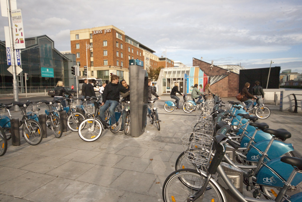
DUBLINBIKE BICYCLE RENTAL SCHEME


SORRY FOR THE DELAY
-
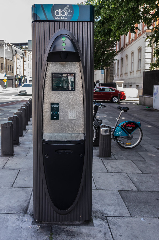
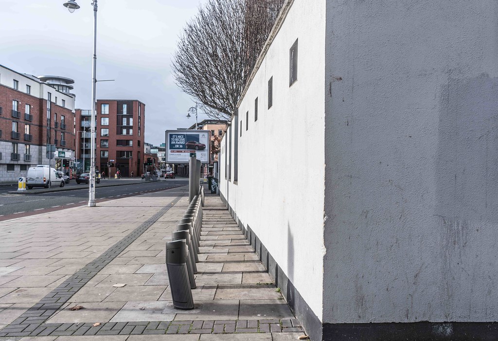
DUBLIN BIKE AT CUSTOM HOUSE QUAY
-
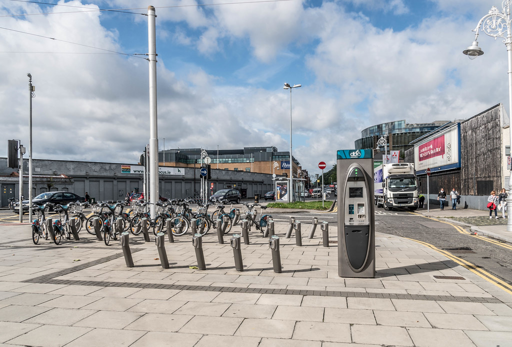
BOLTON STREET DOCKING STATION
-
PARKGATE STREET DOCKING STATION
-
ORMOND QUAY DOCKING STATION
-
KING STREET NORTH
-
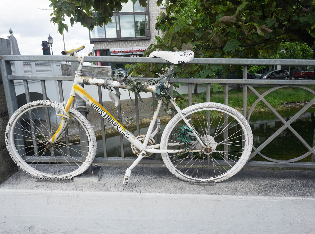
GHOST BIKE - A MEMORIAL
Dublinbikes is a public bicycle rental scheme which has operated in the city of Dublin since 2009. At its launch, the scheme, which is sponsored by JCDecaux, used 450 French-made unisex bicycles with 40 stations. By 2011 this had expanded to 550 bicycles and 44 stations, and in 2013 it was announced that a major expansion of the scheme would add a further 950 bikes and another 58 hire points.
Dublin was the 17th city to implement such a scheme, and it is considered one of the most successful bike sharing schemes in the world.
The scheme was announced by Dubin City Council in 2006 when JCDecaux received 72 free advertising spaces around Dublin in a 15-year deal in return for the advertising company's funding of the project. Critics argued that the deal was an expensive one when compared to Copenhagen where companies pay to have their logos attached to the bicycle. 450 bicycle stands were installed in groups of ten and twenty in forty locations around Dublin from June 2009. The scheme was opposed by An Taisce who said it was "misuse of legislation by a local authority to facilitate a private development".
The dublinbikes scheme was launched on 13 September 2009, with around 150 ordinary cyclists embarking on their first ride behind John Tierney, Dublin City Manager, and Andrew Montague, a councillor who was representing the Lord Mayor of Dublin on the journey.
It was announced on 18 June 2014 that Coca-Cola Zero would become a commercial partner with dublinbikes for three years. Starting at the end of June 2014, the brand was renamed Coca-Cola Zero dublinbikes and the Coca-Cola Zero brand was added to each individual bike in return for investment in the scheme.
The scheme proved to be a great success, much exceeding predictions. Approximately 1,000 people used the bicycles in the first six hours, with a further thousand people having subscribed to use them. Some 11,000 people applied in the first fortnight and Dublin City Council's supply of subscriber cards was reduced to zero, with the Council having initially targeted a 5,000-person uptake in the first year. More than 25,000 people had applied to take part in the scheme by March 2010. Minister for the Environment, Heritage and Local Government John Gormley said after the launch this level of uptake indicated the new "mainstream" approach to cycling in Ireland.
In the first ten months of the scheme, it was reported that there were over 37,000 users, over 828,000 journeys, no accidents, no vandalism, and only one bike missing (which was recovered … rumour has it that the thief tried to sell the bike to a bicycle shop).
On 10 May 2010 (post-launch), city councillors in Dublin voted for more advertising hoardings to be used to help with payments, with more than 30,000 people having subscribed (1,500 was the predicted number of subscribers for this stage of the project). On 14 August 2010, it was announced that the scheme had reached its one millionth trip. By May 2011, two million journeys had been made and the scheme had expanded to 550 bicycles and 44 stations. In 2013 it was announced that a major expansion of the scheme would add a further 950 bikes and another 58 hire points.
| Barrow Street | 53.34164°N 6.23622°W |
| Benson Street | 53.34404°N 6.23347°W |
| Blackhall Place | 53.34879°N 6.28165°W |
| Blessington Street | 53.35680°N 6.26818°W |
| Bolton Street | 53.35108°N 6.26983°W |
| Brookfield Road | 53.33902°N 6.30018°W |
| Cathal Brugha Street | 53.35208°N 6.26056°W |
| Charlemont Street | 53.33069°N 6.25996°W |
| Chatham Street | 53.34090°N 6.26233°W |
| Christchurch Place | 53.34341°N 6.27003°W |
| City Quay | 53.34666°N 6.24616°W |
| Clonmel Street | 53.33609°N 6.26239°W |
| Collins Barracks Museum | 53.34750°N 6.28522°W |
| Convention Centre | 53.34739°N 6.23864°W |
| Custom House | 53.34822°N 6.25400°W |
| Custom House Quay | 53.34804°N 6.24791°W |
| Dame Court | |
Dame Street | 53.34400°N 6.26652°W |
| Denmark Street Great | 53.35559°N 6.26113°W |
| Deverell Place | 53.35144°N 6.25523°W |
| Earlsfort Terrace | 53.33447°N 6.25837°W |
| Eccles Street | 53.35918°N 6.26932°W |
| Eccles Street East | 53.35810°N 6.26560°W |
| Emmet Road | |
Exchequer Street | 53.34304°N 6.26356°W |
| Excise Walk | 53.34796°N 6.24801°W |
| Fenian Street | 53.34148°N 6.24660°W |
| Fitzwilliam Square East | 53.33520°N 6.25092°W |
| Fitzwilliam Square West | 53.33588°N 6.25270°W |
| Francis Street | 53.34210°N 6.27523°W |
| Frederick Street South | |
Fownes Street Upper | 53.34455°N 6.26359°W |
| Georges Dock | |
Georges Quay | 53.34747°N 6.25232°W |
| Golden Lane | 53.34076°N 6.26752°W |
| Grand Canal Dock | 53.34283°N 6.23842°W |
| Grantham Street | 53.33407°N 6.26547°W |
| Grattan Street | 53.33959°N 6.24369°W |
| Greek Street | 53.34687°N 6.27303°W |
| Guild Street | 53.34797°N 6.24091°W |
| Hanover Quay | 53.34410°N 6.23708°W |
| Harcourt Terrace | 53.33257°N 6.25783°W |
| Hardwicke Place | 53.35708°N 6.26315°W |
| Hardwicke Street | 53.35563°N 6.26432°W |
| Hatch Street | 53.33404°N 6.26076°W |
| Herbert Place | 53.33474°N 6.24514°W |
| Herbert Street | 53.33576°N 6.24553°W |
| Heuston Bridge (North) | 53.34784°N 6.29241°W |
| Heuston Bridge (South) | 53.34710°N 6.29203°W |
| Heuston Station (Car Park) | 53.34699°N 6.29779°W |
| Heuston Station (Central) | 53.34662°N 6.29688°W |
| High Street | 53.34344°N 6.27462°W |
| James Street | 53.34346°N 6.28738°W |
| James Street East | 53.33652°N 6.24800°W |
| Jervis Street | 53.34825°N 6.26649°W |
| John Street West | 53.34310°N 6.27716°W |
| Kevin Street | 53.33778°N 6.26774°W |
| Kilmainham Gaol | 53.34211°N 6.31001°W |
| Kilmainham Lane | |
| 53.35029°N 6.27347°W | |
| Leinster Street South | 53.34212°N 6.25435°W |
| Lime Street | 53.34604°N 6.24363°W |
| Market Street South | 53.34237°N 6.28767°W |
| Mater Hospital | 53.36009°N 6.26482°W |
| Merrion Square East | 53.33908°N 6.24696°W |
| Merrion Square West | 53.33994°N 6.25169°W |
| Molesworth Street | 53.34122°N 6.25753°W |
| Mount Brown | 53.34166°N 6.29718°W |
| Mountjoy Square West | 53.35638°N 6.25859°W |
| Mount Street Lower | 53.33788°N 6.24160°W |
| New Central Bank | 53.34715°N 6.23419°W |
| Newman House | 53.33705°N 6.26007°W |
| North Circular Road | 53.35965°N 6.26049°W |
| Oliver Bond Street | 53.34393°N 6.28051°W |
| Ormond Quay Upper | 53.34608°N 6.26827°W |
| Parkgate Street | 53.34799°N 6.29188°W |
| Parnell Square North | 53.35373°N 6.26533°W |
| Parnell Street | 53.35079°N 6.26554°W |
| Pearse Street | 53.34430°N 6.25063°W |
| Princes Street / O'Connell Street | 53.34900°N 6.26049°W |
| Portobello Harbour | 53.33037°N 6.26510°W |
| Portobello Road | 53.33002°N 6.26817°W |
| Royal Hospital | 53.34388°N 6.29706°W |
| Sandwith Street | 53.34524°N 6.24753°W |
| Sir Patricks Dun's | 53.33926°N 6.24077°W |
| Smithfield | 53.34742°N 6.27822°W |
| Smithfield North | 53.34963°N 6.27780°W |
| South Dock Road | 53.34185°N 6.23128°W |
| St. James's Hospital (Central) | 53.33997°N 6.29562°W |
| St. James's Hospital (Luas) | 53.34136°N 6.29293°W |
| Strand Street Great | 53.34713°N 6.26384°W |
| St. Stephen's Green East | 53.33783°N 6.25611°W |
| St. Stephen's Green South | 53.33749°N 6.26169°W |
| Talbot Street | 53.35106°N 6.25266°W |
| The Point | 53.34685°N 6.23076°W |
| Townsend Street | 53.34593°N 6.25455°W |
| Upper Sherrard Street | 53.35841°N 6.26049°W |
| Western Way | 53.35494°N 6.26940°W |
| Wilton Terrace | 53.33230°N 6.25271°W |
| Wolfe Tone Street | 53.34886°N 6.26741°W |
| York Street (East) | 53.33874°N 6.26206°W |
| York Street (West) | 53.33931°N 6.26477°W |