Custom Search
THE GREEN MENU OPTIONS ARE MOBILE FRIENDLY AND ARE FASTER SO THEY ARE RECOMMENDED. THE RED MENU OPTIONS ARE SOMEWHAT SLOWER DEPENDING ON YOUR DEVICE OR BROWSER AND ARE MORE SUITABLE FOR DESKTOPS AND LAPTOPS. THE BLUE OPTIONS ARE PAGE LINKS AND WILL BE PHASED OUT GOING FORWARD
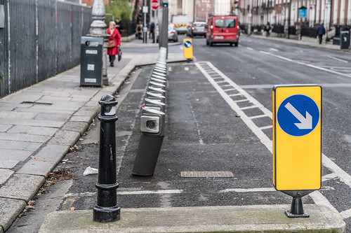
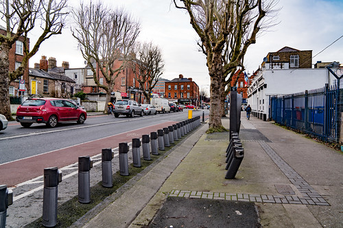
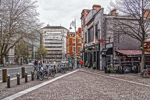
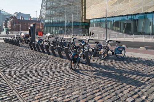
DUBLIN BIKE STATIONS
Dublinbikes is a public bicycle rental scheme which has operated in the city of Dublin since 2009. At its launch, the scheme, which is sponsored by JCDecaux, used 450 French-made unisex bicycles with 40 stations.
By 2011 this had expanded to 550 bicycles and 44 stations, and in 2013 it was announced that a major expansion of the scheme would add a further 950 bikes and another 58 hire points. Dublin was the 17th city to implement such a scheme,[ and it was considered one of the most successful bike sharing schemes in the world, however in recent times progress has stalled with only 2 of 14 phases being rolled out. Currently the scheme loses €376,000 a year, leading to further expansion of Dublin Bikes being put on hold.
By 2011 this had expanded to 550 bicycles and 44 stations, and in 2013 it was announced that a major expansion of the scheme would add a further 950 bikes and another 58 hire points. Dublin was the 17th city to implement such a scheme,[ and it was considered one of the most successful bike sharing schemes in the world, however in recent times progress has stalled with only 2 of 14 phases being rolled out. Currently the scheme loses €376,000 a year, leading to further expansion of Dublin Bikes being put on hold.
LIST OF DUBLINBIKE DOCKING STATIONS
| Name | Location |
| Barrow Street | 53.34164°N 6.23622°W |
| Benson Street | 53.34404°N 6.23347°W |
| Blackhall Place | 53.34879°N 6.28165°W |
| Blessington Street | 53.35680°N 6.26818°W |
| Bolton Street | 53.35108°N 6.26983°W |
| Brookfield Road | 53.33902°N 6.30018°W |
| Cathal Brugha Street | 53.35208°N 6.26056°W |
| Charlemont Street | 53.33069°N 6.25996°W |
| Chatham Street | 53.34090°N 6.26233°W |
| Christchurch Place | 53.34341°N 6.27003°W |
| City Quay | 53.34666°N 6.24616°W |
| Clonmel Street | 53.33609°N 6.26239°W |
| Collins Barracks Museum | 53.34750°N 6.28522°W |
| Convention Centre | 53.34739°N 6.23864°W |
| Custom House | 53.34822°N 6.25400°W |
| Custom House Quay | 53.34804°N 6.24791°W |
| Dame Court | |
Dame Street | 53.34400°N 6.26652°W |
| Denmark Street Great | 53.35559°N 6.26113°W |
| Deverell Place | 53.35144°N 6.25523°W |
| Earlsfort Terrace | 53.33447°N 6.25837°W |
| Eccles Street | 53.35918°N 6.26932°W |
| Eccles Street East | 53.35810°N 6.26560°W |
| Emmet Road | |
Exchequer Street | 53.34304°N 6.26356°W |
| Excise Walk | 53.34796°N 6.24801°W |
| Fenian Street | 53.34148°N 6.24660°W |
| Fitzwilliam Square East | 53.33520°N 6.25092°W |
| Fitzwilliam Square West | 53.33588°N 6.25270°W |
| Francis Street | 53.34210°N 6.27523°W |
| Frederick Street South | |
Fownes Street Upper | 53.34455°N 6.26359°W |
| Georges Dock | |
Georges Quay | 53.34747°N 6.25232°W |
| Golden Lane | 53.34076°N 6.26752°W |
| Grand Canal Dock | 53.34283°N 6.23842°W |
| Grantham Street | 53.33407°N 6.26547°W |
| Grattan Street | 53.33959°N 6.24369°W |
| Greek Street | 53.34687°N 6.27303°W |
| Guild Street | 53.34797°N 6.24091°W |
| Hanover Quay | 53.34410°N 6.23708°W |
| Harcourt Terrace | 53.33257°N 6.25783°W |
| Hardwicke Place | 53.35708°N 6.26315°W |
| Hardwicke Street | 53.35563°N 6.26432°W |
| Hatch Street | 53.33404°N 6.26076°W |
| Herbert Place | 53.33474°N 6.24514°W |
| Herbert Street | 53.33576°N 6.24553°W |
| Heuston Bridge (North) | 53.34784°N 6.29241°W |
| Heuston Bridge (South) | 53.34710°N 6.29203°W |
| Heuston Station (Car Park) | 53.34699°N 6.29779°W |
| Heuston Station (Central) | 53.34662°N 6.29688°W |
| High Street | 53.34344°N 6.27462°W |
| James Street | 53.34346°N 6.28738°W |
| James Street East | 53.33652°N 6.24800°W |
| Jervis Street | 53.34825°N 6.26649°W |
| John Street West | 53.34310°N 6.27716°W |
| Kevin Street | 53.33778°N 6.26774°W |
| Kilmainham Gaol | 53.34211°N 6.31001°W |
| Kilmainham Lane | |
King Street North | 53.35029°N 6.27347°W |
| Leinster Street South | 53.34212°N 6.25435°W |
| Lime Street | 53.34604°N 6.24363°W |
| Market Street South | 53.34237°N 6.28767°W |
| Mater Hospital | 53.36009°N 6.26482°W |
| Merrion Square East | 53.33908°N 6.24696°W |
| Merrion Square West | 53.33994°N 6.25169°W |
| Molesworth Street | 53.34122°N 6.25753°W |
| Mount Brown | 53.34166°N 6.29718°W |
| Mountjoy Square West | 53.35638°N 6.25859°W |
| Mount Street Lower | 53.33788°N 6.24160°W |
| New Central Bank | 53.34715°N 6.23419°W |
| Newman House | 53.33705°N 6.26007°W |
| North Circular Road | 53.35965°N 6.26049°W |
| Oliver Bond Street | 53.34393°N 6.28051°W |
| Ormond Quay Upper | 53.34608°N 6.26827°W |
| Parkgate Street | 53.34799°N 6.29188°W |
| Parnell Square North | 53.35373°N 6.26533°W |
| Parnell Street | 53.35079°N 6.26554°W |
| Pearse Street | 53.34430°N 6.25063°W |
| Princes Street / O'Connell Street | 53.34900°N 6.26049°W |
| Portobello Harbour | 53.33037°N 6.26510°W |
| Portobello Road | 53.33002°N 6.26817°W |
| Royal Hospital | 53.34388°N 6.29706°W |
| Sandwith Street | 53.34524°N 6.24753°W |
| Sir Patricks Dun's | 53.33926°N 6.24077°W |
| Smithfield | 53.34742°N 6.27822°W |
| Smithfield North | 53.34963°N 6.27780°W |
| South Dock Road | 53.34185°N 6.23128°W |
| St. James's Hospital (Central) | 53.33997°N 6.29562°W |
| St. James's Hospital (Luas) | 53.34136°N 6.29293°W |
| Strand Street Great | 53.34713°N 6.26384°W |
| St. Stephen's Green East | 53.33783°N 6.25611°W |
| St. Stephen's Green South | 53.33749°N 6.26169°W |
| Talbot Street | 53.35106°N 6.25266°W |
| The Point | 53.34685°N 6.23076°W |
| Townsend Street | 53.34593°N 6.25455°W |
| Upper Sherrard Street | 53.35841°N 6.26049°W |
| Western Way | 53.35494°N 6.26940°W |
| Wilton Terrace | 53.33230°N 6.25271°W |
| Wolfe Tone Street | 53.34886°N 6.26741°W |
| York Street (East) | 53.33874°N 6.26206°W |
| York Street (West) | 53.33931°N 6.26477°W |


