INTRODUCING A NEW APPROACH
NEW GLOBAL MENU FOR PHOTO CENTRIC SITES
IF YOU PREFER IMAGES TO TEXT THIS IS FOR YOU
EXPLORING LAYTOWN AND BETTYSTOWN
SATURDAY 11 MAY 2024
IF YOU PREFER IMAGES THIS IIS THE BEST OPTION
SELECT ANY IMAGE AS THEY ARE MENU OPTIONS
PUBLISHED MAY 2024
GREATLY EXPANDING MY ACTIVITIES
A NEW QUICK MENU IS AVAILABLE BELOW
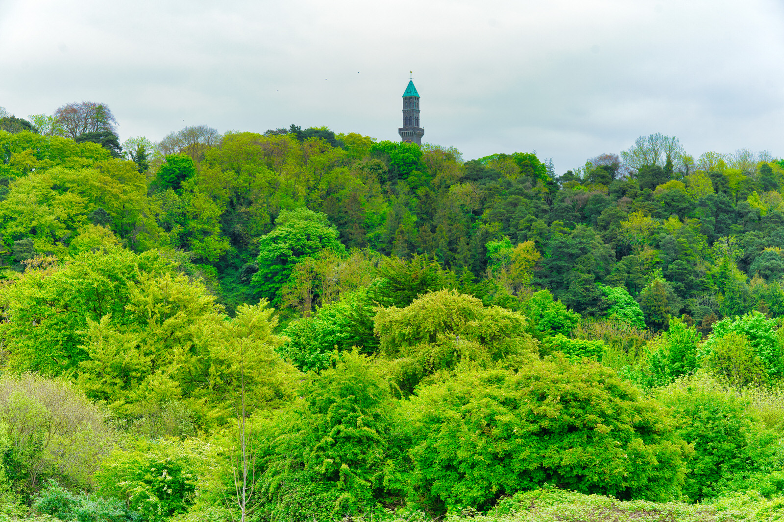
GUINNESS CLOCK
Construction: The Guinness Clock Tower, located on the grounds of the Farmleigh Estate in Dublin, Ireland, was completed in 1880. It was built for Edward Cecil Guinness, a member of the Guinness brewing dynasty and later the first Earl of Iveagh.
Architect: The architect remains unknown, though there's some speculation that British architect T.H. Wyatt might have been involved. The tower's construction was undertaken by the engineering department of the Guinness Brewery.
Purpose: The Clock Tower had several purposes:
Landmark: It was a prominent and decorative landmark visible throughout the area.
Water Supply: The tower held a massive water tank, providing a substantial water supply for the Farmleigh Estate.
Early Electricity: It's believed to have been involved in generating electricity for the house, making Farmleigh one of the first in Ireland to have electric lighting.
Size: The tower stands at roughly 58 meters (200 feet) tall and is a bit taller than Dublin's Liberty Hall.
Materials: Made primarily of limestone sourced near the estate, with internal stairs and a balcony crafted from granite. It's topped with a copper pyramid.
Aesthetics: The Victorian design balanced ornate aesthetics with a focus on practicality.
Local Landmark: The tower is a beloved landmark within the Castleknock area of Dublin, known for its height and distinctive appearance. There's even a local ditty about it: "Mister Guinness has a clock, And on its top a weathercock, To show the people Castleknock”.
Symbol of the Guinness Family: The tower represents the wealth and influence of the Guinness family during this era.
Architectural Interest: It exemplifies the blend of beauty and functionality common in Victorian-era design.
Visiting Farmleigh and Viewing the Tower
The Farmleigh Estate is used by the Irish government for hosting dignitaries and events. It's occasionally open to the public.
You can't usually get directly up to the Clock Tower, but it's a beautiful sight from a distance within the estate.
The view from the tower's balcony is said to be spectacular, stretching across Dublin.
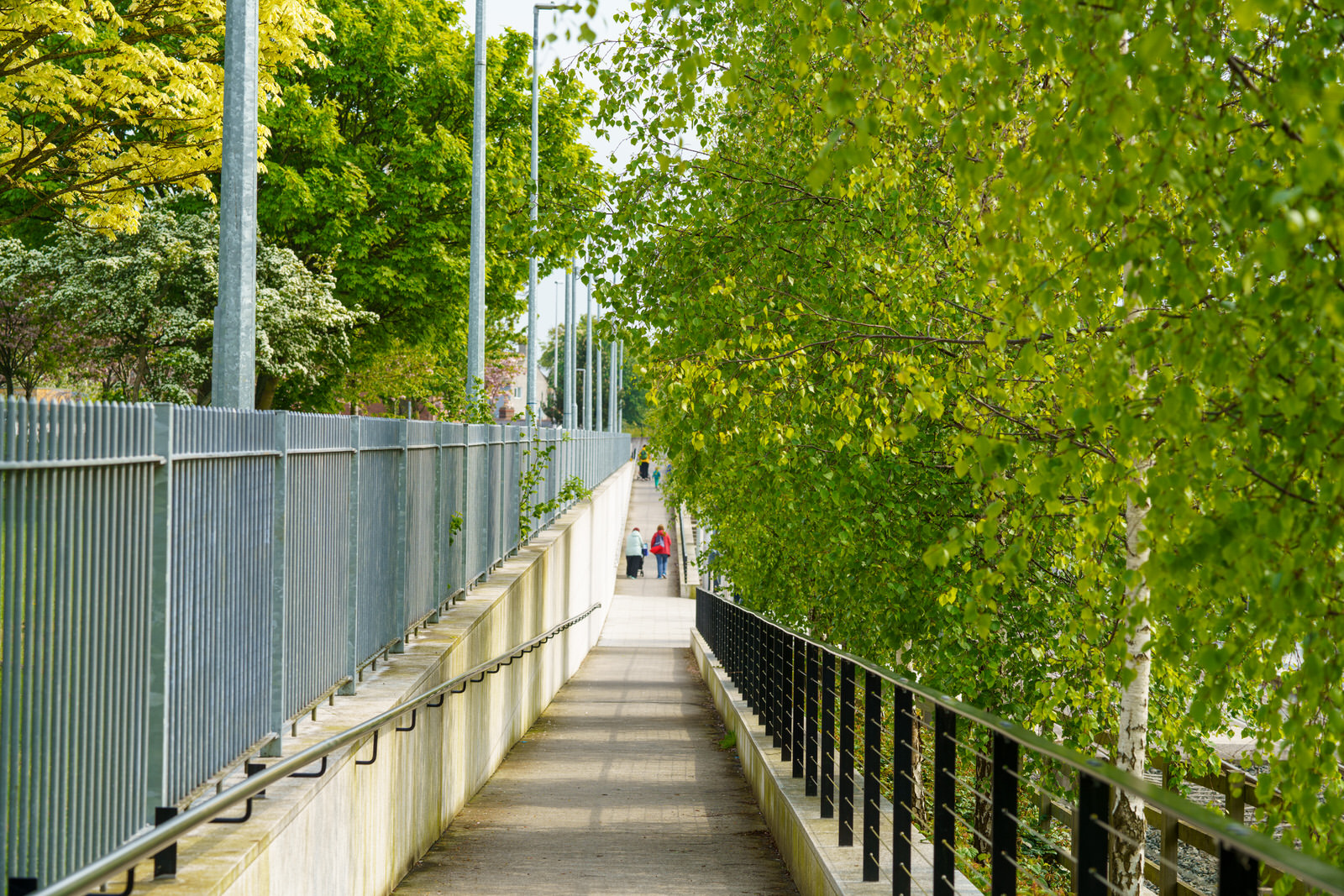
MOUNT BERNARD PARK
The Cabra stop is located on Dublin's Luas Green Line, specifically on the Luas Cross City extension that opened in 2017. It's situated at the northern end of the Broadstone railway cutting, just north of where Connaught Street crosses the line via the Liam Whelan Bridge (rebuilt during the stop's construction).
A long ramp and stairs lead down from the eastern side of the bridge to the middle of the southbound platform.
A pathway at the northern end of the stop provides access to nearby Mount Bernard Park.
Neighborhood: The Cabra stop primarily serves the residential area of Cabra and provides access to the National Botanic Gardens nearby.
Mount Bernard Park
The park's land was once part of the extensive Glasnevin Demesne. In the 19th century, it housed a Catholic girls' reformatory school run by the Sisters of Mercy. In the 1980s, Dublin Corporation (now Dublin City Council) acquired the land and converted it into a public park, named after the adjacent Mount Bernard Avenue.
Remnants of the park's history remain, including a restored walled garden.
The park includes playing fields for soccer and Gaelic sports.
It provides a playground and walking paths for leisure.
The secondary entrance to the Cabra LUAS stop directly connects to Mount Bernard Park, providing convenient access for both park-goers and local commuters.
The arrival of the LUAS has played a role in revitalising the surrounding area, including boosting accessibility to the park.
Until recently I avoided the immediate area as Mount Bernard Park has faced some issues with antisocial behaviour, but efforts are underway to improve safety and make it a more welcoming space for the community.
ROYAL CANAL
Today I explored a short stretch of the Royal canal between Shandon Gardens and Cross Guns Bridge.
The canal bridge and adjacent lock were named for the Earl of Westmoreland, who laid the first stone at this site in 1790. The present bridge structure appears to be a rebuild, probably of about 1864, when the adjacent railway line and bridge were constructed, in order to provide a level road surface across railway and canal. The quality of the ashlar stonework is high and the cast-iron parapets, by Ross & Walpole Ltd Engineers Dublin, and the light standards, add decorative interest. The setting of the lock is enhanced by the presence of a significant group of industrial structures nearby, including Westmoreland (now 5th) lock, the adjacent canal and railway bridge, the former North City Flour mills and a former railway siding. The Royal Canal Company was established in 1789 to construct a canal to provide freight and passenger transport between Dublin and the River Shannon.
There are a few theories about why Cross Guns Bridge in Dublin is named as such, with the most compelling being rooted in local history:
Cross Guns as a Village: Historical evidence, including Tony O'Doherty's research and maps from the 1750s and 19th century, suggests that Cross Guns was once a distinct village within the Manor of Glasnevin. This predates the canal and the bridge's construction.
The Cross Guns Inn: It seems highly likely that the village, and subsequently the bridge, took their name from an old inn called "The Cross Guns." Inns were common landmarks and often influenced place names throughout Ireland.
The Earl of Westmoreland: The most common and most unlikely explanation is that it was originally/officially named Westmoreland Bridge after John Fane, the 10th Earl of Westmoreland and Lord Lieutenant of Ireland from 1790 to 1795. However, the locals nicknamed it "Cross Guns Bridge," possibly due to a misunderstanding of his coat of arms or as a simple description of intersecting elements of the bridge design.
CELTIC CROSSES
The Celtic Cross is a form of Christian cross featuring a nimbus or ring that emerged in Ireland, France, and Great Britain in the Early Middle Ages.
It’s essentially a Latin cross with a nimbus surrounding the intersection of the arms and stem. The form gained new popularity during the Celtic Revival of the 19th century.
The shape, usually decorated with interlace and other motifs from Insular art, became popular for funerary monuments and other uses, and has remained so, spreading well beyond Ireland.
In Ireland, Celtic crosses are a common sight in cemeteries, and also in regions evangelised by Irish missionaries. They are seen as a symbol of Irish culture and heritage.
The history of Irish Celtic crosses stretches back through centuries and they have become a much sought-out feature on the Irish landscape. Whether you are Catholic or Protestant, the Celtic Cross has a meaning that goes beyond simple sectarian divisions in Ireland.
In Glasnevin Cemetery, Celtic crosses are a predominant design found in the cemetery. In Mount Jerome, there are some Celtic crosses, but they are not as numerous. This could be due to different historical and cultural practices.
In Britain, the Celtic cross emerged during the Early Middle Ages, between the 5th and 8th centuries, in Ireland and surrounding regions.
It is believed to have evolved from earlier forms of crosses, including the ringed cross. Possible countries of origin are Ireland, Wales, Gaelic Ireland, England, Britain, and Scotland.
In Scotland, the term ‘Celtic Cross’ first appears in the 1800s with the Celtic revival. Although there are examples of freestanding stone Celtic crosses that date back to the 8th century.
On the Isle of Man, Celtic crosses are integral to the realm of insular art, a unique form of British art that flourished during the post-Roman period.
The Celtic Cross on Grosse Île is a lasting memorial to those who died on Grosse Île in 1847, both the immigrants and those who tried to help them.
In the USA, the Celtic cross is seen as a symbol of Christianity, with pagan associations.
It is also a recognised sign of Irish identity, standing near what was the site of the first Irish parish in Canada.
The Celtic Cross is also seen as a symbol of national identity for many people of Irish or Scottish descent worldwide.
In Canada, the Celtic Cross is a memorial in Ottawa, erected to commemorate the workers and their families that died building the Rideau Canal between 1826 and 1832. The Celtic cross in the churchyard is considered one of the most important and significant crosses on the island.
In conclusion, the Celtic Cross is a symbol that has transcended its religious origins to become a symbol of cultural identity and heritage in many parts of the world. Its prevalence in different regions can vary due to historical, cultural, and religious factors.
essy, a bit inconvenient, but undeniably alive.
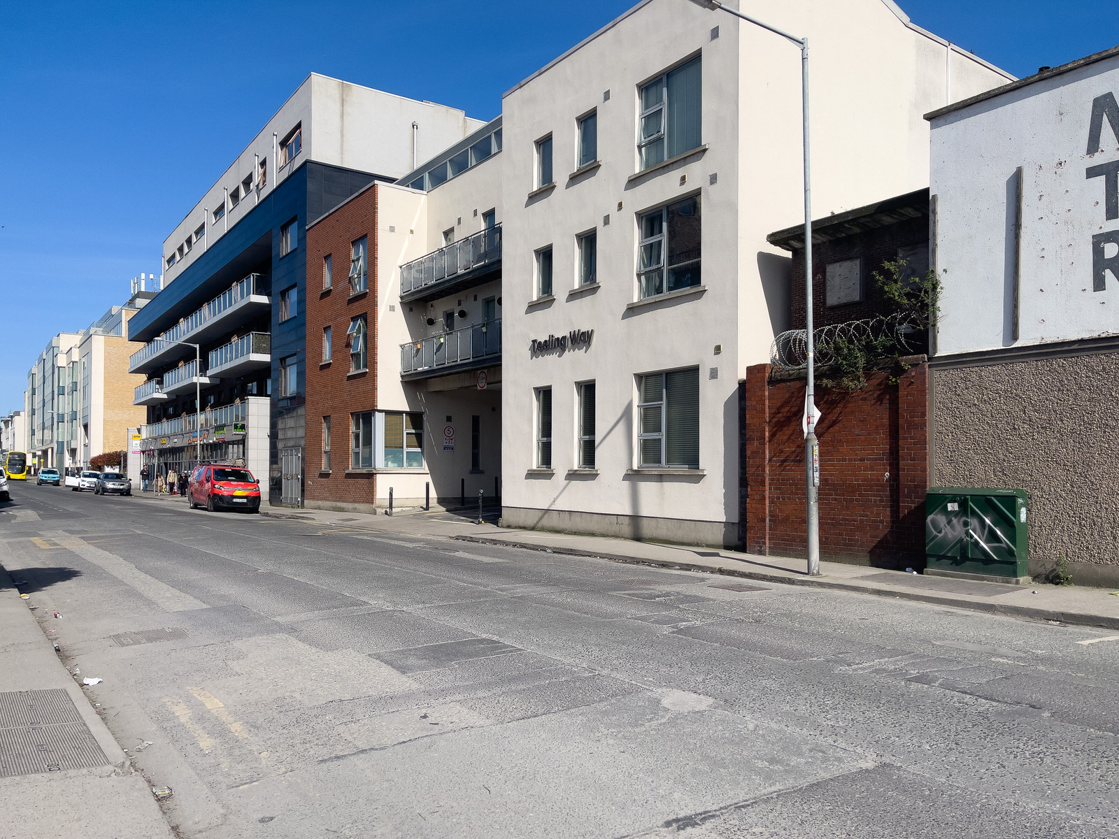
EAST ROAD
I worked in the immediate area for three or four years and in the general docklands area for much longer.
As a result of my most recent visit towards the end of April I tried to write an accurate account of East Road as it is today buy I kept coming across descriptions such as: "The East Road of today is a vibrant mix of the old and the new. Remnants of its industrial heritage still endure alongside modern glass-fronted office buildings, stylish apartments, and lively cafes. Key features include: Business and Technology Focus: East Road is home to numerous companies, particularly in the technology sector. The area attracts major players like Accenture and Silicon Docks, dubbed Ireland's answer to the famed Silicon Valley."
Also: "Transport Links: The area is well-served by public transport, with the Luas (light rail) Red Line stopping nearby, and numerous bus routes providing connections across Dublin."
Forget the sleek brochure promises. East Road ain't just about your tech job and fancy latte. This street is a battleground of Dublin's past and future, where the grit of a working port still clings to the shadows of shiny corporate towers.
Weathered warehouses, some crumbling, others slapped with a fresh coat of paint but still echoing with the clank of industry. Then, boom, a spaceship-looking office block juts into the sky, all glass and arrogance. The buses crawl along, unreliable as ever, while a pack of suited-up techies whizz past on rented scooters, oblivious to the echoes of dockworkers past.
You can grab a decent pint in a pub that hasn't changed much in decades, right next door to a hipster joint charging a fortune for some avocado nonsense. Rent's crazy, but if you snag a spot with a view, you'll see the cranes swinging over the Liffey, a constant reminder that this city just won't stop changing.
East Road isn't polished. There's a rough energy here, a sense that the ghosts of old Dublin are still arm-wrestling with the Silicon Docks crowd. It's a bit messy, a bit inconvenient, but undeniably alive.
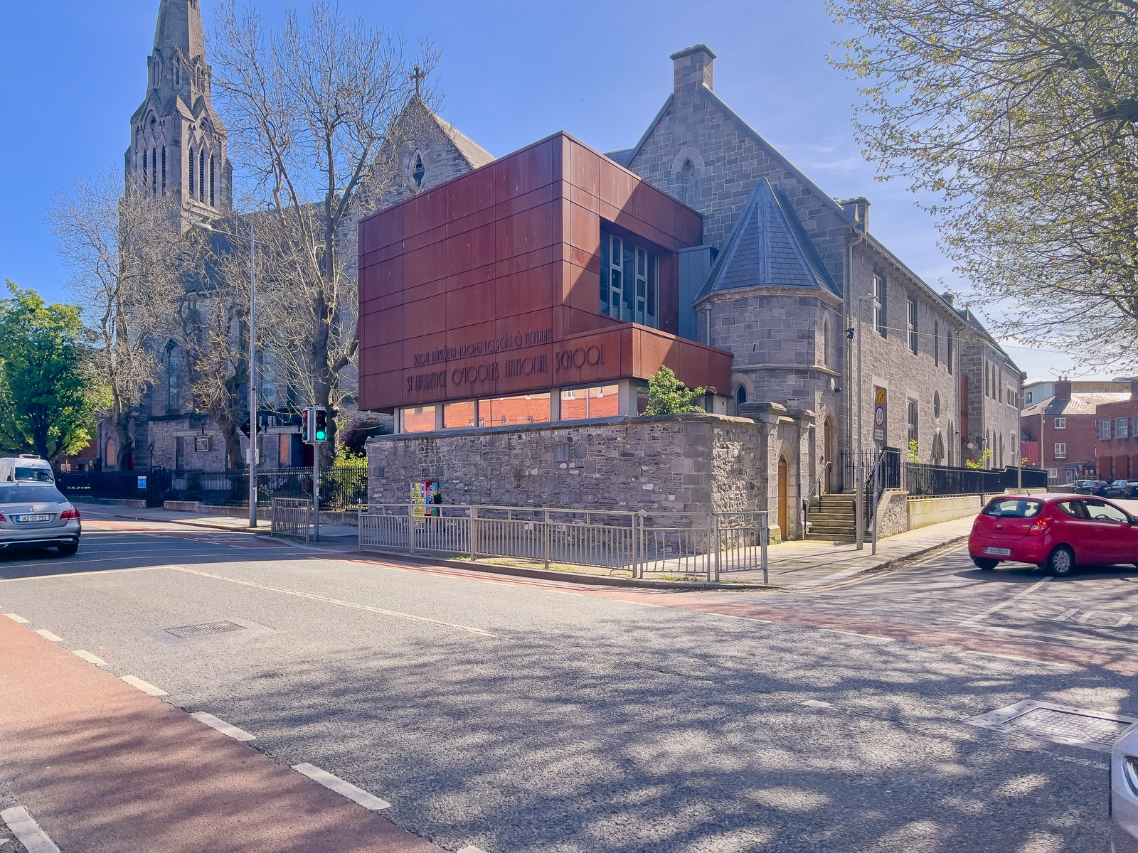
CHURCH AND SCHOOL
I worked in the immediate area for three or four years and in the general docklands area for much longer.
As a result of my most recent visit towards the end of April I tried to write an accurate account of East Road as it is today buy I kept coming across descriptions such as: "The East Road of today is a vibrant mix of the old and the new. Remnants of its industrial heritage still endure alongside modern glass-fronted office buildings, stylish apartments, and lively cafes. Key features include: Business and Technology Focus: East Road is home to numerous companies, particularly in the technology sector. The area attracts major players like Accenture and Silicon Docks, dubbed Ireland's answer to the famed Silicon Valley."
Also: "Transport Links: The area is well-served by public transport, with the Luas (light rail) Red Line stopping nearby, and numerous bus routes providing connections across Dublin."
Forget the sleek brochure promises. East Road ain't just about your tech job and fancy latte. This street is a battleground of Dublin's past and future, where the grit of a working port still clings to the shadows of shiny corporate towers.
Weathered warehouses, some crumbling, others slapped with a fresh coat of paint but still echoing with the clank of industry. Then, boom, a spaceship-looking office block juts into the sky, all glass and arrogance. The buses crawl along, unreliable as ever, while a pack of suited-up techies whizz past on rented scooters, oblivious to the echoes of dockworkers past.
You can grab a decent pint in a pub that hasn't changed much in decades, right next door to a hipster joint charging a fortune for some avocado nonsense. Rent's crazy, but if you snag a spot with a view, you'll see the cranes swinging over the Liffey, a constant reminder that this city just won't stop changing.
East Road isn't polished. There's a rough energy here, a sense that the ghosts of old Dublin are still arm-wrestling with the Silicon Docks crowd. It's a bit messy, a bit inconvenient, but undeniably alive.
As a result of my most recent visit towards the end of April I tried to write an accurate account of East Road as it is today buy I kept coming across descriptions such as: "The East Road of today is a vibrant mix of the old and the new. Remnants of its industrial heritage still endure alongside modern glass-fronted office buildings, stylish apartments, and lively cafes. Key features include: Business and Technology Focus: East Road is home to numerous companies, particularly in the technology sector. The area attracts major players like Accenture and Silicon Docks, dubbed Ireland's answer to the famed Silicon Valley."
Also: "Transport Links: The area is well-served by public transport, with the Luas (light rail) Red Line stopping nearby, and numerous bus routes providing connections across Dublin."
Forget the sleek brochure promises. East Road ain't just about your tech job and fancy latte. This street is a battleground of Dublin's past and future, where the grit of a working port still clings to the shadows of shiny corporate towers.
Weathered warehouses, some crumbling, others slapped with a fresh coat of paint but still echoing with the clank of industry. Then, boom, a spaceship-looking office block juts into the sky, all glass and arrogance. The buses crawl along, unreliable as ever, while a pack of suited-up techies whizz past on rented scooters, oblivious to the echoes of dockworkers past.
You can grab a decent pint in a pub that hasn't changed much in decades, right next door to a hipster joint charging a fortune for some avocado nonsense. Rent's crazy, but if you snag a spot with a view, you'll see the cranes swinging over the Liffey, a constant reminder that this city just won't stop changing.
East Road isn't polished. There's a rough energy here, a sense that the ghosts of old Dublin are still arm-wrestling with the Silicon Docks crowd. It's a bit messy, a bit inconvenient, but undeniably alive.
BY BRIAN KING
Irish sculptor Brian King studied at the National College of Art and Design in Dublin, where he later served as Head of the Department of Sculpture from 1984 to 2004. His large-scale painted metal sculptures imbue abstract geometric form with vibrant colour and expressive movement. King exhibited extensively in Ireland and Europe from the 1960s, including at the Irish Exhibition of Living Art from 1964 to 1978. He represented Ireland at the Paris Biennale in 1969 and 1983. His work is held in many public collections, including Dublin City Gallery The Hugh Lane, Crawford Municipal Gallery in Cork, and the University of Ulster.
VIDEO: PEARSE STATION
Pearse Railway Station, also known as Dublin Pearse, is a major railway station in Dublin, Ireland. Located on Westland Row in the city centre, it serves as a central hub for both commuter and intercity rail services.
VIDEO: MAYNOOTH TRAIN
The train service conveniently connects with the Luas Green Line tram service at Broombridge station. This allows passengers to easily transfer between train and tram and access a wider range of destinations within Dublin.
A NEW QUICK MENU IS AVAILABLE BELOW
PAINT-A-BOX STREET ART
Commercial Disclosure
You will find links to buy products from Amazon, Google and other partners. If you click on these links, you’ll find that the URL includes a small extra piece of text which identifies that the click came from my websites. This text is an affiliate code, and it means that I get a small percentage of the money you spend if you choose to buy that product, or, in some cases, other products from the site soon after. These affiliate links help pay the costs of producing my websites and ensure that the content is free to you.