Custom Search
THE GREEN MENU OPTIONS ARE MOBILE FRIENDLY AND ARE FASTER SO THEY ARE RECOMMENDED. THE RED MENU OPTIONS ARE SOMEWHAT SLOWER DEPENDING ON YOUR DEVICE OR BROWSER AND ARE MORE SUITABLE FOR DESKTOPS AND LAPTOPS. THE BLUE OPTIONS ARE PAGE LINKS AND WILL BE PHASED OUT GOING FORWARD
THE ABBEY RIVER IN LIMERICK
LOADING
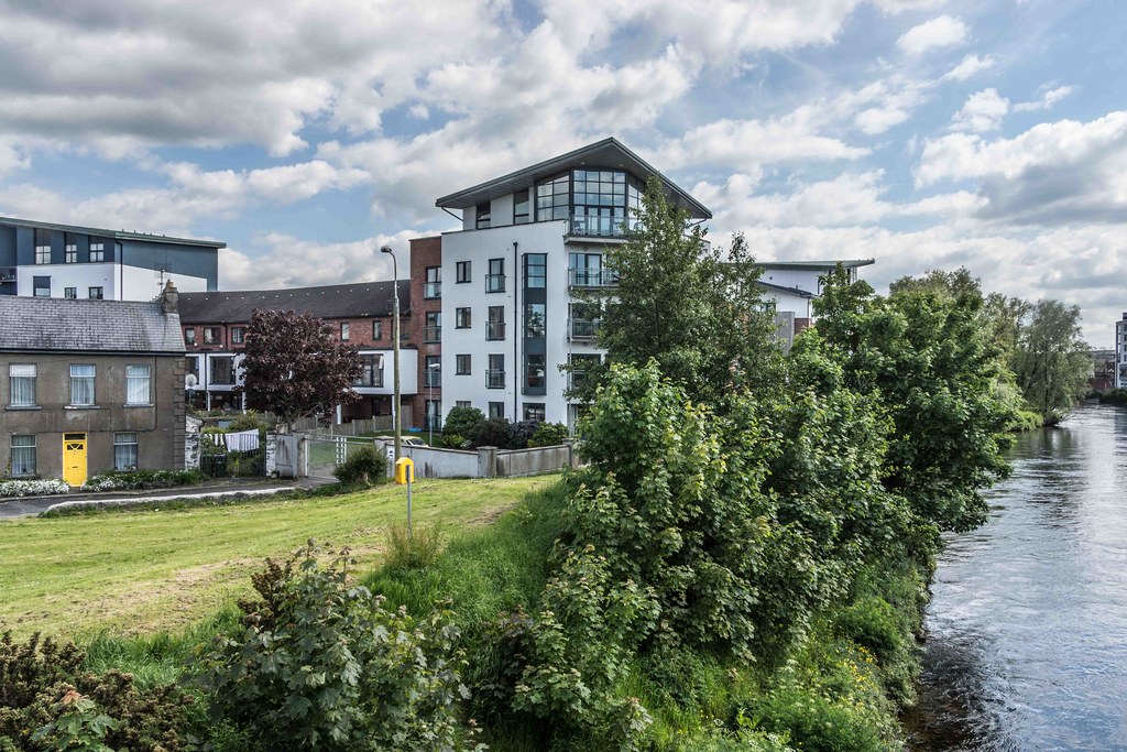
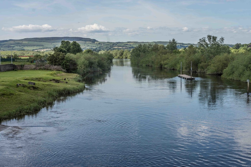
The Abbey River is a distributary arm of the River Shannon that flows around the northeastern, eastern, and southern shores of King's Island, Limerick before rejoining the Shannon at Hellsgate Island.
Hellsgate Island is only visible at low tide. It is bridged by the Abbey Bridge, Baals Bridge, the Canal Bridge, Matthew Bridge, O'Dwyer Bridge, and the Sylvester O'Halloran Footbridge.
King's Island's encirclement by the Shannon and Abbey rivers made it a very defensible location, leading to the founding of Limerick as a Viking settlement in the ninth century. The Abbey River has played a defensive role throughout the city's history, not least during the Cromwellian siege of 1650-51,[5] and the Williamite siege of 1691.
- Sarsfield Bridge (Over the Shannon River)
- Thomond Bridge (Over the Shannon River)
- Shannon Bridge (Over the Shannon River)
- Baals Bridge (Over the Abbey River)
- Mathew Bridge (Over the Abbey River)
- O’Dwyer Bridge (Over the Abbey River)
- Sylvester O’Halloran Footbridge (Over the Abbey River)
- Abbey Bridge (Over the Abbey River)
- Athlunkard Bridge (Over the Shannon River)
- Lock Quay Bridge (Over the Canal)
- The Black Bridge (Over the Shannon River)
- The University Bridge
- The Living Bridge
- Park Road Bridge (Over the Canal)
- Guinness Bridge (over the Canal)
Commercial DisclosurePLEASE NOTE THAT LINKS BELOW MAY REDIRECT YOU TO THE AMAZON LOCATION MOST LIKELY TO SHIP TO YOUR ADDRESS
You will find links to buy products from Amazon, Google and other partners. If you click on these links, you’ll find that the URL includes a small extra piece of text which identifies that the click came from my websites. This text is an affiliate code, and it means that I get a small percentage of the money you spend if you choose to buy that product, or, in some cases, other products from the site soon after. These affiliate links help pay the costs of producing my websites and ensure that the content is free to you.