Custom Search
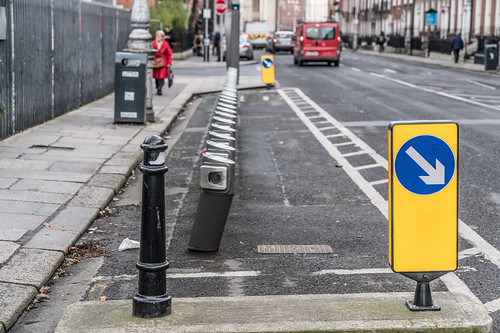
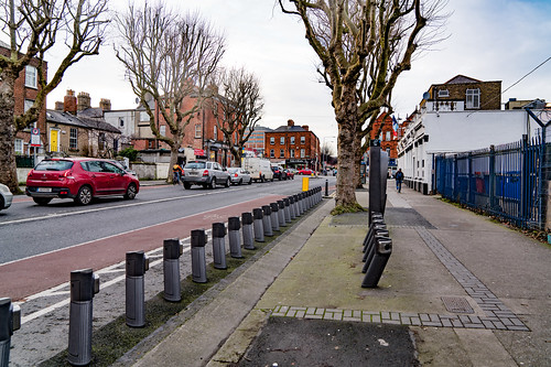
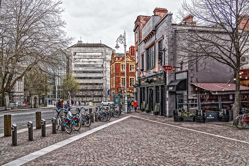
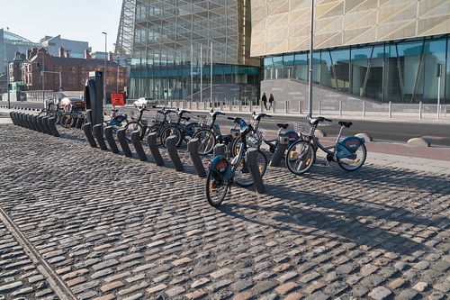
DUBLIN BIKE STATIONS
Dublinbikes is a public bicycle rental scheme which has operated in the city of Dublin since 2009. At its launch, the scheme, which is sponsored by JCDecaux, used 450 French-made unisex bicycles with 40 stations.
By 2011 this had expanded to 550 bicycles and 44 stations, and in 2013 it was announced that a major expansion of the scheme would add a further 950 bikes and another 58 hire points. Dublin was the 17th city to implement such a scheme,[ and it was considered one of the most successful bike sharing schemes in the world, however in recent times progress has stalled with only 2 of 14 phases being rolled out. Currently the scheme loses €376,000 a year, leading to further expansion of Dublin Bikes being put on hold.
By 2011 this had expanded to 550 bicycles and 44 stations, and in 2013 it was announced that a major expansion of the scheme would add a further 950 bikes and another 58 hire points. Dublin was the 17th city to implement such a scheme,[ and it was considered one of the most successful bike sharing schemes in the world, however in recent times progress has stalled with only 2 of 14 phases being rolled out. Currently the scheme loses €376,000 a year, leading to further expansion of Dublin Bikes being put on hold.
LIST OF DUBLINBIKE DOCKING STATIONS
| Name | Location |
| Barrow Street | 53.34164°N 6.23622°W |
| Benson Street | 53.34404°N 6.23347°W |
| Blackhall Place | 53.34879°N 6.28165°W |
| Blessington Street | 53.35680°N 6.26818°W |
| Bolton Street | 53.35108°N 6.26983°W |
| Brookfield Road | 53.33902°N 6.30018°W |
| Cathal Brugha Street | 53.35208°N 6.26056°W |
| Charlemont Street | 53.33069°N 6.25996°W |
| Chatham Street | 53.34090°N 6.26233°W |
| Christchurch Place | 53.34341°N 6.27003°W |
| City Quay | 53.34666°N 6.24616°W |
| Clonmel Street | 53.33609°N 6.26239°W |
| Collins Barracks Museum | 53.34750°N 6.28522°W |
| Convention Centre | 53.34739°N 6.23864°W |
| Custom House | 53.34822°N 6.25400°W |
| Custom House Quay | 53.34804°N 6.24791°W |
| Dame Court | |
Dame Street | 53.34400°N 6.26652°W |
| Denmark Street Great | 53.35559°N 6.26113°W |
| Deverell Place | 53.35144°N 6.25523°W |
| Earlsfort Terrace | 53.33447°N 6.25837°W |
| Eccles Street | 53.35918°N 6.26932°W |
| Eccles Street East | 53.35810°N 6.26560°W |
| Emmet Road | |
Exchequer Street | 53.34304°N 6.26356°W |
| Excise Walk | 53.34796°N 6.24801°W |
| Fenian Street | 53.34148°N 6.24660°W |
| Fitzwilliam Square East | 53.33520°N 6.25092°W |
| Fitzwilliam Square West | 53.33588°N 6.25270°W |
| Francis Street | 53.34210°N 6.27523°W |
| Frederick Street South | |
Fownes Street Upper | 53.34455°N 6.26359°W |
| Georges Dock | |
Georges Quay | 53.34747°N 6.25232°W |
| Golden Lane | 53.34076°N 6.26752°W |
| Grand Canal Dock | 53.34283°N 6.23842°W |
| Grantham Street | 53.33407°N 6.26547°W |
| Grattan Street | 53.33959°N 6.24369°W |
| Greek Street | 53.34687°N 6.27303°W |
| Guild Street | 53.34797°N 6.24091°W |
| Hanover Quay | 53.34410°N 6.23708°W |
| Harcourt Terrace | 53.33257°N 6.25783°W |
| Hardwicke Place | 53.35708°N 6.26315°W |
| Hardwicke Street | 53.35563°N 6.26432°W |
| Hatch Street | 53.33404°N 6.26076°W |
| Herbert Place | 53.33474°N 6.24514°W |
| Herbert Street | 53.33576°N 6.24553°W |
| Heuston Bridge (North) | 53.34784°N 6.29241°W |
| Heuston Bridge (South) | 53.34710°N 6.29203°W |
| Heuston Station (Car Park) | 53.34699°N 6.29779°W |
| Heuston Station (Central) | 53.34662°N 6.29688°W |
| High Street | 53.34344°N 6.27462°W |
| James Street | 53.34346°N 6.28738°W |
| James Street East | 53.33652°N 6.24800°W |
| Jervis Street | 53.34825°N 6.26649°W |
| John Street West | 53.34310°N 6.27716°W |
| Kevin Street | 53.33778°N 6.26774°W |
| Kilmainham Gaol | 53.34211°N 6.31001°W |
| Kilmainham Lane | |
King Street North | 53.35029°N 6.27347°W |
| Leinster Street South | 53.34212°N 6.25435°W |
| Lime Street | 53.34604°N 6.24363°W |
| Market Street South | 53.34237°N 6.28767°W |
| Mater Hospital | 53.36009°N 6.26482°W |
| Merrion Square East | 53.33908°N 6.24696°W |
| Merrion Square West | 53.33994°N 6.25169°W |
| Molesworth Street | 53.34122°N 6.25753°W |
| Mount Brown | 53.34166°N 6.29718°W |
| Mountjoy Square West | 53.35638°N 6.25859°W |
| Mount Street Lower | 53.33788°N 6.24160°W |
| New Central Bank | 53.34715°N 6.23419°W |
| Newman House | 53.33705°N 6.26007°W |
| North Circular Road | 53.35965°N 6.26049°W |
| Oliver Bond Street | 53.34393°N 6.28051°W |
| Ormond Quay Upper | 53.34608°N 6.26827°W |
| Parkgate Street | 53.34799°N 6.29188°W |
| Parnell Square North | 53.35373°N 6.26533°W |
| Parnell Street | 53.35079°N 6.26554°W |
| Pearse Street | 53.34430°N 6.25063°W |
| Princes Street / O'Connell Street | 53.34900°N 6.26049°W |
| Portobello Harbour | 53.33037°N 6.26510°W |
| Portobello Road | 53.33002°N 6.26817°W |
| Royal Hospital | 53.34388°N 6.29706°W |
| Sandwith Street | 53.34524°N 6.24753°W |
| Sir Patricks Dun's | 53.33926°N 6.24077°W |
| Smithfield | 53.34742°N 6.27822°W |
| Smithfield North | 53.34963°N 6.27780°W |
| South Dock Road | 53.34185°N 6.23128°W |
| St. James's Hospital (Central) | 53.33997°N 6.29562°W |
| St. James's Hospital (Luas) | 53.34136°N 6.29293°W |
| Strand Street Great | 53.34713°N 6.26384°W |
| St. Stephen's Green East | 53.33783°N 6.25611°W |
| St. Stephen's Green South | 53.33749°N 6.26169°W |
| Talbot Street | 53.35106°N 6.25266°W |
| The Point | 53.34685°N 6.23076°W |
| Townsend Street | 53.34593°N 6.25455°W |
| Upper Sherrard Street | 53.35841°N 6.26049°W |
| Western Way | 53.35494°N 6.26940°W |
| Wilton Terrace | 53.33230°N 6.25271°W |
| Wolfe Tone Street | 53.34886°N 6.26741°W |
| York Street (East) | 53.33874°N 6.26206°W |
| York Street (West) | 53.33931°N 6.26477°W |


