DRUMCONDRA
Drumcondra is a residential area and inner suburb on the Northside of Dublin, Ireland. It is administered by Dublin City Council. The River Tolka and the Royal Canal flow through the area.
SORRY FOR THE DELAY
The village of Drumcondra was the central area of the Parish of Clonturk, and the two names were used equally for the religious and civil parishes, but the new suburban district of Drumcondra now also encompasses the old Parish of St.Mary.
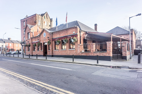
The Cat and Cage Pub on the Drumcondra Road was the site of an old postal stop and the point at which rebels, during the 1798 rebellion, seized a postal cart in order to signal to others in north County Dublin to revolt. The Cat and Cage is located at the corner of Church Avenue.
Under the Dublin Boundaries Act which received the Royal Assent on 6 August 1900, Drumcondra became part of the urban area of Dublin City. The Local Government (Dublin) Act, 1930, First Schedule, Part I lists the townlands of Drumcondra Rural as : Clonturk, Furrypark, Hampstead Hill, Hampstead South, Killester North, North Bull, Puckstown, and Sibylhill. Part II lists the Portions of Townlands as : Killester Demesne, Harmonstown, and Artaine South.
The district is served by Drumcondra railway station, on the main Drumcondra road. The station initially opened on 1 April 1901 but closed on 1 December with the termination of Kingsbridge (now Heuston Station) to Amiens Street (now Connolly Station) services. Part of the original building was demolished in late 1918. It reopened on 2 March 1998 as a station on the Maynooth/Longford commuter line.
The proposed Metro line from Dublin city centre to beyond Dublin Airport was scheduled to be linked with Drumcondra railway station.
Many Dublin Bus routes serve the Drumcondra area, such as the 11, 13, 16, 16A, 33, 41 and 41C amongst others. In addition the Aircoach express coach service to Dublin Airport stops at the Railway station.


