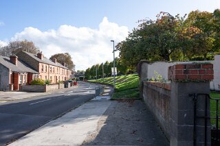
FLOODING CAN BE A PROBLEM IN THE AREA
BOTANIC AVENUE AND PARK [GLASNEVIN - DRUMCONDRA]
Botanic Avenue and "Botanic Park"
Botanic Avenue is a long residential road that connects the main Drumcondra Road (at Fagan's Pub) to Glasnevin, where it becomes Botanic Road. The southern end of this avenue runs directly alongside the edge of Griffith Park.
Botanic Park is a small, quiet, residential cul-de-sac of houses built in the 1970s. Its entrance is on the western side of Botanic Road, directly opposite Griffith Park. The fact of being on a "height" is the critical detail. While the main Botanic Avenue/Road runs parallel to the River Tolka (which is in Griffith Park), the "Botanic Park" cul-de-sac is set back from the road and built on elevated ground.This is a deliberate feature of its design. Planning applications for homes in the cul-de-sac even make reference to "retaining walls" and the "adjustment of ground levels," confirming that the plots are artificially raised, creating a terraced height that separates them from the park's floodplain.
The Area's History of Flooding
The immediate area at the bottom of Botanic Avenue has a severe and well-documented history of flooding.
However, the flood risk is not uniform. It is a story of two different elevations:
The Flood Zone (Low Ground): The source of all flooding here is the River Tolka, which runs through Griffith Park. During periods of extreme rainfall, the river has repeatedly burst its banks and inundated the low-lying land.
Major Floods (1954 & 2002): The area experienced catastrophic floods, most notably in December 1954 and November 2002. In these events, the River Tolka overflowed, and Griffith Park was completely submerged.
Impact on Botanic Avenue: The floodwaters spread onto the lowest-lying sections of Botanic Avenue and adjacent streets like Millmount Road. Homes and businesses at this southern, low-lying end of the avenue were badly damaged, with reports from 1954 mentioning residents being rescued by boat.
The "Safe" Zone (High Ground): This is where "Botanic Park" is located.
Despite being "opposite Griffith Park" and just metres away from the source of the floods, Botanic Park is not known to flood. Its safety is entirely due to its topography. The cul-de-sac is built on a raised embankment, elevating it above the river's floodplain. During the 2002 flood, while the park and the main road were underwater, the homes in the elevated "Botanic Park" cul-de-sac remained safe and dry.
It is important to distinguish between the two. The lower, flat section of Botanic Avenue is synonymous with the River Tolka flood risk. In contrast, the "Botanic Park" cul-de-sac is a prime example of how elevation and design protect it, making it a safe enclave despite its immediate proximity to the flood source in Griffith Park.
Botanic Avenue and "Botanic Park"
Botanic Avenue is a long residential road that connects the main Drumcondra Road (at Fagan's Pub) to Glasnevin, where it becomes Botanic Road. The southern end of this avenue runs directly alongside the edge of Griffith Park.
Botanic Park is a small, quiet, residential cul-de-sac of houses built in the 1970s. Its entrance is on the western side of Botanic Road, directly opposite Griffith Park. The fact of being on a "height" is the critical detail. While the main Botanic Avenue/Road runs parallel to the River Tolka (which is in Griffith Park), the "Botanic Park" cul-de-sac is set back from the road and built on elevated ground.This is a deliberate feature of its design. Planning applications for homes in the cul-de-sac even make reference to "retaining walls" and the "adjustment of ground levels," confirming that the plots are artificially raised, creating a terraced height that separates them from the park's floodplain.
The Area's History of Flooding
The immediate area at the bottom of Botanic Avenue has a severe and well-documented history of flooding.
However, the flood risk is not uniform. It is a story of two different elevations:
The Flood Zone (Low Ground): The source of all flooding here is the River Tolka, which runs through Griffith Park. During periods of extreme rainfall, the river has repeatedly burst its banks and inundated the low-lying land.
Major Floods (1954 & 2002): The area experienced catastrophic floods, most notably in December 1954 and November 2002. In these events, the River Tolka overflowed, and Griffith Park was completely submerged.
Impact on Botanic Avenue: The floodwaters spread onto the lowest-lying sections of Botanic Avenue and adjacent streets like Millmount Road. Homes and businesses at this southern, low-lying end of the avenue were badly damaged, with reports from 1954 mentioning residents being rescued by boat.
The "Safe" Zone (High Ground): This is where "Botanic Park" is located.
Despite being "opposite Griffith Park" and just metres away from the source of the floods, Botanic Park is not known to flood. Its safety is entirely due to its topography. The cul-de-sac is built on a raised embankment, elevating it above the river's floodplain. During the 2002 flood, while the park and the main road were underwater, the homes in the elevated "Botanic Park" cul-de-sac remained safe and dry.
It is important to distinguish between the two. The lower, flat section of Botanic Avenue is synonymous with the River Tolka flood risk. In contrast, the "Botanic Park" cul-de-sac is a prime example of how elevation and design protect it, making it a safe enclave despite its immediate proximity to the flood source in Griffith Park.
FLOODING CAN BE A PROBLEM