THE CAUSEWAY
THE CAUSEWAY ROAD
FROM JAMES LARKIN ROAD TO NORTH BULL ISLAND
II used a Zeiss Batis lens with the Sony FX30 and while the lens had been a favourite of mine it never worked again except in manual mode it must have been damaged by the rain.
This was a session that did not go well. I got lost as I thought that I was at a different location and walked for a long time in the wrong direction. When I arrived at the North BullIsland Interpretative Centre it was closed and I was caught out in an extreme storm and the camera refused to focus and when I returned home the images appeared to be unusable. I was in such a bad humour that I forgot about them until today.
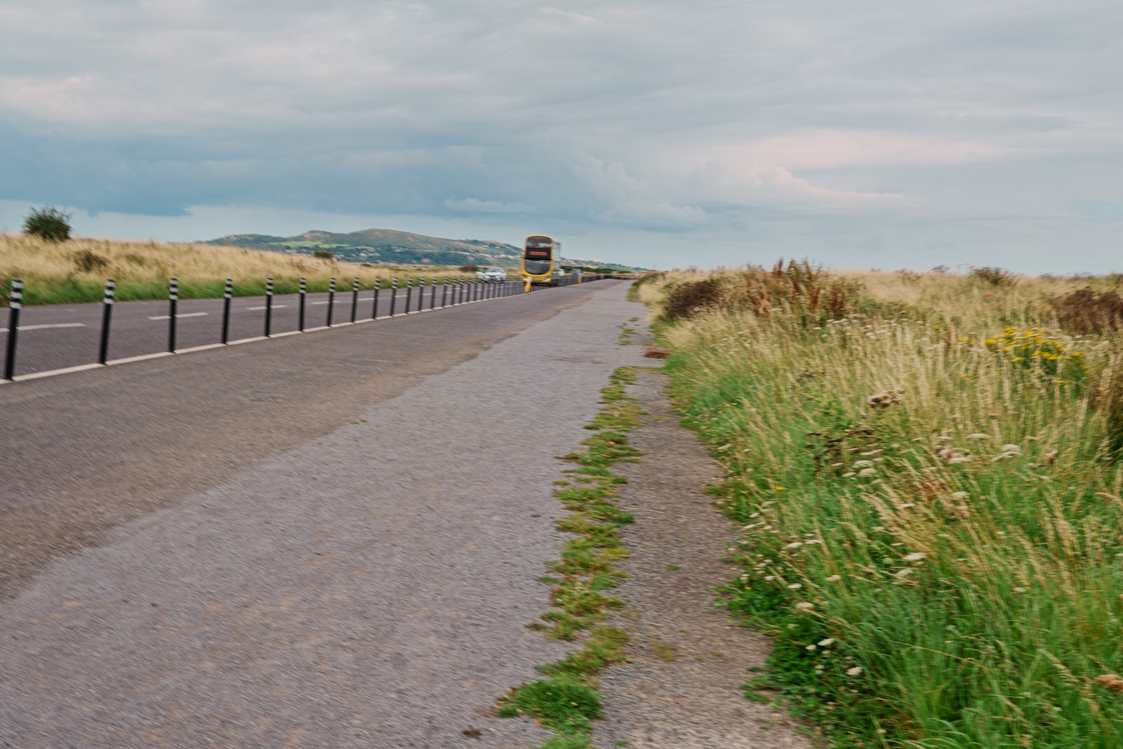
The Causeway Road is a 2.5 kilometer long road that connects Clontarf to North Bull Island in Dublin, Ireland. It was built in 1962 to provide access to the island for cars, as the only other way to get there was by boat. The road is a popular spot for walking, running, and cycling, and it also offers stunning views of Dublin Bay.
North Bull Island is a 5 kilometer long sand spit that is home to a variety of wildlife, including birds, seals, and fish. The island is also a popular spot for swimming, sunbathing, and fishing.
Here are some additional details about the Causeway Road and North Bull Island:
The Causeway Road is open to cars from 6am to 10pm.
There is a car park at the end of the Causeway Road. (There is no longer drive-on access to the beach. )
There is a bus stop at the end of the Causeway Road (I could not locate it even though I did see some buses)
The Causeway Road is a popular spot for birdwatching.
In times past, Dublin Bay had a long-running problem with silting, notably at the mouth of the River Liffey. After years of primitive dredging, an attempt to maintain a clear channel more effectively was begun when, in 1715, the first piles were driven of what was to become the Great South Wall, completed in 1730. This barrier was breached by storm action some years later, and in 1761, a stone pier was commenced, working from the Poolbeg Lighthouse (1768), back to shore, the construction of massive granite blocks being completed in 1795. It was during this period that the building of a North Bull Wall was also proposed, and when it was seen that the South Wall did not solve the silting problem, the authorities responsible for Dublin Port commissioned studies on the matter. Captain William Bligh, of Bounty fame, surveyed Dublin Bay for the Ballast Board in 1801, highlighting the potential of the North Bull sandbank. Its purpose was to clear a sandbar by Venturi action.
A wooden bridge, the first Bull Bridge, was erected in 1819 to facilitate the construction of a stone wall, based on a design by Ballast Board engineer, George Halpin. Started in 1820, the Bull Wall was completed in 1825, at a cost of £95,000.
Over the succeeding 48 years, the natural tidal effects created by the walls deepened the entry to the Liffey from 1.8 m to 4.8 m. Much of the silt now scoured from the river course was deposited on the North Bull, and a true island began to emerge, with people venturing out to the growing beach. The volume of visitors was increased by the commencement of horse tram services to Clontarf in 1873, and further by the laying of a full tram line to Howth, opening in 1900, with stops in the Clontarf / Dollymount area, and a Coast Guard station was built at the landward end of the Bull Wall.
A lighthouse sits on the North Bull Wall.
This was a session that did not go well. I got lost as I thought that I was at a different location and walked for a long time in the wrong direction. When I arrived at the North BullIsland Interpretative Centre it was closed and I was caught out in an extreme storm and the camera refused to focus and when I returned home the images appeared to be unusable. I was in such a bad humour that I forgot about them until today.
The Causeway Road is a 2.5 kilometer long road that connects Clontarf to North Bull Island in Dublin, Ireland. It was built in 1962 to provide access to the island for cars, as the only other way to get there was by boat. The road is a popular spot for walking, running, and cycling, and it also offers stunning views of Dublin Bay.
North Bull Island is a 5 kilometer long sand spit that is home to a variety of wildlife, including birds, seals, and fish. The island is also a popular spot for swimming, sunbathing, and fishing.
Here are some additional details about the Causeway Road and North Bull Island:
The Causeway Road is open to cars from 6am to 10pm.
There is a car park at the end of the Causeway Road. (There is no longer drive-on access to the beach. )
There is a bus stop at the end of the Causeway Road (I could not locate it even though I did see some buses)
The Causeway Road is a popular spot for birdwatching.
In times past, Dublin Bay had a long-running problem with silting, notably at the mouth of the River Liffey. After years of primitive dredging, an attempt to maintain a clear channel more effectively was begun when, in 1715, the first piles were driven of what was to become the Great South Wall, completed in 1730. This barrier was breached by storm action some years later, and in 1761, a stone pier was commenced, working from the Poolbeg Lighthouse (1768), back to shore, the construction of massive granite blocks being completed in 1795. It was during this period that the building of a North Bull Wall was also proposed, and when it was seen that the South Wall did not solve the silting problem, the authorities responsible for Dublin Port commissioned studies on the matter. Captain William Bligh, of Bounty fame, surveyed Dublin Bay for the Ballast Board in 1801, highlighting the potential of the North Bull sandbank. Its purpose was to clear a sandbar by Venturi action.
A wooden bridge, the first Bull Bridge, was erected in 1819 to facilitate the construction of a stone wall, based on a design by Ballast Board engineer, George Halpin. Started in 1820, the Bull Wall was completed in 1825, at a cost of £95,000.
Over the succeeding 48 years, the natural tidal effects created by the walls deepened the entry to the Liffey from 1.8 m to 4.8 m. Much of the silt now scoured from the river course was deposited on the North Bull, and a true island began to emerge, with people venturing out to the growing beach. The volume of visitors was increased by the commencement of horse tram services to Clontarf in 1873, and further by the laying of a full tram line to Howth, opening in 1900, with stops in the Clontarf / Dollymount area, and a Coast Guard station was built at the landward end of the Bull Wall.
A lighthouse sits on the North Bull Wall.
![THE CAUSEWAY ROAD [FROM JAMES LARKIN ROAD TO NORTH BULL ISLAND] 001](files/drag-and-drop-img-425.jpg)
![THE CAUSEWAY ROAD [FROM JAMES LARKIN ROAD TO NORTH BULL ISLAND] 002](files/drag-and-drop-img-426.jpg)
![THE CAUSEWAY ROAD [FROM JAMES LARKIN ROAD TO NORTH BULL ISLAND] 003](files/drag-and-drop-img-427.jpg)
![THE CAUSEWAY ROAD [FROM JAMES LARKIN ROAD TO NORTH BULL ISLAND] 004](files/drag-and-drop-img-428.jpg)
![THE CAUSEWAY ROAD [FROM JAMES LARKIN ROAD TO NORTH BULL ISLAND] 005](files/drag-and-drop-img-429.jpg)
![THE CAUSEWAY ROAD [FROM JAMES LARKIN ROAD TO NORTH BULL ISLAND] 006](files/drag-and-drop-img-430.jpg)
![THE CAUSEWAY ROAD [FROM JAMES LARKIN ROAD TO NORTH BULL ISLAND] 007](files/drag-and-drop-img-431.jpg)
![THE CAUSEWAY ROAD [FROM JAMES LARKIN ROAD TO NORTH BULL ISLAND] 008](files/drag-and-drop-img-432.jpg)
![THE CAUSEWAY ROAD [FROM JAMES LARKIN ROAD TO NORTH BULL ISLAND] 009](files/drag-and-drop-img-433.jpg)
![THE CAUSEWAY ROAD [FROM JAMES LARKIN ROAD TO NORTH BULL ISLAND] 010](files/drag-and-drop-img-434.jpg)
![THE CAUSEWAY ROAD [FROM JAMES LARKIN ROAD TO NORTH BULL ISLAND] 011](files/drag-and-drop-img-435.jpg)
![THE CAUSEWAY ROAD [FROM JAMES LARKIN ROAD TO NORTH BULL ISLAND] 012](files/drag-and-drop-img-436.jpg)
![THE CAUSEWAY ROAD [FROM JAMES LARKIN ROAD TO NORTH BULL ISLAND] 013](files/drag-and-drop-img-437.jpg)
![THE CAUSEWAY ROAD [FROM JAMES LARKIN ROAD TO NORTH BULL ISLAND] 014](files/drag-and-drop-img-438.jpg)
![THE CAUSEWAY ROAD [FROM JAMES LARKIN ROAD TO NORTH BULL ISLAND] 015](files/drag-and-drop-img-439.jpg)
![THE CAUSEWAY ROAD [FROM JAMES LARKIN ROAD TO NORTH BULL ISLAND] 016](files/drag-and-drop-img-440.jpg)
![THE CAUSEWAY ROAD [FROM JAMES LARKIN ROAD TO NORTH BULL ISLAND] 017](files/drag-and-drop-img-441.jpg)
![THE CAUSEWAY ROAD [FROM JAMES LARKIN ROAD TO NORTH BULL ISLAND] 018](files/drag-and-drop-img-442.jpg)
![THE CAUSEWAY ROAD [FROM JAMES LARKIN ROAD TO NORTH BULL ISLAND] 019](files/drag-and-drop-img-443.jpg)
![THE CAUSEWAY ROAD [FROM JAMES LARKIN ROAD TO NORTH BULL ISLAND] 020](files/drag-and-drop-img-444.jpg)

December Menu

November Menu